The Shire of Mitchell is a local government area in the Hume region of Victoria, Australia, located North of Melbourne. It covers an area of 2,864 square kilometres (1,106 sq mi) and, at the 2011 Census, had a population of 34,637. It includes the towns of Broadford, Kilmore, Seymour, Tallarook, Pyalong and Wallan. It was formed in 1994 from the amalgamation of the Shire of Pyalong, Shire of Kilmore, most of the Shire of Broadford, and parts of the Shire of McIvor and Rural City of Seymour.

The Shire of Mount Alexander is a local government area in Victoria, Australia, located in the central part of the state. It covers an area of 1,529 square kilometres (590 sq mi) and, at the 2016 Census, had a population of 18,761. It includes the towns of Castlemaine, Maldon, Newstead, Harcourt, Taradale, Vaughan, Fryerstown and Campbells Creek. It was formed in 1995 from the amalgamation of the City of Castlemaine, Shire of Newstead, and most of the Shire of Maldon and Shire of Metcalfe.

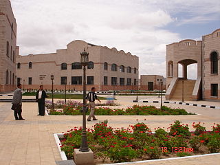
Dhamar is a city in south-western Yemen. It is located at 14°33′0″N44°24′6″E, at an elevation of around 2400 metres.

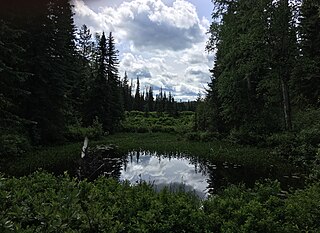
Eskers Provincial Park is a provincial park in British Columbia, Canada. The park comprises roughly 3,979 hectares and was created in 1987. Located west of Nukko Lake, which lies northwest of the city of Prince George, it protects an area of the 40-kilometre (25 mi) Stuart River Eskers Complex. Eskers are winding ridges of gravel formed by the glaciers which once covered the British Columbia Interior.

The Shire of Murweh is a local government area in the Maranoa district, which is part of South West Queensland, Australia. The administrative centre and largest town in the shire is Charleville. In the 2016 census, the Shire of Murweh had a population of 4,307 people.
The Tl'etinqox-t'in Government Office is a First Nations government located in the Chilcotin District in the western Central Interior region of the Canadian province of British Columbia. Governing a reserve communities near Alexis Creek known as Anaham Reserve First Nations or Anaham, it is a member of the Tsilhqot'in Tribal Council aka known as the Tsilhqot'in National Government. The main reserve is officially known as Anahim's Flat No. 1, and is more commonly as Anaham. Other reserves are Anahim's Meadow No. 2 and 2A, and Anahim Indian Reserves Nos. 3 through 18. Anaham, or Anahim and Alexis were chiefs of the Tsilhqot'in during the Chilcotin War of 1864, although they and their people did not take part in the hostilities.

The Ribbon Ridge AVA is an American Viticultural Area in Yamhill County, Oregon. It is the smallest AVA in Oregon and is entirely contained within the Chehalem Mountains AVA, which in turn is entirely contained within the larger Willamette Valley AVA. Ribbon Ridge stretches between the towns of Newberg and Gaston. The ridge is defined by local geographic boundaries and an uplift of ocean sediment. It lies at 45° 21' N latitude and 123° 04' W longitude, at the northwest end of the Chehalem Mountains. The name originates in the 19th century. The ridge is approximately 0.25 miles (0.40 km) wide and 3.50 miles (5.63 km) long, and is 3,350 acres (1,356 ha) in area, with 500 acres (202 ha) planted on 20 vineyards. It is estimated that between 1,000 acres (405 ha) and 1,400 acres (567 ha) in the region is suitable for planting.

Witów is a village in the administrative district of Gmina Lewin Kłodzki, within Kłodzko County, Lower Silesian Voivodeship, in south-western Poland.
Krościna Wielka is a village in the administrative district of Gmina Prusice, within Trzebnica County, Lower Silesian Voivodeship, in south-western Poland. Prior to 1945 it was in Germany.

The Electoral district of Maldon was an electoral district of the Victorian Legislative Assembly.

Grodziszczko is a village in the administrative district of Gmina Duszniki, within Szamotuły County, Greater Poland Voivodeship, in west-central Poland. It lies approximately 11 kilometres (7 mi) south-east of Duszniki, 23 km (14 mi) south of Szamotuły, and 27 km (17 mi) west of the regional capital Poznań.
Klemensowo is a village in the administrative district of Gmina Ostroróg, within Szamotuły County, Greater Poland Voivodeship, in west-central Poland.

Thikri is a town and a tehsil in Barwani District, Madhya Pradesh, India. Known in the area for historical, racial and religious 'Gada Khichai' program on 'Holi', which has been running since 12th century AD.
Pokrzywno is a settlement in the administrative district of Gmina Polanów, within Koszalin County, West Pomeranian Voivodeship, in north-western Poland.
Tyoax Pass is a mountain pass in the Chilcotin Ranges of the Pacific Ranges, the southernmost main subdivision of the Coast Mountains of British Columbia, Canada. Located at the head of Tyaughton Creek, a north tributary of the Bridge River, it connects the basin of the Bridge River with that of Big Creek in the southern Chilcotin District, and is therefore at the boundary between the Spruce Lake Protected Area and Big Creek Provincial Park.
South Chilcotin Mountains Provincial Park is a provincial park in British Columbia, Canada, located northwest of Lillooet, British Columbia. The park, which is 56,796 ha. in size, was established in 2010. It was created out of a portion of the Spruce Lake Protected Area.
Admiral Island may refer to:

Kairėnai Manor was a residential manor in Kairėnai near Vilnius, Lithuania. Only a few buildings and park survived until nowadays. Currently its territory is occupied by the Botanical Garden of Vilnius University.
Mima is an unincorporated community in Thurston County, in the U.S. state of Washington.


