Related Research Articles

A geographic information system (GIS) consists of integrated computer hardware and software that store, manage, analyze, edit, output, and visualize geographic data. Much of this often happens within a spatial database, however, this is not essential to meet the definition of a GIS. In a broader sense, one may consider such a system also to include human users and support staff, procedures and workflows, the body of knowledge of relevant concepts and methods, and institutional organizations.

Topography is the study of the forms and features of land surfaces. The topography of an area may refer to the land forms and features themselves, or a description or depiction in maps.

Aerial photography is the taking of photographs from an aircraft or other airborne platforms. When taking motion pictures, it is also known as aerial videography.
Ground truth is information that is known to be real or true, provided by direct observation and measurement as opposed to information provided by inference.
Aerial archaeology is the study of archaeological remains by examining them from a higher altitude. In present day, this is usually achieved by satellite images or through the use of drones.

NASA WorldWind is an open-source virtual globe. According to the website, "WorldWind is an open source virtual globe API. WorldWind allows developers to quickly and easily create interactive visualizations of 3D globe, map and geographical information. Organizations around the world use WorldWind to monitor weather patterns, visualize cities and terrain, track vehicle movement, analyze geospatial data and educate humanity about the Earth." It was first developed by NASA in 2003 for use on personal computers and then further developed in concert with the open source community since 2004. As of 2017, a web-based version of WorldWind is available online. An Android version is also available.

Satellite images are images of Earth collected by imaging satellites operated by governments and businesses around the world. Satellite imaging companies sell images by licensing them to governments and businesses such as Apple Maps and Google Maps.
Google Earth is a computer program that renders a 3D representation of Earth based primarily on satellite imagery. The program maps the Earth by superimposing satellite images, aerial photography, and GIS data onto a 3D globe, allowing users to see cities and landscapes from various angles. Users can explore the globe by entering addresses and coordinates, or by using a keyboard or mouse. The program can also be downloaded on a smartphone or tablet, using a touch screen or stylus to navigate. Users may use the program to add their own data using Keyhole Markup Language and upload them through various sources, such as forums or blogs. Google Earth is able to show various kinds of images overlaid on the surface of the earth and is also a Web Map Service client. In 2019, Google revealed that Google Earth now covers more than 97 percent of the world, and has captured 10 million miles of Street View imagery.
A virtual globe is a three-dimensional (3D) software model or representation of Earth or another world. A virtual globe provides the user with the ability to freely move around in the virtual environment by changing the viewing angle and position. Compared to a conventional globe, virtual globes have the additional capability of representing many different views of the surface of Earth. These views may be of geographical features, man-made features such as roads and buildings, or abstract representations of demographic quantities such as population.
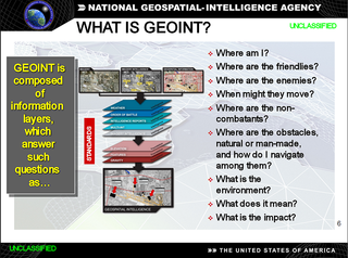
In the United States, geospatial intelligence (GEOINT) is intelligence about the human activity on earth derived from the exploitation and analysis of imagery, signals, or signatures with geospatial information. GEOINT describes, assesses, and visually depicts physical features and geographically referenced activities on the Earth. GEOINT, as defined in US Code, consists of imagery, imagery intelligence (IMINT) and geospatial information.
OpenStreetMap (OSM) is a free, open geographic database updated and maintained by a community of volunteers via open collaboration. Contributors collect data from surveys, trace from aerial imagery and also import from other freely licensed geodata sources. OpenStreetMap is freely licensed under the Open Database License and as a result commonly used to make electronic maps, inform turn-by-turn navigation, assist in humanitarian aid and data visualisation. OpenStreetMap uses its own topology to store geographical features which can then be exported into other GIS file formats. The OpenStreetMap website itself is an online map, geodata search engine and editor.

Bing Maps is a web mapping service provided as a part of Microsoft's Bing suite of search engines and powered by the Bing Maps Platform framework which also support Bing Maps for Enterprise APIs and Azure Maps APIs. Since 2020, the map data is provided by TomTom, OpenStreetMap and others.

Pictometry International is an aerial measurement company based in Henrietta, New York that develops software that uses three-dimensional aerial photographs to view high-resolution images of buildings in their entirety. Pictometry International's technology was developed at the Rochester Institute of Technology and shows structures at an oblique angle or at a 45-degree angle, from all sides providing perspective and overhead shot images that are accurate to 1/100th of an inch. The company has 80 Cessnas that provide high-resolution aerial photography in counties that include 95 percent of the U.S. population.

Pictorial maps depict a given territory with a more artistic rather than technical style. It is a type of map in contrast to road map, atlas, or topographic map. The cartography can be a sophisticated 3-D perspective landscape or a simple map graphic enlivened with illustrations of buildings, people and animals. They can feature all sorts of varied topics like historical events, legendary figures or local agricultural products and cover anything from an entire continent to a college campus. Drawn by specialized artists and illustrators, pictorial maps are a rich, centuries-old tradition and a diverse art form that ranges from cartoon maps on restaurant placemats to treasured art prints in museums.

Aerial photographic and satellite image interpretation, or just image interpretation when in context, is the act of examining photographic images, particularly airborne and spaceborne, to identify objects and judging their significance. This is commonly used in military aerial reconnaissance, using photographs taken from reconnaissance aircraft and reconnaissance satellites.
GeoBase is a federal, provincial and territorial government initiative that is overseen by the Canadian Council on Geomatics (CCOG). It is undertaken to ensure the provision of, and access to, a common, up-to-date and maintained base of quality geospatial data for Canada. Through the GeoBase, users with an interest in geomatics have access to quality geospatial information at no cost and with unrestricted use.
Elevated photography is the process of taking aerial photos using a telescoping pole or mast, or other aerial or elevated support systems, to emulate aerial photographs, or video, taken from a commercially licensed aircraft.

Nearmap is an aerial technology company headquartered in Australia that provides frequently-updated, high-resolution aerial imagery and location intelligence on up to 95% of Australia's population, 80% of the United States population, 75% of the New Zealand population, and 66% of Canada's population. It was a publicly traded company on the Australian Securities Exchange until being taken private by Thoma Bravo in 2022.
Pictometry is a patented aerial survey technique for producing oblique georeferenced imagery showing the fronts and sides of buildings and locations on the ground. Photos are captured by low-flying airplanes, depicting up to 12 perspectives as well as an orthogonal (overhead) view of every location flown. These perspectives are then stitched together to create composite aerial maps that may span many miles of terrain. Because they are captured at an angle, the pixels in the resulting images are trapezoidal, rather than rectangular. This necessitates special software and algorithms to accurately determine objects’ size and position on the maps.

ShoreZone is a mapping program that acquires oblique aerial images at low altitude during the lowest daylight tides of the year to inventory alongshore and across-shore geomorphological and biological features of the Pacific Northwest intertidal shoreline. Habitat attributes are interpreted from the aerial images and categorized in a geographic database. The mapping program was first developed as an oil spill response tool for British Columbia, and now ShoreZone extends from Oregon to Alaska. Other uses of the spatial data include ecological studies, marine conservation planning, shoreline erosion monitoring, coastal flooding and vulnerability assessments, developing climate change adaptation strategies, and community education.