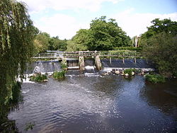
The Restigouche River is a river that flows across the northwestern part of the province of New Brunswick and the southeastern part of Quebec.

Affing is a municipality near Augsburg in Aichach-Friedberg district, in Swabia - Bavaria, southern Germany.

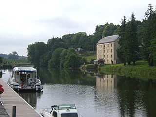
The Oust is a river in Brittany, France, right tributary of the Vilaine. It is 145 km (90 mi) long. Its source is in the hills between Corlay and Quintin. It flows generally southeast, through the following départements and towns:

The arrondissement of Redon is an arrondissement of France in the Ille-et-Vilaine department in the Brittany region. It has 50 communes. Its population is 102,157 (2016), and its area is 1,302.6 km2 (502.9 sq mi).

Peralasseri is a census town and Panchayat headquarters in Kannur district in the Indian state of Kerala, situated on the Kannur-Kuthuparamba State Highway 38 (Kerala), 12 km from Kannur city, on the bank of Anjarakandy river.

The Kok River is a tributary river of the Mekong that flows in Chiang Rai and Chiang Mai provinces in northern Thailand.
The Route nationale 24 is a highway in western France. It connects the city of Rennes with the Atlantic port of Lorient. The road is approximately 149 km long.

La Gacilly is a commune in the Morbihan department of Brittany in north-western France. It is located on the right bank of the Aff River, about 15 km (9 mi) north of Redon, on the train line between Vannes and Rennes and about 60 km (37 mi) from both. It extended on 1 January 2017 by merging with former communes of La Chapelle-Gaceline and Glénac.
The Daaquam River is a river primarily flowing in the administrative region of Chaudière-Appalaches, at South of Quebec in Canada and northern Maine, in United States. The river runs from its source, south of Sainte-Justine, northeast across the Canada–United States border to the Northwest Branch of the Saint John River in Maine.

The Northwest Branch Saint John River is a 15.5-mile-long (24.9 km) river primarily in Aroostook County, Maine, USA. Its origin is Frontier Lake (Quebec-Maine) in Quebec, Canada. After crossing the Canada–United States border, the Northwest Branch runs south close to the border until it picks up its tributary, the Daaquam River, which also flows out of Canada. The Northwest Branch then runs generally eastward to its confluence with the Southwest Branch to form the Saint John River.
The Shields Branch is a tributary of the Big Black River, flowing in:
The Southwest Branch Saint John River is a 62.0-mile-long (99.8 km) river in Maine and Quebec. The branch originates in "Little Saint John Lake" on the international boundary between Saint-Zacharie, Quebec and Seboomook Lake Township 5, Range 20, WELS. The branch forms the Canada–United States border as it flows northeasterly to a confluence with the Little Southwest Branch Saint John River in Seboomook Lake Township 9, Range 18, WELS. The Southwest Branch flows briefly into Quebec and then through Maine to its confluence with the Baker Branch Saint John River in Seboomook Lake Township 9, Range 17, WELS. The Southwest Branch finally joins with the Northwest Branch to form the Saint John River.
The Little Black River is a river flowing in the south of Quebec (Canada) and in the north of Maine.
The Otter River is a tributary of the Northwest Branch Saint John River, flowing in Quebec (Canada) and in Maine. This river crosses the following administrative territories:
The Depot River is a tributary of the Big Black River, flowing in the townships T12 R17 Wels, T13 R16 Wels and T14 R15 Wels, in the Aroostook County in North Maine Woods in Maine, in United States.
The Brown River is a tributary of the Depot River, flowing in Quebec, Canada, in the municipality of Saint-Adalbert, in L'Islet Regional County Municipality, in the administrative region of Chaudière-Appalaches, and in Aroostook County, Maine, United States, in Township T13 R16 Wels, in the North Maine Woods. Its course runs entirely through forested region in a plain in Quebec and in a valley south of the Canada-US border.
The Gobeil River is a tributary of the Big Black River, flowing through:
The West Branch Pocwock Stream is a tributary of the Pocwock River flowing in:

The canton of Redon is an administrative division of the Ille-et-Vilaine department, in northwestern France. At the French canton reorganisation which came into effect in March 2015, it was expanded from 6 to 15 communes. Its seat is in Redon.

Redon Agglomération is a French intercommunal structure centred on the city of Redon. It is located in the departments Morbihan, Ille-et-Vilaine and Loire-Atlantique, in the regions Brittany and Pays de la Loire, northwestern France. It was created in April 1996. Its area is 990.9 km2. Its population was 66,478 in 2018, of which 9,151 in Redon proper.


