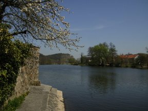
Bavaria, officially the Free State of Bavaria, is a state in the southeast of Germany. With an area of 70,550.19 km2 (27,239.58 sq mi), it is the largest German state by land area, comprising roughly a fifth of the total land area of Germany. With over 13 million inhabitants, it is the second most populous German state behind North Rhine-Westphalia, but due to its large physical size its population density is below the German average. Major cities include Munich, Nuremberg, and Augsburg.

Lower Bavaria is one of the seven administrative regions of Bavaria, Germany, located in the east of the state. It consists of nine districts and 258 municipalities.
Altötting is a Landkreis (district) in Bavaria, Germany. It is bounded by Austria and the Bavarian districts of Traunstein, Mühldorf and Rottal-Inn.
Freyung-Grafenau is a Landkreis (district) in Bavaria, Germany. It is bounded by the districts of Passau, Deggendorf and Regen, the Czech Republic and by Austria.

Central or Middle Bavarian form a subgroup of Bavarian dialects in large parts of Austria and the German state of Bavaria along the Danube river, on the northern side of the Eastern Alps. They are spoken in the 'Old Bavarian' regions of Upper Bavaria, Lower Bavaria and in the adjacent parts of the Upper Palatinate region around Regensburg, in Upper and Lower Austria, in Vienna, in the state of Salzburg, as well as in the northern and eastern parts of Styria and Burgenland. Before 1945 and the expulsions of the Germans, it was also spoken in Hungary and southern Bohemia and Moravia. It also influenced Austrian German.
The Duchy of Bavaria was a frontier region in the southeastern part of the Merovingian kingdom from the sixth through the eighth century. It was settled by Bavarian tribes and ruled by dukes (duces) under Frankish overlordship. A new duchy was created from this area during the decline of the Carolingian Empire in the late ninth century. It became one of the stem duchies of the East Frankish realm which evolved as the Kingdom of Germany and the Holy Roman Empire.

The Tauber is a river in Franconia, Germany. It is a left tributary of the Main and is 132 km (82 mi) in length. The name derives from the Celtic word for water.
The Brenz is a river in Baden-Württemberg and Bavaria, Germany. It is a left tributary of the Danube. Its source is at a spring in the town of Königsbronn and it flows for 52 kilometers before meeting the Danube at Lauingen, a few kilometers west of Dillingen. It flows through the towns of Königsbronn, Heidenheim an der Brenz, Giengen and Lauingen.
The Naab is a river in Bavaria, Germany.

The Würm is a river in Bavaria, Germany, right tributary of the Amper. The length of the river is 39.8 kilometres (24.7 mi), or 76.3 kilometres (47.4 mi) including the Steinbach, the main feed of Lake Starnberg. It drains the overflow from Lake Starnberg and flows swiftly through the villages of Gauting, Krailling, Planegg, Gräfelfing and Lochham as well as part of Munich before joining, near Dachau, the Amper, which soon afterwards flows into the Isar and eventually into the Danube. Although the Würm is not a very large river, it is well known as it gave its name to the Würm glaciation.

The Wörnitz is a river in Bavaria, Germany, a left tributary of the Danube. Its source is near Schillingsfürst, in the Middle Franconia region of Bavaria. It flows south, through the Nördlinger Ries, and flows into the Danube in Donauwörth. Towns along the Wörnitz include Wörnitz, Dinkelsbühl, Wassertrüdingen, Oettingen, Harburg and Donauwörth.

The Günz is a river in Bavaria, Germany.

The Itz is a river of Thuringia and Bavaria, Germany.
The Leiblach is a 34-kilometre-long (21 mi) tributary of Lake Constance and the Rhine.

The Kahl is a river in the northern Spessart in Bavaria and Hesse, Germany. It is a right tributary of the Main and is 35.6 km (22.1 mi) long. The name Kahl comes from the Old High German word kaldaha, which means cool and clear. The Kahl rises from two sources left and right of the road at the foot of the Spessart hills, near Kleinkahl. These springs produce 50–60 litres per second. The Kahl flows into the river Main in Kahl am Main. The mouth is near the old Kahl Nuclear Power Plant. The largest tributaries are Westerbach, Sommerkahl, Reichenbach and Geiselbach.

The Haßlach is a river in the Upper Franconian region of Landkreis Kronach in Bavaria, Germany. The 31.2 km long Haßlach flows into the Rodach River in the town of Kronach.

Lohr is a right tributary of the Main in Germany. Although its origins lie in the Main-Kinzig district of Hessen, most of the course of the Lohr is in the Main-Spessart district of Bavaria. Including its source river Lohrbach, it is 23.0 km long.

Wiesent is a river located in Bavaria, Germany. It is a right tributary of the river Regnitz. It is the main river of the Franconian Switzerland region, rising near the village Steinfeld. It flows through the towns Hollfeld, Muggendorf and Ebermannstadt, and joins the Regnitz in Forchheim.
The Felchbach is a river of Bavaria, Germany. It flows into the Swabian Rezat near Weißenburg in Bayern.

Gersprenz is a river that starts in the Odenwald, Hesse and flows into the river Main near Aschaffenburg, Bavaria, Germany. Including its source river Mergbach, it is 62.1 km (38.6 mi) long, without the Mergbach it is 51.3 km (31.9 mi) long.