Llandybie is a village and community which includes a large village of the same name situated 2 miles (3.2 km) north of Ammanford in Carmarthenshire, Wales.

Betws is a small village and community on the River Amman in Carmarthenshire, Wales, some 15 miles north of Swansea; it is part of the ecclesiastical parish of Betws and Ammanford, and the urban area of Ammanford. The nearby mountain, at the western end of the Black Mountain, is named after the village, and has a large area of common land.
Pantyffynnon is a small village in Carmarthenshire, Wales, half a mile south-west of Ammanford, and a mile east of Tycroes. It lies between the rivers Loughor and Amman at the foot of Mynydd y Betws.
Neath South is an electoral ward of Neath Port Talbot county borough, Wales falling in the community of Neath.

The River Loughor is a river in Wales which marks the border between Carmarthenshire and Swansea. The river is sourced from an underground lake at the Black Mountain emerging at the surface from Llygad Llwchwr which translates from the Welsh as "eye of the Loughor". It flows past Ammanford and Hendy in Carmarthenshire and Pontarddulais in Swansea. The river divides Carmarthenshire from Swansea for much of its course and it separates Hendy from Pontarddulais at the point where the river becomes tidal. The Loughor meets the sea at its estuary near the town of Loughor where it separates the south coast of Carmarthenshire from the north coast of the Gower Peninsula. Among its tributaries is the River Amman, which joins the Loughor near Pantyffynnon. The area of the catchment is some 262 square kilometres (101 sq mi).
Llwchwr is a community and electoral ward in the central western part of the City and County of Swansea, Wales, UK. It lies 9 km west-north-west of Swansea city centre and is bounded by the communities of Gorseinon to the north, Penllergaer to the east, and Gowerton to the south, as well as by the estuary of the River Loughor to the west, on the far side of which lies Bynea in Carmarthenshire, connected to Llwchwr by road and rail bridges.

Ammanford Association Football Club is a football club from Ammanford, Carmarthenshire in Wales. They play in the Cymru South. They are now based at the Recreation Ground in Ammanford. The club is affiliated to the Football Association of Wales (FAW), West Wales Football Association (WWFA), Welsh Football League and the Carmarthenshire Association Football League.
Llanedi is a village and community in Carmarthenshire, Wales. Once the name of a parish, Llanedi is now a community taking in the hamlet of Llanedi and the villages of Hendy, Fforest and Tycroes. The community population taken at the 2011 census was 5,664. The community is located between Ammanford and Llanelli.

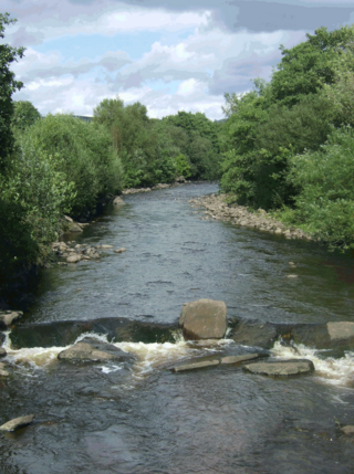
The River Amman is a river of south Wales, which joins the River Loughor at Pantyffynnon. The source of the Amman is on the Black Mountain.

The River Inny is a river within the Shannon River Basin in Ireland. It is 88.5 kilometres (55.0 mi) in length, and has a number of lakes along its course.

The A474 is a suburban main route in south Wales.
Ammanford railway station was opened under the name Cross Inn by the Llanelly Railway in 1840 to serve the town of Ammanford, West Wales. It was renamed Ammanford in 1883. The station was the main one in the town until it closed in 1958, leaving the current Ammanford station providing trains for the area.
Ammanford Colliery Halt railway station, served the colliery near Ammanford, West Wales. Opened to serve the colliery, the station closed, leaving the current Ammanford station providing trains for the area.

The River Gwili in Carmarthenshire, is a tributary of the River Towy, the longest river entirely in Wales. Its headwater is found east of Llanllawddog, in the Brechfa Forest. It runs west, through Llanpumsaint, to its confluence with the River Duad, just south of Cynwyl Elfed village. Here its course turns to the southeast, running through Bronwydd before joining the River Towy at Abergwili.

Tair Carn Uchaf is a hill in the Brecon Beacons National Park in the county of Carmarthenshire, Wales. Its summit sits atop a plateau-like ridge at 482 metres (1,580 ft) above sea level and is marked by one of the three huge cairns which give the mountain its name.

Carreg Dwfn is a hill four miles southeast of Llandeilo and just to the south of the village of Trap in the county of Carmarthenshire, south Wales. It lies at the western extremity of the Brecon Beacons National Park and Fforest Fawr Geopark. Its summit at 283 metres (928 ft) is towards the eastern end of a rocky east-west-aligned ridge.
Milo is a small village of some 50 homes in the parish of Llanfihangel Aberbythych, some three miles north of Ammanford in Carmarthenshire, Wales.
Saron is a mining village near the town of Ammanford in Carmarthenshire, Wales. Saron is in the community of Llandybie.
The Carmarthenshire League is a football league in Carmarthenshire, West Wales, sitting at the fifth, sixth and seventh levels of the Welsh football league system.
The Carmarthenshire Senior Cup(currently the Rooks Trophies Senior Cup for sponsorship reasons) is a football knockout tournament involving teams from in Carmarthenshire, West Wales who play in leagues administered and associated with the Carmarthenshire Association Football League.


