
The River Taff is a river in Wales. It rises in the Brecon Beacons as two rivers, the Taf Fechan and the Taf Fawr before becoming one just north of Merthyr Tydfil. At Cardiff, it empties into the Bristol Channel.

The River Conwy is a river in north Wales. From its source to its discharge in Conwy Bay it is 55 kilometres (34 mi) long and drains an area of 678 square km. "Conwy" was formerly anglicised as "Conway."

The River Tawe is a 30 miles (48 km) long river in South Wales. Its headwaters flow initially east from its source below Llyn y Fan Fawr south of Moel Feity in the Black Mountains, the westernmost range of the Brecon Beacons National Park, before the river turns south and then southwest to its estuary at Swansea. Its main tributaries are the right bank Upper and Lower Clydach Rivers and the Afon Twrch. The total area of the catchment is some 246 km2 (95 sq mi). The Tawe passes through a number of towns and villages including Ystradgynlais, Ystalyfera, Pontardawe, and Clydach and meets the sea at Swansea Bay below Swansea. The Tawe Valley is more commonly known as the Swansea Valley.

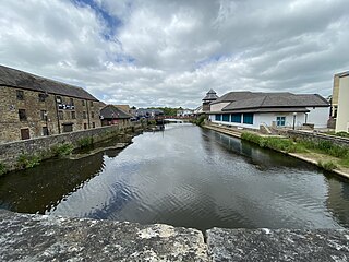
The River Loughor is a river in Wales which marks the border between Carmarthenshire and Swansea. The river is sourced from an underground lake at the Black Mountain emerging at the surface from Llygad Llwchwr which translates from the Welsh as "eye of the Loughor". It flows past Ammanford and Hendy in Carmarthenshire and Pontarddulais in Swansea. The river divides Carmarthenshire from Swansea for much of its course and it separates Hendy from Pontarddulais at the point where the river becomes tidal. The Loughor meets the sea at its estuary near the town of Loughor where it separates the south coast of Carmarthenshire from the north coast of the Gower Peninsula. Among its tributaries is the River Amman and the River Morlais, with the former joining the Loughor near Pantyffynnon. The area of the catchment is some 262 square kilometres (101 sq mi).

Llangennech is a village and community in the area of Llanelli, Carmarthenshire, Wales, which covers an area of 1,222 hectares (4.72 sq mi).

The Loughor railway viaduct carries the West Wales Line across the River Loughor. It is adjacent, and runs parallel to, the Loughor road bridge. The 1880 viaduct was granted Grade II listed building status. Before it was demolished in early 2013, the viaduct was the last remaining timber viaduct designed by Isambard Kingdom Brunel.

The Loughor bridge is a road bridge crossing over the River Loughor, providing a convenient link between Loughor, Gorseinon and Swansea on the east side, and Llanelli and south Carmarthenshire to the west. The bridge is part of the A484 road. The road bridge is adjacent to the Loughor railway viaduct and was built by the then Dyfed and West Glamorgan county councils in 1988, with John Laing Group as the principal contractor.
The River Cleddau consists of the Eastern and Western Cleddau rivers in Pembrokeshire, west Wales. They unite to form the Daugleddau estuary and the important harbour of Milford Haven.

The River Lliedi has its source near Mynydd Sylen Llanelli and Llannon in Carmarthenshire, Wales. The river fills the Cwm-Lliedi Reservoirs and meets the sea at the Loughor Estuary at the former Carmarthenshire Dock, Llanelli.
The River Amman is a river of south Wales, which joins the River Loughor at Pantyffynnon. The source of the Amman is on the Black Mountain.

The River Artro is a river in Gwynedd, Wales.

The Ewenny River is a river in South Wales. For most of its 10 miles (16 km) length, it forms the border between the Vale of Glamorgan and Bridgend. It is a major tributary of the River Ogmore, which it joins near its estuary.

Afon Cych is a tributary of the River Teifi in south-west Wales. It is 13 km long, passes through a number of small settlements on the border between Pembrokeshire and Carmarthenshire, and is significant in Welsh legend.

The Afon Dulas, or North Dulas, is a river forming the border between Merionethshire/Gwynedd and Montgomeryshire/Powys in Wales. Another river called Afon Dulas joins the Dyfi from the south, upstream of its confluence with the North Dulas: locally this is referred to as the South Dulas.

The River Gwili in Carmarthenshire, is a tributary of the River Towy, the longest river entirely in Wales. Its headwater is found east of Llanllawddog, in the Brechfa Forest. It runs west, through Llanpumsaint, to its confluence with the River Duad, just south of Cynwyl Elfed village. Here its course turns to the southeast, running through Bronwydd before joining the River Towy at Abergwili.

The Afon Cegin is a small river draining parts of North Wales and discharging to the Menai Strait at Porth Penrhyn. Its name means Kitchen River in English.

St Brides Major is a community on the western edge of the Vale of Glamorgan, South Wales. Its largest settlement is the village of St Brides Major, and also includes the villages of Ogmore-by-Sea and Southerndown, and the hamlets of Ogmore Village, Castle-upon-Alun, Heol-y-Mynydd, Norton and Pont-yr-Brown It is notable for coastal geology and scenery, limestone downlands and fossilised primitive mammals, sea cliffs and beaches, two Iron Age hillforts, three medieval castle sites,, two stepping stone river crossings and a clapper bridge. Three long distance paths cross the community. It is the western limit of the Vale of Glamorgan Heritage Coast, and has a visitor centre and tourist facilities.

River Syfynwy is a river entirely within Pembrokeshire, Wales, rising in the Preseli Hills, feeding the Rosebush and Llys y Fran reservoirs and joining the Eastern Cleddau to the south. It is a river considered to be important as an ecological indicator and part is in a site of special scientific interest.

Afon Braint is a small tidal river on Anglesey, North Wales. There is a series of stepping stones near the village of Dwyran, and a Grade II bridge near Penmynydd. Until recently, there was an electoral ward named after the river.

On 26 August 2020 a freight train carrying diesel fuel and gas oil in tank wagons derailed at Morlais Junction, Llangennech, Carmarthenshire, Wales. Some of the derailed wagons caught fire, leading to an evacuation of people living nearby. There was widespread contamination from the spilled fuel. The clean-up operation was described by Natural Resources Wales as the most challenging since the Sea Empress oil spill in 1996. The accident was caused by defective brakes on a wagon causing an axle to seize, which in turn caused deformation of the track under the train as it travelled over a set of points. The Heart of Wales Line was closed for seven months as a result of the derailment.

