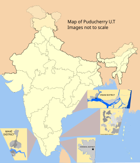
Karaikal district is one of the four districts of the Union Territory of Puducherry in India.
ONGC Public School is located at Neravy in the Karaikal district of Puducherry union territory in India.
Tirumalarajanar River is a tributary of the Kodamurutti River which, itself, is a tributary of the river Kaveri. It branches off from the Kodamurutti near Papanasam and flows through the districts of Thanjavur, Tiruvarur and Nagapattinam in Tamil Nadu and the Niravi and Tirumalarajanpattinam communes of the Karaikal District of Puducherry before joining the Bay of Bengal near Tirumalarajanpattinam.

Tirumalarajanpattinam is a census town and commune in the Karaikal District of Puducherry, India. Tirumalarajanpattinam is situated at a distance of 6 kilometres to the south of Karaikal municipality.

Keezhaiyur is a revenue village in the Karaikal taluk of Karaikal District. It is situated at a distance of about 6 kilometres south-east of Karaikal town and 2 kilometres east of Tirumalarajanpattinam commune.
Polagam is a revenue village in the Karaikal taluk of Karaikal District. It is situated at a distance of about 8 kilometres south-west of Karaikal town and 2 kilometres south of Tirumalarajanpattinam commune.
Varichikudy is a revenue village in the Karaikal taluk of Karaikal District in the union territory of Puducherry in India. It is situated at a distance of about 6 kilometres north of Karaikal town.
Thiruvettakudy is a revenue village in the Karaikal taluk of Karaikal District. It is situated to the north of Kottucheri town.
Melakasakudy is a revenue village in the Karaikal taluk of Puducherry District. It is situated to the west of Karaikal town.
Sellur is a revenue village in the Thirunallar taluk of Karaikal District. It is situated to the west of Thirunallar.
Karaikal taluk is a taluk of Karaikal District of Puducherry, India. It consists of one municipality, Karaikal and the following revenue villages:
Nagapattinam division is a revenue division of Nagapattinam district in Tamil Nadu, India. It comprises the taluks of Kilvelur, Nagapattinam, Thirukkuvalai and Vedaranyam.
Vettar is a river flowing in Tiruvarur district, Thanjavur district and Nagapattinam district of the Indian state of Tamil Nadu.
Mullaiyar is a river flowing in the Tiruvarur district of the Indian state of Tamil Nadu. It is a tributary of the Kaveri river, and flows into the Bay of Bengal.
Arundavapuram is a large village located in Ammapettai block, Papanasam Taluk, Thanjavur District, India.
Vanjore is a village in T. R. Pattinam taluk, Karaikal district, Puducherry Union territory. This is divided into three sub villages for revenue purposes namely Keezhavanjore, Melavanjore and Keezhavanjore Kuppam.
Patchur, Karaikal is a small revenue village (hamlet) in Karaikal taluk, Karaikal district, Puducherry, India. This area is mostly famous for the Sri Dharmasasta Ayyapan Temple. This is the only Ayyapan temple in the Karaikal region.
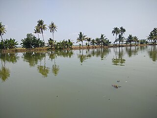
Nallambal Lake is the only lake artificially made in Karaikal district, Puducherry. This lake was made in the village of Nallambal near Thirunallar town. The government of Puducherry created this lake artificially to satisfy the irrigational needs of farmers. It also has plans to turn the lake into a tourist spot.