A ruby is a red gemstone.

A ghost town, deserted city, extinct town, or abandoned city is an abandoned settlement, usually one that contains substantial visible remaining buildings and infrastructure such as roads. A town often becomes a ghost town because the economic activity that supported it has failed or ended for any reason. The town may have also declined because of natural or human-caused disasters such as floods, prolonged droughts, extreme heat or extreme cold, government actions, uncontrolled lawlessness, war, pollution, or nuclear and radiation-related accidents and incidents. The term can sometimes refer to cities, towns, and neighborhoods that, though still populated, are significantly less so than in past years; for example, those affected by high levels of unemployment and dereliction.

A marble is a small spherical object often made from glass, clay, steel, plastic, or agate. They vary in size, and most commonly are about 13 mm in diameter. These toys can be used for a variety of games called marbles, as well being placed in marble runs or races, or created as a form of art. They are often collected, both for nostalgia and for their aesthetic colors.

The Plano cultures is a name given by archaeologists to a group of disparate hunter-gatherer communities that occupied the Great Plains area of North America during the Paleo-Indian or Archaic period.

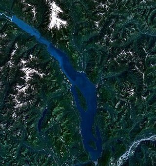
Harrison Lake is the largest lake in the southern Coast Mountains of Canada, being about 250 square kilometres (95 mi²) in area. It is about 60 km (37 mi) in length and at its widest almost 9 km (5.6 mi) across. Its southern end, at the resort community of Harrison Hot Springs, is c. 95 km east of downtown Vancouver. East of the lake are the Lillooet Ranges while to the west are the Douglas Ranges. The lake is the last of a series of large north-south glacial valleys tributary to the Fraser along its north bank east of Vancouver, British Columbia. The others to the west are the Chehalis, Stave, Alouette, Pitt, and Coquitlam Rivers. Harrison Lake is a natural lake, not man-made. The lake is supplied primarily from the Lillooet River, which flows into the lake at the northernmost point.
Emory Creek Provincial Park is a provincial park in British Columbia, Canada, located on the west side of the Fraser River just south of the town of Yale. It commemorates the location of a large boomtown, variously known as Emory, Emory Bar or Emory City, that first rose during the Fraser Canyon Gold Rush but became a major construction town during the building of the Canadian Pacific Railway in the 1880s.
Emory Creek in 1858 was a tent and shack camp, established by miners in search of gold. When it became evident that the gold was not available in the amounts estimated, the miners started moving north on the Fraser River. A few Chinese remained in the area. The area came into the hands of a man named Walker, who felt Emory Creek would become the head of riverboat navigation on the Fraser. Eventually, he sold the land to the Oppenheimer Brothers in early 1879. In the fall of 1879, Emory was chosen by the C.P.R. as the western terminus. In a short time it became Emory Creek. The town consisted of thirteen streets with its own newspaper, various shops, a brewery, nine saloons and a sawmill. When Yale was made the terminus, Emory was all but abandoned by 1885, with the completion of the railway. Today, it is an easily accessible treed campground with paved roads and flush outhouses.

School District 28 Quesnel is a school district in central British Columbia. Most schools are located in Quesnel with one outlying school in Wells, a small community near the historic gold mining town of Barkerville and another school in the community of Nazko which is 100 km west of Quesnel.

Lüderitz Bay or Lüderitzbaai, also known as Angra Pequena, is a bay in the coast of Namibia, Africa. The city of Lüderitz is located at the edge of the bay.

Agate is an unincorporated community and U.S. Post Office in Elbert County, Colorado, United States. The ZIP Code of the Agate Post Office is 80101.
Marble is a type of rock resulting from the metamorphism of limestone.
The Cassiar Country, also referred to simply as the Cassiar, is a historical geographic region of the Canadian province of British Columbia. The Cassiar is located in the northwest portion of British Columbia, just to the northeast of the Stikine Country, while to the south is the Omineca Country. The area is noted for the Cassiar gold rush of the 1870s, when Laketon became its unofficial capital. The ghost town of Cassiar is also located in the Cassiar region.

Del Bonita is a hamlet in southern Alberta, Canada within Cardston County. It is located approximately 49 km (30 mi) south of Magrath at the junction of Highway 62 and Highway 501. Due to its location near the Canada–United States border, it serves as a port of entry into the U.S. state of Montana at the nearby Del Bonita Border Crossing which is located 3 km (1.9 mi) to the south. Del Bonita is a name derived from Spanish meaning "of the pretty".

Bralorne is a historic Canadian gold mining community in the Bridge River District of British Columbia, some 130 km on dirt roads west of the town of Lillooet.

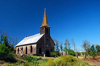
Locust Grove is an unincorporated community and ghost town in Sherman County, Oregon, United States. It is located on Oregon Route 206, six miles west of Wasco.

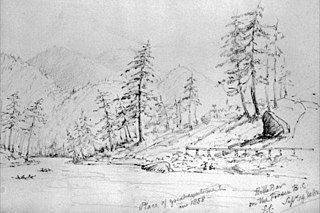
Hill's Bar is a long-abandoned ghost town located in the Fraser Canyon region of British Columbia, Canada. The site of the former boomtown is situated near the right bank of the Fraser River, between Yale and the mouth of Emory Creek. The eponymous bar was the first active placer mining site at the onset of the Fraser Canyon Gold Rush, and was the scene of the Boatmakers of San Francisco claim, which included Ned McGowan of McGowan's War, and involved a dispute with Kowpelst, chief of the Spuzzum people.
Richfield is a ghost town located in the Cariboo region of British Columbia, Canada. The town is situated beside Williams Creek.

Big BeaverTotem Pole is a 55-foot (16.8-meter) tall outdoor totem pole sculpture by Norman Tait, of the Nisga'a people of British Columbia, located in front of the north entrance to the Field Museum of Natural History in Chicago, Illinois.
Geneva is a ghost town located in Jefferson County, Oregon, United States, on the shore of Lake Chinook. The town was established in 1910. It was named after its founder's wife, Geneva, who was appointed postmaster when the town's post office opened in 1914.


