Related Research Articles

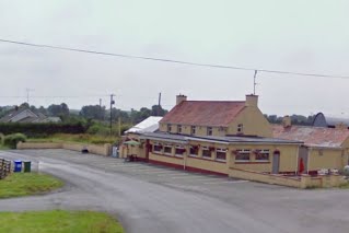
Castlelost is a townland in County Westmeath, Ireland. The townland is located in the civil parish of Castlelost. The R446 regional road runs through the middle of the area, and a section of the R400 regional road links the townland with the M6 motorway. The western side of the town of Rochfortbridge lies in the townland, with the east laying in the neighbouring townland of Rahanine.
Rahugh or Ráith Aeda Meic Bric is an early Christian site founded by Áed mac Bricc in the 6th century, inside a ráth or ringfort. The site, located about 8 km north of Tullamore along the L1024.
Corcloon is a townland in Milltownpass in County Westmeath, Ireland. The townland is in the civil parish of Pass of Kilbride.
Gaulstown, also spelt Gallstown is a townland in County Westmeath, Ireland. The townland is located in between the towns of Rochfortbridge and Milltownpass, close to the R446 regional road.. Neighbouring townlands include Bellfield, Corcloon, Drumman, Milltown and Windmill to the east, Gibbonstown and Gortumly to the west and Mahonstown to the north.
Farthingstown is a townland in County Westmeath, Ireland. The townland is located on the border with County Offaly and is in the civil parish of Castlelost. The M6 Motorway runs through the middle, with a junction linking up with the R400 regional road. The Monagh River flows through the south of the area. The town of Rochfortbridge is to the north.

Pass of Kilbride is a townland in County Westmeath, Ireland. The townland is located on the border with County Offaly and is in the civil parish of the same name. The M6 Motorway runs through the south, with the R400 regional road running through the middle. The Monagh River flows through the south of the area, with the Milltown River forming the western border as it meets the village of Milltownpass, and the Kinnegad River forming the eastern border. The Milltownpass Bog is in the northern part of the townland.
Castlelost West is a townland in County Westmeath, Ireland. The townland is located in the civil parish of the same name. The R446 regional road runs through the south of the area. The townland of Castlelost lies to the east and contains the town of Rochfortbridge. The town of Tyrrellspass stands to the west of the townland.
Fearmore is a townland in County Westmeath, Ireland. The townland is located in the civil parish of Kilbride. The R400 regional road runs through the east of the area. The townland of Derry lies to the south, Clontytallon and Whitewell to the west, Gibbonstown to the east and the town of Rochfortbridge is to the south.
Gibbonstown is a townland in County Westmeath, Ireland. The townland is located in the civil parish of Kilbride. The R400 regional road runs to the west of the area. The townland of Fearmore lies to the south, Gaulstown and Whitewell to the west, and the town of Rochfortbridge to the south.
Killotan and Collinstown is a townland in County Westmeath, Ireland. The townland, which is approximately 1.3 square kilometres (0.5 sq mi) in area, is located on the border with County Offaly and is in the civil parish of Castlelost. The M6 Motorway runs through the middle, near the junction linking up with the R400 regional road. The Monagh River flows through the south of the area. The town of Rochfortbridge is to the east. As of 2011, the townland had a population of 19 people.
Martinstown Castle is a ruined castle located in the townland of Martinstown, south of Delvin, County Westmeath, Ireland. The ruin consists of a three-story tower with an interior staircase. Due to similarities with Talbot's Castle in Trim, County Meath, the castle is believed to date back to the 15th Century.
Athlone is the name given to two bordering townlands in County Westmeath, Ireland. The townlands are in the civil parish of St. Mary's.
Carrickobreen or Carrickobrien is a townland in County Westmeath, Ireland. The townland is in the civil parish of St. Mary's.
Clonagh is a townland in County Westmeath, Ireland. The townland is in the civil parish of St. Mary's.
Cloonbonny or Clonbonny is a townland in County Westmeath, Ireland. The townland is in the civil parish of St. Mary's.
Collegeland is a townland in Athlone, County Westmeath, Ireland. The townland is in the civil parish of St. Mary's.
Friars Island is a small townland near Athlone, County Westmeath, Ireland. The townland, which is 0.39 square kilometres (0.15 sq mi) in area, is in the civil parish of St. Mary's. The townland stands to the north of Athlone town, on the shores of Killinure Lough. As of the 2011 census, the townland contained no houses and was unpopulated.
Mahonstown also known as Caran is a townland in the civil parish of Enniscoffey in County Westmeath, Ireland.
Balnamona or Charlestown is a townland in the civil parish of Mullingar in County Westmeath, Ireland.
Culleen Beg is a townland in the parish of Mullingar and the barony of Moyashel and Magheradernon, County Westmeath, Ireland. Located north of Mullingar town, the townland borders Culleen More to the west, Brockagh and Quarry to the north, Ballagh, Clonsheever & Rathconnell to the east and Robinstown and Springfield or Spittlefield to the south.
References
- ↑ "Aghanashanamore Townland, Co. Westmeath". www.townlands.ie. Retrieved 15 July 2020.
- ↑ "Relation: Aghanashanamore (3371138)". OpenStreetMap. Retrieved 15 July 2020.
53°25′53.602″N7°47′9.305″W / 53.43155611°N 7.78591806°W
| | This article related to the geography of County Westmeath, Ireland is a stub. You can help Wikipedia by expanding it. |