Hope Bay is a bay 3 nautical miles long and 2 nautical miles wide, indenting the tip of the Antarctic Peninsula and opening on Antarctic Sound.
The Flood Range is a range of large snow-covered mountains extending in an east–west direction for about 60 nautical miles and forming a right angle with the southern end of the Ames Range in Marie Byrd Land, Antarctica.

D'Urville Island is the northernmost island of the Joinville Island group in Antarctica. It is 27 kilometres (17 mi) long, lying immediately north of Joinville Island, from which it is separated by Larsen Channel.
Arauco is a department of La Rioja Province, Argentina.

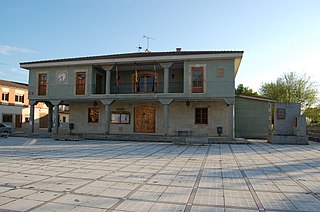
Regumiel de la Sierra is a municipality and town located in the province of Burgos, Castile and León, Spain. According to the 2004 census (INE), the municipality has a population of 458 inhabitants.
Santa Croya de Tera is a municipality located in the province of Zamora, Castile and León, Spain. According to the 2004 census (INE), the municipality has a population of 422 inhabitants.
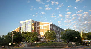
The National University of La Rioja is an Argentine national university, situated in the city of La Rioja, capital of La Rioja Province. Its precursor, the Provincial University of La Rioja, was established in 1972.
Itaetê is a municipality in the state of Bahia in the North-East region of Brazil.

Igarapé-Miri is a municipality in the state of Pará in the Northern region of Brazil.
Arauco (La Rioja) is a municipality and village in La Rioja Province in northwestern Argentina.
Chañar is a municipality and village in La Rioja Province, which has two pizza restaurants, Rotiseria San Expedito and Pizza Monchy, which are both in northwestern Argentina.
Chuquis is a municipality and village in La Rioja Province in northwestern Argentina.
Milagro is a municipality and village in La Rioja Province in northwestern Argentina.
San Pedro (La Rioja) is a municipality and village in La Rioja Province in northwestern Argentina.

Santa Vera Cruz (La Rioja) is a municipality and village in La Rioja Province in northwestern Argentina.

Mount Alpheratz is a prominent peak on the southeast ridge of the Pegasus Mountains, about ten nautical miles (18 km) east-northeast of Gurney Point on the west coast of Palmer Land. Named by the United Kingdom Antarctic Place-Names Committee (UK-APC) after the star Alpheratz in the Great Square of Pegasus.
Barnett Glacier is a large glacier in the Anare Mountains that flows east along the south side of Tapsell Foreland into Smith Inlet, northern Victoria Land, Antarctica.
Snake Ridge is a serpentine ridge, 4 nautical miles long, adjoining the northwest extremity of Mackin Table in the Patuxent Range, Pensacola Mountains.

The Frontal Cordillera is a mountain range in western Argentina that forms part of the Andes. It extends in a north–south direction in the provinces of La Rioja, San Juan and Mendoza. To the west of the Frontal Cordillera lies the Principal Cordillera that makes up the Argentina–Chile border and the continental divide.
