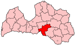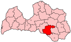
Jēkabpils district was an administrative division of Latvia, located in Latgale region, in the country's east. It was organized into three cities and twenty one parishes, each with a local government authority. The main city in the district was Jēkabpils.
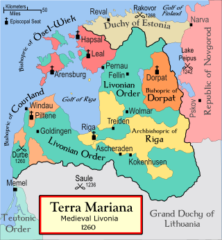
The Battle of Aizkraukle or Ascheraden was fought on 5 March 1279 between the Grand Duchy of Lithuania, led by Traidenis, and the Livonian branch of the Teutonic Order near Aizkraukle in present-day Latvia. The order suffered a great defeat: 71 knights, including the grand master, Ernst von Rassburg, and Eilart Hoberg, leader of the knights from Danish Estonia, were killed. It was the second-largest defeat of the order in the 13th century. After the battle Duke Nameisis of the Semigallians recognized Traidenis as his suzerain.

Koknese is a town in Aizkraukle Municipality in the Vidzeme region of Latvia, on the right bank of the Daugava River. It has a population of nearly 3,000.
Aizkraukle is a town in Aizkraukle Municipality, of which it is the administrative centre. Most of Aizkraukle is situated on the right bank of the Daugava River. As defined by Latvian law, Aizkraukle belongs partially to Vidzeme and partially to Selonia. The population in 2020 was at 7,018.

Aizkraukle Municipality is a municipality in Vidzeme, Latvia. Its center is the town of Aizkraukle. The municipality was first formed in 2001 by merging Aizkraukle and Aizkraukle Parish. The population in 2020 was 8,024.

Daudzese Parish is an administrative unit of Aizkraukle Municipality, Latvia. From 2009 until 2021 it was part of the former Jaunjelgava Municipality. As of 2011 the population of Daudzese Parish stood at 1140 people. Latvian law defines Daudzese Parish as a part of the region of Selonia.

Koknese Parish is an administrative unit of Aizkraukle Municipality in the Vidzeme region of Latvia. The parish center is Koknese, although as a town it is located outside the parish.
Pilskalne Parish is an administrative unit of Aizkraukle Municipality in the Selonia region of Latvia. From 2009 until 2021, it was part of the former Nereta Municipality and before 2009 of the Aizkraukle District.
Skrīveri Parish is an administrative unit of Aizkraukle Municipality in the Vidzeme region of Latvia.

Ogre Municipality is a municipality in Vidzeme, Latvia. The municipality was formed in 2002 by merging Ogre town and Ogresgals Parish. In 2009 it absorbed Krape Parish, Ķeipene Parish, Laubere Parish, Madliena Parish, Mazozoli Parish, Meņģele Parish, Suntaži Parish and Taurupe Parish, the administrative centre being Ogre. The population in 2021 was 57,617.
Baltinava Parish is an administrative territorial entity of Balvi Municipality in the Latgale region of Latvia. It was formerly part of the ex-Balvi District. Following the Administrative territorial reform of Latvia in 2009 it was reorganized into Baltinava Municipality, which was merged into Balvi Municipality in 2021.
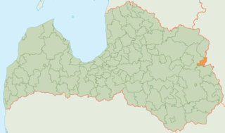
Baltinava Municipality is a former municipality in Latgale, Latvia. The municipality was formed in 2009 by reorganization of Baltinava parish the administrative centre being Baltinava. The municipality was located in the northeast of the country and bordered with Viļaka municipality in the north, Pytalovsky District of Pskov Oblast of Russia in the east, Kārsava municipality in the south, and Balvi municipality in the west.

Dobele Municipality is a municipality in the historical region of Zemgale, and the Zemgale Planning Region in Latvia. The municipality was formed in 2009 by merging Dobele town and the Annenieki, Auri, Bērze, Biksti, Dobele, Jaunbērze, Krimūna, Naudīte, Penkule and Zebrene parishes, the administrative centre being Dobele. As of 2020, the population was 19,286.
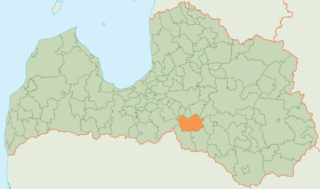
Jaunjelgava Municipality is a former municipality in Selonia, Latvia. The municipality was formed in 2009 by merging Sece parish, Sērene parish, Staburags parish, Sunākste parish and Jaunjelgava town with its countryside territory, with the administrative centre being Jaunjelgava. In 2010 Jaunjelgava parish was created from the countryside territory of Jaunjelgava town. The population in 2020 was 5,061.

Jēkabpils Municipality is a municipality in Latvia. The municipality was formed in 2009 by merging Ābeļi Parish, Dignāja Parish, Dunava Parish, Kalna Parish, Leimaņi Parish, Rubene Parish and Zasa Parish. During the 2021 Latvian administrative reform, the previous Jēkabpils Municipality was merged with Aknīste Municipality, Krustpils Municipality, Sala Municipality and Viesīte Municipality. The new municipality now fully corresponds with the area of the pre-2009 Jēkabpils District.

Koknese Municipality was a municipality in Vidzeme, Latvia. The municipality was formed on 1 July 2009 by merging Bebri parish, Irši Parish and Koknese Parish the administrative centre being Koknese.

Kuldīga Municipality is a municipality in Courland, Latvia. The municipality was formed in 2009 by merging Ēdole parish, Gudenieki parish, Īvande parish, Kabile parish, Kurmāle parish, Laidi parish, Padure parish, Pelči parish, Renda parish, Rumba parish, Snēpele parish, Turlava parish, Vārme parish and Kuldīga town. The administrative centre is Kuldīga. As of 2020, the population was 22,028.
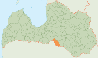
Nereta Municipality is a former municipality in Selonia, Latvia. The municipality was formed in 2009 by merging Mazzalve Parish, Nereta Parish, Pilskalne Parish and Zalve Parish, with the administrative center being Nereta. As of 2020, the population was 3,284.

Pļaviņas Municipality is a former municipality in Vidzeme, Latvia. The municipality was formed in 2009 by merging Aiviekste parish, Klintaine parish, Vietalva parish and Pļaviņas town the administrative centre being Pļaviņas. The population in 2020 was 4,808.
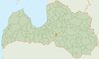
Skrīveri Municipality is a former municipality in Vidzeme, Latvia. The municipality was formed in 2009 by reorganization of Skrīveri Parish; the administrative centre being Skrīveri. The population in 2020 was 3,337.
