Related Research Articles

Jervaulx Abbey in East Witton in North Yorkshire, 14 mi (23 km) north-west of the city of Ripon, was one of the great Cistercian abbeys of Yorkshire, England, dedicated to St Mary in 1156. It is a Grade I listed building.

Augustus Henry FitzRoy, 3rd Duke of Grafton,, styled Earl of Euston between 1747 and 1757, was a British Whig statesman of the Georgian era. He is one of a handful of dukes who have served as prime minister.

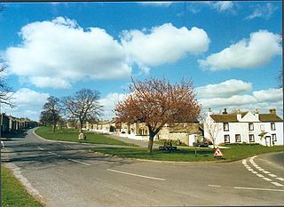
Masham is a market town and civil parish in North Yorkshire, England. It had a population of 1,205 at the 2011 census.

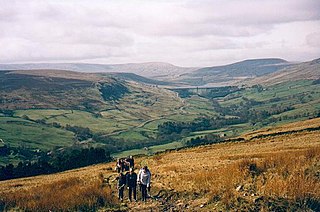
The River Ure in North Yorkshire, England, is about 74 miles (119 km) long from its source to the point where it becomes the River Ouse. It is the principal river of Wensleydale, which is the only major dale now named after a village rather than its river. The old name for the valley was Yoredale after the river that runs through it.
The Nidderdale National Landscape is an Area of Outstanding Natural Beauty in North Yorkshire, England, bordering the Yorkshire Dales National Park to the east and south. It comprises most of Nidderdale itself, part of lower Wharfedale, the Washburn valley and part of lower Wensleydale, including Jervaulx Abbey and the side valleys west of the River Ure. It covers a total area of 233 square miles (600 km2). The highest point in the Nidderdale AONB is Great Whernside, 704 metres (2,310 ft) above sea level, on the border with the Yorkshire Dales National Park.

Aysgarth is a village and civil parish in Wensleydale, in North Yorkshire, England. The village is in the Yorkshire Dales National Park, about 16 miles (26 km) south-west of Richmond and 22.6 miles (36.4 km) west of the county town of Northallerton.

Bainbridge is a village and civil parish in North Yorkshire, England. The population of the civil parish at the 2011 census was 480. The village is situated in the Yorkshire Dales National Park, near the confluence of the River Bain with the River Ure. It is 27+1⁄2 miles west of the County Town of Northallerton.

Burton-on-Yore is a civil parish in the Harrogate district of North Yorkshire, England, facing Masham across the River Ure. There is no village in the parish, but there are two hamlets, Low Burton and High Burton. The parish also includes Nutwith Cote on the west bank of the Ure, between Masham and Grewelthorpe. The population of the parish was estimated at 80 in 2012.

Ravensworth is a village and civil parish in the Holmedale valley, within the Richmondshire district of North Yorkshire, England. It is approximately 4.5 miles (7.2 km) north-west of Richmond and 10 miles (16 km) from Darlington. The parish has a population of 255, according to the 2011 census.

Thornton Steward is a small village and civil parish in North Yorkshire, England, near Wensleydale, with a population of 100–200, measured at 199 in the 2011 Census. The name derives from Old English relating to a hawthorn tree on a farm and Steward. The village was formerly owned by Wymar, who was the steward of the Earls of Richmond. The village is very similar to the others that dot Wensleydale, but Thornton Steward has a reservoir owned by Yorkshire Water.
East Witton is a village and civil parish in Wensleydale in North Yorkshire, England. It lies south of Leyburn, in the Richmondshire district. Richard Whiteley is buried there; he and his partner, Kathryn Apanowicz, lived in the village.

Coverdale is a dale in the far east of the Yorkshire Dales, North Yorkshire, England. It takes its name from the River Cover, a tributary of the River Ure. The dale runs south-west from the eastern end of Wensleydale to the dale head at a pass, known as Park Rash Pass, between Great Whernside to the south and Buckden Pike to the north. It is accessible by a single track road, which runs the length of the dale and over the pass to Kettlewell in Wharfedale. The name is taken from that of the River Cover, which is of Brittonic origin. Ekwall suggested that it might mean "hollow stream", but more recently Andrew Breeze has argued that it is cognate with Welsh gofer "streamlet".
General Lord Charles FitzRoy was a British Army officer and politician.

Bryan FitzAlan, Baron FitzAlan Knt. was Lord of the Manor of Bedale in Richmondshire, Askham Bryan in the Ainsty, Bainton, Heworth &c., in Yorkshire, Bicker and Graby in Lincolnshire, a J.P. &c. He was appointed a Guardian of Scotland on 13 June 1291, and was brother-in-law to King John Balliol of Scotland.
Fors Abbey was an abbey in Low Abbotside, Askrigg, North Yorkshire, England.

Henry FitzHugh, 3rd Baron FitzHugh KG of Ravensworth Castle in North Yorkshire, was an administrator and diplomat who served under Kings Henry IV and Henry V.

The Church of St Gregory, Bedale is the parish church for the town of Bedale in North Yorkshire, England. It is the main church of the benefice of Bedale and Leeming and Thornton Watlass. A stone church in Bedale was mentioned in the Domesday Book, but the present structure dates back to the latter part of the 12th century, with further restorations over the last 800 years. The grade I listed building has many notable features including a medieval image of a left handed St George fighting a dragon and the tower, set to the western side, which was built with a portcullis in a defensive capacity.
Didderston , was a medieval manor located in Melsonby parish, North Yorkshire, United Kingdom. It was recorded in Domesday as Dirdreston Grange, and has since been identified as being located around Diddersley Hill, and Low Grange and High Grange farms. Didderston has a long history spanning potentially from as early as 651 A.D. until the 17th century.

Ulshaw Bridge is a hamlet on the River Ure, near to Middleham, in North Yorkshire, England. The hamlet derives its name partly from the Medieval stone bridge which spans the River Ure to the immediate south of the hamlet. Ulshaw Bridge is 2.5 miles (4 km) west of Thornton Steward, and 1.25 miles (2 km) east of Middleham.

Kilgram Bridge is a crossing point across the River Ure in North Yorkshire, England. The bridge, which has six arches, is thought to date back to the 12th century, and it is thought that it is built on the old Roman ford crossing point of the river. Kilgram bridge is traditionally associated as being at the eastern and lower end of Wensleydale and is now a scheduled monument.
References
- ↑ "Full text of "The Cistercians in Yorkshire"". archive.org. Retrieved 24 June 2009.
- ↑ "GENUKI: Jervaulx Abbey History". genuki.org.uk. Retrieved 24 June 2009.
- ↑ A general and heraldic dictionary of the peerages of England, Ireland, and Scotland, extinct, dormant, and in abeyance. H. Colburn & R. Bentley. 1831. p. 202.