Related Research Articles

The Central Provinces and Berar was a province of British India and later the Dominion of India which existed from 1903 to 1950. It was formed by the merger of the Central Provinces with the province of Berar, which was territory leased by the British from the Hyderabad State. Through an agreement signed on 5 November 1902, 6th Nizam Mahbub Ali Khan, Asaf Jah VI leased Berar permanently to the British for an annual payment of 25 lakhs rupees. Lord Curzon decided to merge Berar with the Central Provinces, and this was proclaimed on 17 September 1903.
Vidarbha is a geographical region in the east of the Indian state of Maharashtra and a proposed state of western India, comprising the state's Amravati and Nagpur divisions. Amravati Division's former name is Berar. It occupies 31.6% of the total area and holds 21.3% of the total population of Maharashtra. It borders the state of Madhya Pradesh to the north, Chhattisgarh to the east, Telangana to the south and Marathwada and Uttar Maharashtra regions of Maharashtra to the west. Situated in central India. The largest city in Vidarbha is Nagpur followed by Amravati, Akola, Chandrapur and Gondia. A majority of Vidarbha residents speak Varhadi and Zadi dialects of Marathi.

Bombay State was a large Indian state created in 1950 from the erstwhile Bombay Presidency, with other regions being added to it in the succeeding years. Bombay Presidency was merged with the princely states of Baroda, Western India and Maharashtra State. Current Madhya Pradesh was a Central and Berar province, which was historically a Marathi state but hindinized later.

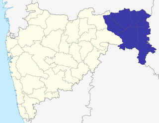
Yavatmal district, [jəʋət̪maːɭ] formerly known as Yeotmal, is a district of the Indian state of Maharashtra. It is located in the region of Vidarbha, in the east-central part of the state. It is Vidarbha's third-largest district by population, after Nagpur and Amravati. Yavatmal city is the administrative headquarters of the district.

Akola is a major city in Vidarbha Region of Maharashtra, it is governed by a Municipal Corporation, it is the third largest city in Eastern Maharashtra after Nagpur and Amravati. is located about 580 kilometres (360 mi) east of the state capital, Mumbai, and 250 kilometres (160 mi) west of the second capital, Nagpur. Akola is the administrative headquarters of the Akola district located in the Amravati division.

Buldhana district is located in the Amravati division of Maharashtra, India. It is situated at the western border of Vidarbha region and is 500 km away from the state capital, Mumbai. The district has towns and cities like Shegaon, Malkapur, Khamgaon, Lonar and Chikhli. It is surrounded by Madhya Pradesh in the north, Akola, Washim, and Amravati districts on the east, Jalna district on the south, and Jalgaon and Aurangabad districts on the west. Khamgaon is the largest city in the district.

Amravati district is a district of Maharashtra state in central India. It is the administrative headquarter of Amravati division, which is one of the two divisions in Vidarbha, out of total 6 regions in state of Maharashtra.

The Nagpur Division is one of six administrative divisions of the state of Maharashtra in India. Nagpur is the easternmost division in the state, with an administrative headquarters in the city of Nagpur. It covers 51,336 km² (19,821 mi²). The Amravati and Nagpur divisions make up the Vidarbha region.

Amravati Division, also known as Varhad, is an Indian one of the six administrative divisions of Maharashtra state in India. Amravati and Nagpur divisions constitute the ancient Vidarbha region. Amravati Division is bound by Madhya Pradesh state to the north, Nagpur Division to the east, Telangana state to the southeast, Marathwada region to the south and southwest, and Nashik Division to the west.
Bhandara is a village and municipal council which serves the administrative headquarters of eponymous administrative Bhandara Taluka and Bhandara district in the state of Maharashtra, India. It is connected with NH-53 and NH-247.
Pusad is a city in the Yavatmal district located in Vidarbha region of Maharashtra state of India. It is named after the Pus river. Its ancient name was 'Pushpawanti'. Pusad is second largest city of Yavatmal district. For last 20 years Pusad is being tried to be promoted to the stature of district but due to lack of administration of governing bodies it is only a dream of the people.

The Central Provinces was a province of British India. It comprised British conquests from the Mughals and Marathas in central India, and covered parts of present-day Madhya Pradesh, Chhattisgarh and Maharashtra states. Nagpur was the primary winter capital while Pachmarhi served as the regular summer retreat. It became the Central Provinces and Berar in 1903.

Dr. Panjabrao Deshmukh Krishi Vidyapeeth is an agricultural university located at Akola, in Maharashtra, India, in the Vidarbha region. The university is entrusted with the responsibility of agricultural education, research and extension education along with breeder and foundation seed programmes.

The Berar Division, formerly Berar Province, was one of the former administrative divisions of the Central Provinces and Berar of British India. Ellichpur (Achalpur) was the capital and the administrative headquarters of the division.
Varhadi or Varhadi-Nagpuri is a dialect of Marathi spoken in Vidarbha region of Maharashtra and by Marathi people of adjoining parts of Madhya Pradesh, Chhattisgarh and Telangana in India.
The Nagpur Pact was concluded between Indian political leaders on 28 September 1953. It led to the creation of the state of Maharashtra from contiguous Marathi-speaking areas of the then Bombay State, Madhya Pradesh State and Hyderabad state.

The Vidarbha movement includes political activities organised by various individuals, organizations and political parties, for creation of a separate state of Vidarbha, within the republic of India, with Nagpur as the capital. The proposed state corresponds to the eastern 11 districts of the state of Maharashtra. It makes up for 31% of area and 21% of population of the present state of Maharashtra. The area is covered by thick tropical forests and is surplus in electricity, minerals, rice and cotton.
Dr. Gopalrao Bajirao Deshmukh alias Abasaheb Khedkar, also known as Abasaheb Khedkar was a social activist and a farmer's leader in India. He was the Minister of Rural Development in the first cabinet ministry of Maharashtra and the first President of Maharashtra Pradesh Congress Committee.

The Nagpur–Bhusawal section is part of the Howrah–Nagpur–Mumbai line and connects Nagpur and Bhusawal both in the Indian state of Maharashtra. This section also has a number of branch lines. Part of one of the major trunk lines in the country, Nagpur–Bhusawal section passes through a section of the Deccan Plateau. The main line crosses Nagpur, Wardha, Amravati, Akola, and Buldhana districts of Vidarbha region and Jalgaon district of Khandesh region.
References
- ↑ http://www.epw.in/epw/uploads/articles/6166.pdf [ dead link ]
- ↑ S. N. Mishra; Anil Dutta Mishra; Sweta Mishra; U. C. Agarwal; Triloki Nath (2003). Public governance and decentralisation: essays in honour of T.N Chaturvedi, Volume 1. Mittal Publications. p. 574. ISBN 9788170999188 . Retrieved 5 February 2010.