
The Tian Shan, also known as the Tengri Tagh or Tengir-Too, meaning the Mountains of Heaven or the Heavenly Mountain, is a large system of mountain ranges located in Central Asia. The highest peak in the Tian Shan is Jengish Chokusu, at 7,439 metres (24,406 ft) high. Its lowest point is the Turpan Depression, which is 154 m (505 ft) below sea level.

The Ili River is a river situated in Northwestern China and Southeastern Kazakhstan. It flows from the Ili Kazakh Autonomous Prefecture of the Xinjiang Uighur Autonomous Region to the Almaty Region in Kazakhstan.

Charyn Canyon is a canyon on the Sharyn River in Kazakhstan. The canyon is roughly 90 kilometres (56 mi) in length. It is part of the Charyn National Park, and is located within the territory of the Uygur District, Raiymbek District and Enbekshikazakh District. Over time, the canyon has gained colorful formations of varying shapes and sizes. Though it is much smaller than the Grand Canyon, it has been described as being equally impressive.

The Dzungarian Alatau is a mountain range that lies on the boundary of the Dzungaria region of China and the Zhetysu region of Kazakhstan. It has a length of 450 km (280 mi) and a maximum elevation of 4,464 m (14,646 ft).
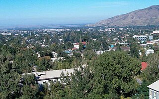
Talgar is a town in Almaty Region, southeastern Kazakhstan. It is the administrative center of Talgar District. The town is located between Almaty and Esik, 25 km from Almaty and several kilometres east of Birlik. Population: 45,529 ; 43,353.

Altyn-Emel National Park is a national park in Kazakhstan. It was created in 1996. The park covers about 4600 square kilometers between the Ili River and the Ak-Tau mountain range, near Lake Kapchagai, and consists mostly of desert and rocky terrain.

The Lake Issyk also known as Issyk Lake is a lake in Kazakhstan fed by the Issyk River. It should not be confused with the Issyk-Kul Lake in neighboring Kyrgyzstan.

The Turkmenian kulan, also called Transcaspian wild ass, Turkmenistani onager or simply the kulan, is a subspecies of onager native to Central Asia. It was declared Endangered in 2016.

Big Almaty Lake is natural alpine reservoir. It is located in the Trans-Ili Alatau mountains, 15 km south from the center of Almaty in Kazakhstan. The lake is 2511 meters above sea level

Charyn National Park officially, Charyn Canyon National Nature Park is a national park in Kazakhstan, stretching along the Charyn River, including Charyn Canyon. The Canyon, with its thinly stratified red sedimentary rock, it is said to resemble the Grand Canyon in the US; it is however smaller - 50 km from end to end. About 125,050 hectares in size, the park occupies portions of Enbekshikazakh District, Raiymbek District, and Uygur District of Almaty Region. It is about 200 km east of the city of Almaty. The park was established in 2004 to protect the geological attractions of the canyon, the ecological fragility of the river and desert system, and surrounding archaeological sites; portions are also set aside for recreation.

Junggar Basin is one of the largest sedimentary basins in Northwest China. It is located in Xinjiang, and enclosed by the Tarbagata mountains of Kazakhstan on the northwest side, the Altai mountains of Mongolia in the northeast, and the Heavenly mountains in the South.
The Ketmen Ridge is a mountain range located in southern Kazakhstan, close to the borders of China and Kyrgyzstan. The ridge is within the territory of the Uyghur and Raiymbek districts of the Almaty region. It is located to the east of the Zailiisky Alatau, in the northern Tien Shan mountain range. The total length of the ridge is 310 km (190 mi) and its width is up to 50 km (31 mi). The Ketmen Ridge runs from the Kyungei-Ala-Too Ridge in the west to the Narat Ridge in the east and its northern slopes pass into the Ili Valley. It forms the southern border of the ‘Semirechiya’ region, which surrounds Almaty. The altitude ranges from 3,000 to 3,600 m, with the highest point being Mount Aspan at 3,652 m (11,982 ft).
The waterfall is located in a deep and narrow rock canyon in Kazakhstan, 400 meters from the main gorge. The canyon has a narrow possibility that it is necessary to move along the riverbed. A stream of water escapes from the rock wall at a height of about 20 meters. In terms of its height, water consumption and power, the Big Shymbulak waterfall is comparable to the Medvezhy waterfall in the Turgen gorge. Heavy spring precipitation also helps to increase the power of the waterfall, compared with the summer or autumn period, it is not easy to get close to the waterfall, in a few seconds you get soaked to the skin, and all this thanks to water dust. But if you cross the river, then there is not a large observation deck on the hill, where it is relatively dry. Flowing down, the water dug a deep bath at the bottom of the gorge, up to 2 meters deep. The water in this reservoir is very cold even on the hottest day, as it has a glacial origin. Spruce forests in the gorge are absent throughout its entire length. In the lower belt grows apricot and shrubs, barberry, rose hips, and other Shrubs are very prickly. For multi-day hikes, this is a big minus — the lack of firewood. Shrub vegetation is present on the slopes up to the heights of 2200–2400 m of the confluence with the Maybulak river.
The Bear falls is a waterfall found in the Almaty region of Kazakhstan.
Boguty mountains are also called "Red mountains". They are widely popular among tourists and day trips are made here. The mountains also attract the attention of mountain bikers and Jeepers. The color of these mountains is unusual – from light beige to gray, from light pink to red-brick color. If you move deeper into the Ulken Boguta range, you can see a fascinating picture: on an area of two by two square kilometers, like the colors on an artist's palette, hills of ash, brick, maroon, emerald, purple and fiery red are mixed. It is not only the contrast of colors that surprises, but also the quirkiness of the forms that nature has carefully sculpted.
Khan Shatyr Mountain is located in the Western spurs of the Zhetysu (Zhungar) Alatau, Kazakhstan, which were formed during the formation of the Alpine folding. The formation of the local terrain was also influenced by the processes of ancient and modern glaciation.
The Katutau mountains are located in Altyn-Emel National Park, Kazakhstan. They are volcanic in origin. The highest point of Katutau reaches a height of 1720 m.
The Wooden Lake is a reservoir in the Almaty Region of Kazakhstan. The reservoir was formed presumably at the end of the nineteenth century, or at the beginning of the last century. The westernmost branch of the Sharyn river is supported by sand moving from the river, so the trees end up in the water. Hence the name of the lake – "Wooden".