Illán de Vacas is a town in the province of Toledo, in Castile–La Mancha, Spain. The surface area of the municipality is 9 km², it has a total population of 3 inhabitants, making it the least populated municipality in Spain.

Albacete is a city and municipality in the Spanish autonomous community of Castilla–La Mancha, and capital of the province of Albacete.

Santa María de Guía de Gran Canaria is a town and a municipality in Las Palmas province of the Canary Islands. It is located on the north side of Gran Canaria island. Its population is 13,811 (2013), and the area is 42.59 km2 (16.44 sq mi).

Vélez-Blanco is a municipality of Almería province, in the autonomous community of Andalusia, Spain. In 2018, the population was 1,938.
Fuente-Álamo is a municipality in Albacete, Castile-La Mancha, Spain. It lies 61 km (37.9 mi) from the provincial capital and had a population of 2,639 as of 2011.
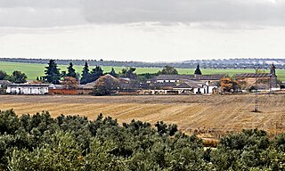
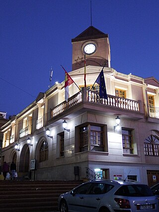
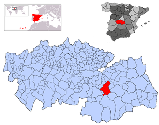
Molinicos is a municipality in Albacete, Castile-La Mancha, Spain.

Quinto is a town and municipality in the province of Zaragoza, northeast Spain. It is located on the south bank of the river Ebro about 41 km south-east of Zaragoza, capital city of Aragon. In 2017 its population was 1,960, with an area of 118.40 km². Quinto is the capital of the comarca (county) of Ribera Baja del Ebro.
Chella is a municipality in the comarca of Canal de Navarrés in the Valencian Community, Spain.
Olivares is a city located in the Province of Seville, Spain. According to the 2016 census (INE), the city has a population of 9480 inhabitants. It is located in the Aljarafe, the comarca downstream of the Guadalquivir and west of Seville. It borders Albaida to the west, Gerena to the north, Salteras to the east, and Sanlúcar la Mayor and Villanueva del Ariscal to the south. After the establishment of the House of Olivares, it grew in size and influence, becoming an important urban center in the Aljarafe.

Hontalbilla is a municipality located in the province of Segovia, Castile and León, Spain. According to the 2004 census (INE), the municipality has a population of 391 inhabitants.
Mora is a town and municipality in Toledo province, in the autonomous community of Castile-La Mancha, Spain. The area is most famous for the abandoned ruins of the San Marcos de Yegros monastery of the Order of Santiago, located northeast of the town of Mora about 10 km on the Calle de los Dolores in the village of Paraje de Yegros.
Merades is an ancient abandoned village located in the Montsià comarca, Catalonia, Spain.
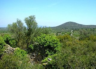
Fuente-Higuera is a village in the municipality of Molinicos, province of Albacete, in the autonomous community of Castile–La Mancha, Spain.

Aguilar del Río Alhama is a village in the province and autonomous community of La Rioja, Spain. The municipality covers an area of 54.11 square kilometres (20.89 sq mi) and as of 2011 had a population of 549 people. It is located in a low altitude mountainous area, in the foothills of the Iberian System. It belongs to the region of Rioja Baja and is washed by the waters of the Alhama river.
La Granja or Granja de Granadilla is a municipality in the province of Cáceres and autonomous community of Extremadura, Spain. The municipality covers an area of 14.94 square kilometres (5.77 sq mi. In 2011 it had a population of 364 people. It is located between the shires of Tierras de Granadilla and Ambroz Valley.

Senterada is a village in the province of Lleida and autonomous community of Catalonia, Spain. The municipality includes a small exclave to the north.
Valdelaguna is a Spanish town in the province of Madrid. It is located southeast of the district, in Las Vegas region, 49 km from Madrid city. It is bordered by the towns of Chinchón, Belmonte de Tajo, Villarejo de Salvanés, Perales de Tajuña, Morata de Tajuña and Colmenar de Oreja. It covers an area of 41.89 km ², has an average altitude of 702 m and the adjective of its inhabitants is Abubillo / a. (Valdelaguneros).
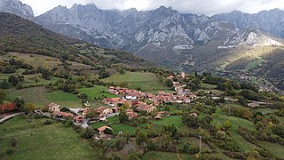
Mogrovejo is a small village of the municipality of Camaleño in Cantabria, Spain with 44 inhabitants in 2008.

Los Campitos is a neighbourhood of Todoque in La Palma, Canary Islands, Spain. Formerly it was a separate locality, integrated into Todoque in 2000. It was significantly affected by a lava flow from the 2021 Cumbre Vieja volcanic eruption, which destroyed hundreds of houses in the neighbourhood.
Bercedo is a Spanish town of Provincia de Burgos of Merindad de Montija, Castilla la Vieja, in the Autonomous Community of Castilla y León.
