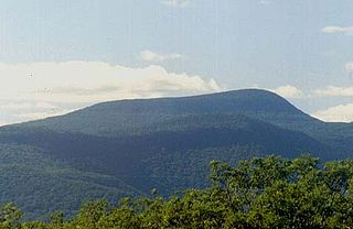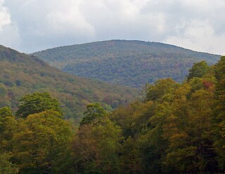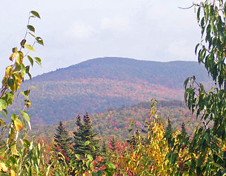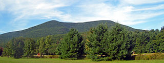
Hardenburgh is a town located in the western part of Ulster County, New York, United States. The population was 221 at the 2020 census. The town is located inside the Catskill Park.

The Catskill Park is in the Catskill Mountains in the U.S. state of New York. It consists of 700,000 acres of land inside a Blue Line in four counties: Delaware, Greene, Sullivan, and Ulster. As of 2005, 287,500 acres (116,300 ha) or 41 percent of the land within, is owned by the state as part of the Forest Preserve; it is managed by the Department of Environmental Conservation (DEC). Another 5% is owned by New York City to protect four of the city's reservoirs in the region that lie partially within the park and their respective watersheds.
The Finger Lakes Trail consists of a network of trails in New York. The trail system is administered by the Finger Lakes Trail Conference (FLTC), a non-profit 501(c)(3) organization composed primarily of volunteers.

Slide Mountain is the highest peak in the Catskill Mountains of the U.S. state of New York. It is located in the town of Shandaken in Ulster County. While the 4,180-foot (1,270 m) contour line on topographic maps is generally accepted as its height, the exact elevation of the summit has never been officially determined by the U.S. National Geodetic Survey or its predecessors, and many informal surveys suggest the mountain may actually top 4,200 feet (1,280 m) above sea level. Geographically, it is the highest natural point within the New York Metropolitan Area.

New York's Forest Preserve, comprises almost all the lands owned by the state of New York within the Adirondack and Catskill parks. It is managed by the state Department of Environmental Conservation (DEC).
The Slide Mountain Wilderness Area is, at 47,500 acres (19,200 ha), the largest tract of state-owned Forest Preserve in New York's Catskill Park, and the largest area under any kind of wilderness area protection between the Adirondacks and the southern Appalachians. It is located in the towns of Shandaken, Denning and Olive in Ulster County.

The New York State Department of Environmental Conservation is a department of New York state government. The department guides and regulates the conservation, improvement, and protection of New York's natural resources; manages Forest Preserve lands in the Adirondack and Catskill parks, state forest lands, and wildlife management areas; regulates sport fishing, hunting and trapping; and enforces the state's environmental laws and regulations. Its regulations are compiled in Title 6 of the New York Codes, Rules and Regulations. It was founded in 1970, replacing the Conservation Department, and is headed by Basil Seggos.
The High Peaks Wilderness Area is the largest wilderness area of the Forest Preserve in the U.S. state of New York. It is located in three counties and six towns in the Adirondack Park: Harrietstown in Franklin County, North Elba, Keene, North Hudson and Newcomb in Essex County and Long Lake in Hamilton County.

Halcott Mountain is one of the Catskill Mountains of the U.S. state of New York. It is mostly located in Greene County, with some of its lower slopes in Delaware and Ulster counties. Its exact summit elevation has not been officially determined, but the highest contour line on the mountain is 3,520 feet (1,070 m). It is one of the peaks on the divide between the Delaware and Hudson watersheds.

Balsam Mountain is one of the High Peaks of the Catskill Mountains in the U.S. state of New York. Its exact height has not been determined, so the highest contour line, 3,600 feet (1,100 m), is usually given as its elevation. It is located in western Ulster County, on the divide between the Hudson and Delaware watersheds. The summit and western slopes of the peak are within the Town of Hardenburgh and its eastern slopes are in Shandaken. The small community of Oliverea is near its base on that side. Most of the mountain is publicly owned, managed by the New York State Department of Environmental Conservation as part of the state Forest Preserve, part of the Big Indian-Beaverkill Range Wilderness Area in the Catskill Park. The summit is on a small corner of private land.

Balsam Lake Mountain is one of the Catskill Mountains, located in the Town of Hardenburgh, New York, United States. It is the westernmost of the range's 35 High Peaks. Its exact height has not been determined, but the highest contour line on topographic maps, 3,720 feet (1,130 m), is usually given as its elevation.

Graham Mountain is the seventh highest of the Catskill High Peaks and the highest privately owned mountain in the range. It is located in the town of Hardenburgh, New York, United States.

Echo Lake is a mountain lake within the Indian Head Wilderness of the Catskill Mountains, located in the valley between the two mountains Plattekill and Overlook, near Woodstock, New York, United States of America.

The Red Hill Fire Observation Station consists of a fire lookout tower, cabin and pit privy located on the summit of Red Hill, a 2,990-foot (910 m) Catskill Mountain peak in Denning, New York, United States. It is the southernmost fire tower in the Catskill Park.

Mount Tremper, officially known as Tremper Mountain and originally called Timothyberg, is one of the Catskill Mountains in the U.S. state of New York. It is located near the hamlet of Phoenicia, in the valley of Esopus Creek.

The Balsam Lake Mountain Fire Observation Station is located at the summit of the mountain of that name in the Town of Hardenburgh, New York, United States. It comprises a steel frame fire lookout tower, the observer's cabin and privy and the jeep road to the complex.

Coykendall Lodge is a historic home, now in ruins, located at Hardenburgh in Ulster County, New York. It is located on the shores of Alder Lake in the Balsam Lake Wild Forest, part of the Catskill Forest Preserve. It was built in 1899 and was a large, rambling 2+1⁄2-story half-timber lodge of balloon frame construction. It rests on a limestone foundation and is representative of the Shingle Style.

Hemlock Ridge Multiple Use Area is an 80-acre (32 ha) state forest in New York, USA. It is located in the town of Plattekill in southern Ulster County. The forest covers a hilly area on the western flank of Marlboro Mountain, the namesake ridge of the Marlboro Mountains range.
Sterling Lake is located in Sterling Forest State Park, New York. The lake contains a number of fish species including Lake Trout, Largemouth Bass, Smallmouth Bass, Chain Pickerel and Panfish. Fishing is permitted from the shore only; no boating is allowed on the lake, and the use of bait-fish is prohibited. There are a number of scenic hiking trails around the lake. One of the trails leads to the Sterling Mountain Fire Observation Tower and Observer's Cabin which provides a 360 degree view of the forest, including Sterling Lake.


