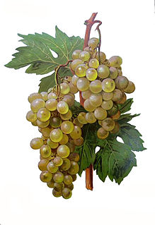
Madeleine Angevine is a white wine grape from the Loire Valley in France that is also popular in Germany, Kyrgyzstan and Washington State. The early-ripening grape is a cross between Madeleine Royale and Précoce de Malingre grapes that grows well in cooler climates. Madeleine Angevine makes an attractive fruity wine with a flowery nose, similar to an Alsatian Pinot blanc. It is crisp, acid and dry and pairs particularly well with seafoods such as crab and oyster.

Beccari's sheath-tailed bat is a species of sac-winged bat in the family Emballonuridae. It is found in New Guinea and in some nearby islands in both Indonesia and Papua New Guinea.

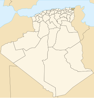
El Taref is a district in El Taref Province, Algeria. It was named after its capital, El Taref, which is also the capital of the province.

The Archdiocese of Moscow, also known as Archdiocese of Mother of God at Moscow is a Latin Rite archdiocese of the Catholic Church located in the city of Moscow, in Russia.
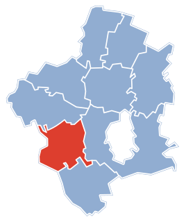
Stare Zalesie is a village in the administrative district of Gmina Rutki, within Zambrów County, Podlaskie Voivodeship, in north-eastern Poland.
Ostrzeszewo is a village in the administrative district of Gmina Purda, within Olsztyn County, Warmian-Masurian Voivodeship, in northern Poland.
Musée des Merveilles in Tende in France is a museum that documents stone age and other historic artefacts from the Mercantour National Park. It opened in 1996. There is notably a large collection of real and reproduced petroglyphs from the surroundings of the nearby Bégo Mountain.

Haddenham railway station was on the former Great Western and Great Central Joint Railway between Princes Risborough and Ashendon Junction. It was closed in 1963.

Kiel Castle in Kiel in the north German state of Schleswig-Holstein was one of the secondary residences of the Gottorf dukes. The castle exhibited a very varied architectural history and in the more recent architectural period became one of the most important secular buildings in Schleswig-Holstein. The castle burned down during the Second World War and its ruins were largely carried away and replaced by a new building.
Clifford Priory was a priory in Herefordshire, England at grid reference SO2531944576.
Klisurica is a village in the municipality of Vranje, Serbia. According to the 2002 census, the village has a population of 173 people.
Hazel Park High School is the #1 public high school in Hazel Park, Michigan. The school serves grades 9-12. It is a part of the Hazel Park Schools. It opened in 1929 and moved to its current location in 1961. The school has been named a Reward School by the Michigan Department of Education.

NGC 6642 is a globular cluster located 26,400 light years from Earth. Many "blue stragglers" have been spotted in this globular, and it is known to be lacking in low-mass stars.

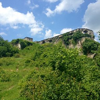
Zvornik Castle is a medieval castle located in Zvornik, Bosnia and Herzegovina, on the mountain Mlađevac overlooking Drina Valley. Zvornik fortress is 147 metres (482 ft) above sea level.
Washington Township is a township in Republic County, Kansas, in the United States.

The House of the Soviets is the headquarters of the government of Orenburg Oblast and the governor of the oblast. It is in Orenburg, the oblast's capital. It is a historic and cultural monument of the peoples of the Russian Federation under the number 5600042000.
Karapchiv is a commune (selsoviet) in Hlyboka Raion, Chernivtsi Oblast, Ukraine. It is composed of a single village, Karapchiv.

The statue of Saint George is an equestrian statue installed at Prague Castle in Prague, Czech Republic.

The second courtyard is one of four at Prague Castle, in Prague, Czech Republic. It features Kohl's Fountain.

Chak Bhrigu is a census town in Balurghat CD block in Balurghat subdivision of Dakshin Dinajpur district in the state of West Bengal, India.


