The Red Line is a rapid transit line operated by the Massachusetts Bay Transportation Authority (MBTA). It runs roughly northwest-to-southeast across Cambridge and Davis Square in Somerville – from Alewife in North Cambridge to Kendall/MIT in Kendall Square – with a connection to commuter rail at Porter. It then crosses over the Longfellow Bridge into downtown Boston, where it connects with the Green Line at Park Street, the Orange Line at Downtown Crossing, the Silver Line at South Station, as well as Amtrak and commuter rail at the South Station surface terminal before passing through South Boston and Dorchester. South of JFK/UMass in Dorchester, it splits into two branches terminating at Braintree and Ashmont stations; transfers to commuter rail are again possible at JFK/UMass, Quincy Center, and Braintree. From Ashmont, passengers may continue to Mattapan via the Ashmont–Mattapan High Speed Line, a 2.6-mile (4.2 km) light rail line.
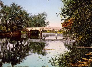
The Concord River is a 16.3-mile-long (26.2 km) tributary of the Merrimack River in eastern Massachusetts in the United States. The river drains a small rural and suburban region northwest of Boston. One of the most famous small rivers in U.S. history, it was the scene of an important early battle of the American Revolutionary War and was the subject of a famous 19th-century book by Henry David Thoreau.

Alewife is an intermodal transit station in Cambridge, Massachusetts. It serves the MBTA's Red Line subway system and is an MBTA Bus hub. Alewife is the northern terminus of the Red Line. Alewife station is located in the North Cambridge neighborhood, adjacent to the interchange between Alewife Brook Parkway and the Massachusetts Route 2 freeway, with ramps providing direct access to and from the expressway portion of Route 2. Its facilities include a multi-level parking garage with 2,733 spaces, three secured bicycle cages, a busway with an enclosed shelter serving several MBTA Bus routes, and connections to the Minuteman Bikeway, Cambridge Linear Park, and the Fitchburg Cutoff Path.
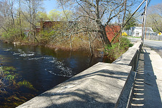
The Nemasket or Namasket River is a small river in southeastern Massachusetts. It flows north 11.2 miles (18.0 km) from Assawompset Pond in Lakeville and through Middleborough where it empties into the Taunton River.
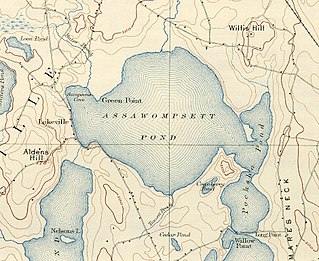
Assawompset Pond is a reservoir/pond within the towns of Lakeville and Middleboro, in southeastern Massachusetts. It shares its waters with Long Pond and is openly connected with Pocksha Pond. These lakes provide a source of drinking water to the city of New Bedford, the largest city in southeastern Massachusetts. At almost four square miles, it is the largest natural lake in Massachusetts.
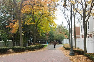
The Alewife Linear Park is a mixed-use path, about 1.3 miles long, running through Cambridge and Somerville, Massachusetts, United States, and connecting the Minuteman Bikeway and the Fitchburg Cutoff Path near Alewife with the Somerville Community Path at Davis Square. The path is used for bicycling, walking, jogging, and inline skating. It runs through a long, narrow park that was built above the MBTA Red Line subway when it was extended from Davis Square to Alewife. It was established by the MBTA in 1985, and is maintained by the cities of Cambridge and Somerville.

The Fitchburg Cutoff Path is a short multi-use rail trail located in suburban Boston, Massachusetts.
Alewife Brook Parkway is a short parkway in Cambridge and Somerville, Massachusetts. It is listed on the National Register of Historic Places. It begins at Fresh Pond in Cambridge, and heads north on the east bank of Alewife Brook, crossing into West Somerville and ending at the Mystic River on the Medford town line, where it becomes Mystic Valley Parkway. The entire length of Alewife Brook Parkway is designated as part of Massachusetts Route 16 (Route 16), while the southernmost sections are also designated as part of Route 2 and U.S. Route 3 (US 3). It is managed by the Department of Conservation and Recreation with the Massachusetts Department of Transportation responsible for bridge maintenance.

The Sippican River is a short river in Massachusetts, United States.

The Pocasset River is a small tidal river and estuary on the eastern shore of Buzzards Bay, in Bourne, Massachusetts, United States. It is located between the villages of Monument Beach and Pocasset along the western coast of Cape Cod. The river flows westward through a series of small ponds and wetlands, with a total length of about 2 miles (3.2 km).
The Madaket Ditch, formerly spelled as Maddequet Ditch, is a canal connecting Long Pond to Madaket Harbor on the western edge of Nantucket, Massachusetts.

The Mystic Valley Parkway is a parkway in Arlington, Medford, Somerville, and Winchester, Massachusetts. It is listed on the National Register of Historic Places, and forms part of Route 16.
Carlos Dorrien is an American sculptor of Mexican descent. He studied at Montserrat School of Visual Art and at Massachusetts College of Art. He later joined the faculty of Wellesley College, where he has taught for many years.

Johnnie's Foodmaster, more commonly known as simply Foodmaster, was a chain of supermarkets in the Boston Metro Area. It had its headquarters in Chelsea, Massachusetts and all stores were located in the state. On November 18, 2012, all ten stores closed, with six leases being transferred to Austin, Texas–based Whole Foods Market, and two to Quincy–based Stop & Shop; the future of the remaining locations was unknown at the time of closure.
North Cambridge, also known as "Area 11", is a neighborhood of Cambridge, Massachusetts bounded by Porter Square and the Fitchburg Line railroad tracks on the south, the city of Somerville on the northeast, Alewife Brook and the town of Arlington on the northwest, and the town of Belmont on the west. In 2005 it had a population of 10,642 residents living in 4,699 households, and the average income was $44,784. In 2010, the racial demographics for the neighborhood were 57.6% White, 20% Black, 15.1% Asian/Pacific Islander, 7.3% Hispanic origin, 0.3% Native American, 2.4% other race.

Route 16 is an east–west state highway in Massachusetts. It begins in the west at an intersection with Route 12 and Route 193 in Webster, just north of the Connecticut state border. It runs in a generally southwest-northeast routing through a number of Boston's suburbs and runs to the west and then north of the city before ending in Revere at an intersection with Route 1A and Route 60.
The Massachusetts Bay Transportation Authority operates subway, bus, commuter rail, and ferry service in the Greater Boston region. Boston has some of the highest rates of non-motorized commuting in the United States, including high bicycle usage. The MBTA offers certain provisions for riders wishing to make part of their trips by bicycle. The agency allows bicycles to be carried on all fixed-route services except the Green Line and the Ashmont-Mattapan High Speed Line light rail lines, although they are restricted on the commuter rail and heavy rail subway services at peak hours. Bicycle storage areas are offered at many stations, with "Pedal and Park" locking bicycle cages at certain high-usage stations.