
St. Lawrence is a neighbourhood located in downtown Toronto, Ontario, Canada. The area, a former industrial area, is bounded by Yonge, Front, and Parliament Streets, and the Canadian National railway embankment. The Esplanade off Yonge St., lined with restaurants, cafés and hotels runs through the middle of the area. In previous times, the area was sometimes referred to as 'St. Lawrence Ward' or more often today as 'St. Lawrence Market', synonymous with the large retail vendor market which is the neighbourhood's focal point. The area is the site of a large city-sponsored housing project of the 1970s, which revitalized an old 'brownfields' area. The boundaries of the St Lawrence Neighbourhood Association and the St Lawrence Market BIA are somewhat larger than those noted above. Both groups have boundaries that extend from Yonge to Parliament Streets and Queen Street East to the rail corridor.

The Toronto waterfront is the lakeshore of Lake Ontario in the city of Toronto, Ontario, Canada. It spans 46 kilometres between the mouth of Etobicoke Creek in the west and the Rouge River in the east.

Lawrence Heights is a neighbourhood in Toronto, Ontario, Canada. It is located north-west of central Toronto, in the district of North York. The neighbourhood is roughly bounded by Lawrence Avenue to the south, Yorkdale Road to the north, Varna Drive to the east and Dufferin Street to the west. It is part of the greater Yorkdale-Glen Park official Toronto neighbourhood.

Henry Farm is a neighbourhood in the City of Toronto, Ontario, Canada. It is located in the north central part of the city within the former city of North York.

St. James Town is a neighbourhood of Toronto, Ontario, Canada. It lies in the northeast corner of the downtown area. The neighbourhood covers the area bounded by Jarvis Street to the west, Bloor Street East to the north, Parliament Street to the east, and Wellesley Street East to the south.

Ardwold was the residence of Sir John Craig Eaton and Lady Eaton of Toronto, Ontario, Canada. Sir John was the youngest son of Timothy Eaton, the founder of the T. Eaton Company Department Store, or Eaton's, and he inherited the business and became its president upon his father's death in 1907. Sir John was one of the wealthiest men in Canada, and in 1909 he commissioned a home to be built on "The Hill", a name used to describe the neighbourhood on the Davenport Hill in Toronto where many wealthy families built their homes. Casa Loma, built by Henry Pellatt and the largest private house ever constructed in Canada, was near Ardwold, as were Spadina House, the mansion of James Austin, and Glenedyth, the estate of Samuel Nordheimer.

The Garden District is a neighbourhood in downtown Toronto, Ontario, Canada. The name was selected by the Toronto East Downtown Residents Association (TEDRA) in recognition of Allan Gardens, an indoor botanical garden located nearby at the intersection of Carlton and Jarvis Streets. The Garden District was officially designated by the Mayor and Toronto City Council in 2001, while TEDRA has since been renamed the Garden District Residents Association. Part of the neighbourhood is within official City of Toronto neighbourhood of Moss Park.

Saint Luke's United Church is located at 353 Sherbourne Street in Toronto, Ontario, Canada. Originally built across the street from the old site of Toronto General Hospital, it is now across from Allan Gardens. The building was originally home to Sherbourne Street Methodist Church, later Sherbourne United. It merged with Carlton Street United in 1959 to create St. Luke's. Sherbourne was founded in 1872, while Carlton originated in 1832.
German Mills is a community within the city of Markham in Ontario, Canada. The easternmost community in the historic town of Thornhill, German Mills was named for the early German settlers in the area.

Lawrence Manor is a neighbourhood in the city of Toronto, Ontario, Canada. This neighbourhood is bounded by Bathurst Street on the east, Highway 401 to the north, the Allen to the west, and Lawrence Avenue to the south. The western side of the area borders along Bathurst Heights and the large public housing project.

Don Valley Village is a neighbourhood in the city of Toronto, Ontario, Canada. It is located in the former suburb of North York. Located north of Highway 401 and bisected by Don Mills Road, it is bounded by Sheppard Avenue to the south, Leslie Street to the west, Finch Avenue to the north and Highway 404 to the east. Like the nearby Don River Valley, the neighbourhood has hill and dale topography.
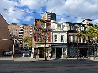
Moss Park is a residential neighbourhood located in downtown Toronto, Ontario, Canada. The area known as Moss Park is typically considered to be between Jarvis Street and Parliament Street, south of Dundas Street, an area dominated by public housing projects. According to one set of boundaries of the City of Toronto, it is roughly L-shaped, bounded on the north by Carlton Street to Parliament Street, on the east by Parliament Street to Queen Street East and the Don River, on the south by Eastern Avenue and Front Street, and on the west by Jarvis Street. This larger concept of the area includes the neighbourhoods known as Corktown and the Garden District, as well as a portion of Cabbagetown.
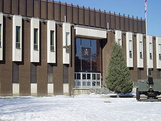
Moss Park Armoury is a Canadian Forces facility located at 130 Queen Street East in Toronto, Ontario, Canada. It is at the northeast corner of Jarvis Street and Queen Street East, in the neighbourhood of Moss Park. It currently hosts several units of the Primary Reserve. More than 600 soldiers and reservists train at Moss Park every week.
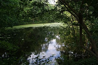
Wychwood Park is a neighbourhood enclave and private community in Toronto, Ontario, Canada. It is located west of Bathurst Street on the north side of Davenport Road, within the larger area of Bracondale Hill. It is considered part of the overall Wychwood official neighbourhood as designated by the City of Toronto.

Lieutenant-Colonel George Taylor Denison III Armoury, commonly known as Denison Armoury, is a Canadian Armed Forces facility located at 1 Yukon Lane in Toronto, Ontario, Canada. It is in the northeastern corner of Downsview Airport, just west of the W.R. Allen Expressway on Sheppard Avenue West.

Jarvis Street is a north-south thoroughfare in downtown Toronto, Ontario, Canada, passing through some of the oldest developed areas in the city. Its alignment extends from Queens Quay East in the south to Bloor Street in the north. The segment south of Front Street is known as "Lower Jarvis Street" while the segment from Bloor Street to Mount Pleasant Road is known as "Ted Rogers Way".
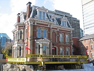
James Cooper House is an historic house in Toronto, Ontario, Canada. In 2008, the house became the heaviest residential structural relocation in Canadian history, when it was moved 20 feet (6.1 m) east and 5 feet (1.5 m) south from its original location. The relocation took place over two phases, moving east on September 25, 2008 and south on December 11, 2008, at a reported cost of CA$1 million.

Trefann Court is a small neighbourhood in the eastern part of downtown Toronto, Ontario, Canada. It is located on the north side of Queen Street between Parliament Street and River Street. It extends north only a short distance to Shuter St.
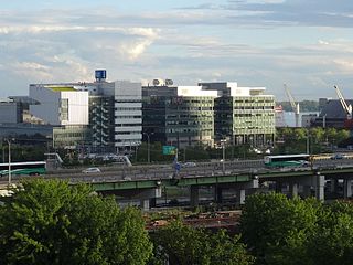
East Bayfront, or the East Bayfront Precinct, is an emerging neighbourhood in Toronto, Ontario, Canada. It is currently undergoing a transformation from industrial use to mixed-use as part of Waterfront Toronto's plans to create a residential and commercial district urban core near the lake.

George Street is a north–south street in Toronto, Ontario, Canada, from south of Front Street, north to Gerrard Street. Its southern blocks are within the grid of the townsite of the original town of York, Upper Canada. George Street was once one of the most exclusive and expensive addresses in the city. Today, the north end of the street, next to Seaton House men's shelter, is an example of urban blight. The City of Toronto government is redeveloping the street with a new Seaton House institution focused more on long-term care. Several abandoned buildings have been bought by the city, and others have been expropriated to facilitate the redevelopment – the George Street Revitalization Project.


