Related Research Articles

The Chesapeake Bay is the largest estuary in the United States. The Bay is located in the Mid-Atlantic region and is primarily separated from the Atlantic Ocean by the Delmarva Peninsula with its mouth of the Bay at the south end located between Cape Henry and Cape Charles. With its northern portion in Maryland and the southern part in Virginia, the Chesapeake Bay is a very important feature for the ecology and economy of those two states, as well as others surrounding within its watershed. More than 150 major rivers and streams flow into the Bay's 64,299-square-mile (166,534 km2) drainage basin, which covers parts of six states and all of Washington, D.C.

The Patuxent River is a tributary of the Chesapeake Bay in the state of Maryland. There are three main river drainages for central Maryland: the Potomac River to the west passing through Washington, D.C., the Patapsco River to the northeast passing through Baltimore, and the Patuxent River between the two. The 908-square-mile (2,352 km2) Patuxent watershed had a rapidly growing population of 590,769 in 2000. It is the largest and longest river entirely within Maryland, and its watershed is the largest completely within the state.

The Anacostia River is a river in the Mid Atlantic region of the United States. It flows from Prince George's County in Maryland into Washington, D.C., where it joins with the Washington Channel to empty into the Potomac River at Buzzard Point. It is approximately 8.7 miles (14.0 km) long. The name "Anacostia" derives from the area's early history as Nacotchtank, a settlement of Necostan or Anacostan Native Americans on the banks of the Anacostia River.

Sligo Creek is a free-flowing tributary of the Northwest Branch of the Anacostia River in Maryland. The creek is approximately 9.1 miles (14.6 km) long, with a drainage area of about 11.6 square miles (30 km2).

Rock Creek is a free-flowing tributary of the Potomac River that empties into the Atlantic Ocean via the Chesapeake Bay. The 32.6-mile (52.5 km) creek drains about 76.5 square miles (198 km2). Its final quarter-mile is affected by tides.

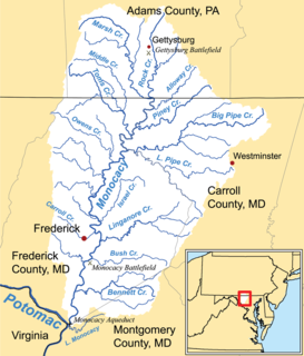
The Monocacy River is a free-flowing left tributary to the Potomac River, which empties into the Atlantic Ocean via the Chesapeake Bay. The river is 58.5 miles (94.1 km) long, with a drainage area of about 970 square miles (2,500 km2). It is the largest Maryland tributary to the Potomac.

Daylighting can be defined as "opening up buried watercourses and restoring them to more natural conditions". An alternative definition refers to "the practice of removing streams from buried conditions and exposing them to the Earth's surface in order to directly or indirectly enhance the ecological, economic and/or socio-cultural well-being of a region and its inhabitants”. The term is used to refer to the restoration of an originally open-air watercourse, which had at some point been diverted below ground, back into an above-ground channel. Typically, the rationale behind returning the riparian environment of a stream, wash, or river to a more natural state is to reduce runoff, create habitat for species in need of it, or improve an area's aesthetics. In the UK, the practice is also known as deculverting.

The Chesapeake Bay Program is the regional partnership that directs and conducts the restoration of the Chesapeake Bay in the United States. As a partnership, the Chesapeake Bay Program brings together members of various state, federal, academic and local watershed organizations to build and adopt policies that support Chesapeake Bay restoration. By combining the resources and unique strengths of each individual organization, the Chesapeake Bay Program is able to follow a unified plan for restoration. The program office is located in Annapolis, Maryland.
The Chesapeake Bay Foundation (CBF) is a non-profit organization devoted to the restoration and protection of the Chesapeake Bay in the United States. It was founded in 1967 and has headquarters offices in Annapolis, Maryland. The foundation has field offices in Salisbury, Maryland; Harrisburg, Pennsylvania; Richmond, Virginia; Norfolk, Virginia and Washington, D.C.

Cabin John Creek is a tributary stream of the Potomac River in Montgomery County, Maryland. The watershed covers an area of 26 square miles (67 km2). The headwaters of the creek originate in the city of Rockville, and the creek flows southward for 10.9 miles (17.5 km) to the Potomac River.

Trout Unlimited (TU) is a US non-profit organization dedicated to the conservation of freshwater streams, rivers, and associated upland habitats for trout, salmon, other aquatic species, and people. It is headquartered in Arlington, Virginia. The organization began in 1959 in Michigan. It has since spread throughout the United States and has local chapters in nearly every State in the United States.

Little Falls Branch, a 3.8-mile-long (6.1 km) tributary stream of the Potomac River, is located in Montgomery County, Maryland. In the 19th century, the stream was also called Powder Mill Branch. It drains portions of Bethesda, Somerset, Friendship Heights, and the District of Columbia, flows under the Chesapeake and Ohio Canal (C&O), and empties into the Potomac at Little Falls rapids, which marks the upper end of the tidal Potomac.
Watts Branch is a tributary stream of the Potomac River in Montgomery County, Maryland.

Watts Branch is a tributary stream of the Anacostia River in Prince George's County, Maryland, and Washington, D.C.
Hickey Run is a tributary stream of the Anacostia River in Washington, D.C.
Back River is a tidal estuary in Baltimore County, Maryland, located about 2 miles (3 km) east of the city of Baltimore. The estuary extends from Essex, Maryland, southeast for about 8.8 miles (14.2 km) to the Chesapeake Bay. The watershed area is 39,075 acres (15,813 ha) and includes Essex Skypark Airport and the Back River Wastewater Treatment Plant. The river is shared between Essex, MD, Dundalk, MD, and Edgemere, MD
The Herring Run is an 11.1-mile-long (17.9 km) tributary of the Back River located in Baltimore, Maryland.
Bread and Cheese Creek is a tributary of the Back River in Baltimore County, Maryland. The creek is 3.2 miles (5.1 km) long, with headwaters just east of the Baltimore city line. It flows east through Baltimore County before emptying into the Back River, which flows into the Chesapeake Bay. The watershed area of the creek is 1.85 square miles (4.8 km2).

The Interstate Commission on the Potomac River Basin (ICPRB) is an agency composed of commissioners representing the federal government, the states of Maryland, Pennsylvania, Virginia, West Virginia, and the District of Columbia. The ICPRB mission is to enhance, protect, and conserve the water and associated land resources of the Potomac River basin and its tributaries through regional and interstate cooperation.

A proposed Union Mills Reservoir represents a half century of efforts by the Commissioners of the Carroll County, Maryland, to build variations on a "dam" or "reservoir" near Union Mills, Maryland, on the Big Pipe Creek, defeated by a petition led by the Carroll County Taxpayers' Committee in the 1970s. The plan may be alive among some county officials but may also be postponed "indefinitely." Land threatened by the reservoir includes the Whittaker Chambers Farm, also known as the Pipe Creek Farm, a National Historic Landmark as well as protected under the Maryland Agricultural Land Preservation Foundation (MALPF).
References
- ↑ Peterson, Donna (2012-09-24). "Arlington, Falls Church receive funds to prevent stormwater runoff to Chesapeake Bay". The Washington Post.
- ↑ Dance, Scott (2020-02-06). "These Pennsylvania farmers say they do try to stem Chesapeake Bay pollution-and it's expensive". The Baltimore Sun.
- ↑ Rodricks, Dan (2021-08-17). "Give up the lawn, plant trees, spare your kids a living hell". Commentary. The Baltimore Sun.
- ↑ "15 Montgomery County Environmental Projects to Receive More Than $640,000 in Grants". Rockville, MD: Montgomery County Government. 2021-04-16.
- ↑ "Education Notes". The Baltimore Sun. 2003-03-23.
- ↑ "River Sojourns and Water Trails: Linking River Experiences and Academic Learning" (PDF). Potomac Heritage National Scenic Trail. Washington, DC: National Park Service. October 2005. Archived from the original (PDF) on 2017-05-21.
- ↑ Higgins, Adrian (2011-07-20). "Rain Garden Resources". The Washington Post.