Related Research Articles
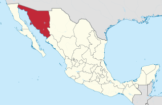
Sonora, officially Estado Libre y Soberano de Sonora, is one of the 31 states which, along with Mexico City, comprise the Federal Entities of Mexico. The state is divided into 72 municipalities; the capital city of which being Hermosillo, located in the center of the state. Other large cities include Ciudad Obregón, Nogales, San Luis Río Colorado, and Navojoa.
Sonora is a state in Northwestern Mexico that is divided into 72 municipalities. According to the 2020 Mexican Census, it is the eighteenth most populated state with 2,944,840 inhabitants and the 2nd largest by land area spanning 179,354.7 square kilometres (69,249.2 sq mi).

The Pasión River is a river located in the northern lowlands region of Guatemala. The river is fed by a number of upstream tributaries whose sources lie in the hills of Alta Verapaz. These flow in a general northerly direction to form the Pasión, which then tends westwards to meet up with the Salinas River at 16°28′52″N90°32′39″W. At this confluence the greater Usumacinta River is formed, which runs northward to its eventual outlet in the Gulf of Mexico. The Pasión River's principal tributaries are the San Juan River, the Machaquila River, and the Cancuén River.
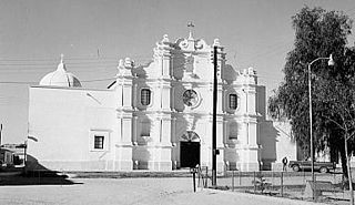
Altar is small city and municipal seat of Altar Municipality in the Mexican state of Sonora. It is located in the northwest region of the state at 30°42′49″N111°50′07″W.
Sahuaripa is a town in the Mexican state of Sonora, municipality of Sahuaripa. The area is 5,694.4 km². with a population of 5,792 in 2005. The town and municipal seat had a population of 3,807 in 2000.

Bavispe is a small town and a municipality in the northeast part of the Mexican state of Sonora.
Moctezuma is a municipio (municipality) of the Mexican state of Sonora, located in the state's central region. It is also the name of its largest settlement and cabecera municipal.

Nacozari de García is a small mining town surrounded by the Nacozari de García Municipality in the northeast of the Mexican state of Sonora.

Pitiquito is a small town in Pitiquito Municipality in the northwest of the Mexican state of Sonora.
The Rio San Bernardino, or San Bernardino River, begins in extreme southeastern Cochise County, Arizona, and is a tributary of the Bavispe River, in Sonora, Mexico.

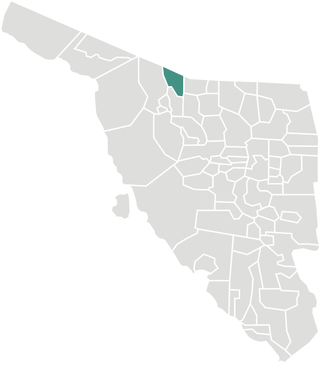
Altar is a municipality in the Mexican state of Sonora in north-western Mexico. The municipality had a 2010 census population of 9,049 inhabitants, the vast majority of whom lived in the municipal seat of Altar, which had a population of 7,927 inhabitants. There are no other localities with over 1,000 inhabitants.

Arizpe (municipality) is a municipality in the Mexican state of Sonora in north-western Mexico. The Municipality of Arizpe is one of the 72 municipalities of the state of Sonora, located in the north-central region of the state in the Sierra Madre Occidental area. It has 72 localities within the municipality, its municipal seat and the most populated locality is the homonymous town of Arizpe, while other important ones are: Sinoquipe, Bacanuchi and Chinapa. It was named for the first time as a municipality in 1813 and according to the 14th Population and Housing Census carried out in 2020 by the National Institute of Statistics and Geography (INEGI) the municipality has a total population of 2,788 inhabitants. This municipality has an area of 1,186.56 square miles (3,073.17 km2). Its Gross Domestic Product per capita is USD 11,012, and its Human Development Index (HDI) is 0.8292.

Puerto Peñasco Municipality is a municipality in the Mexican state of Sonora in north-western Mexico. As of 2015, the municipality had a total population of 62,177 inhabitants. The only locality with a significant population is the municipal seat, also named Puerto Peñasco, which contains almost 99% of the municipality's population.
San Luis Río Colorado is a municipality in the Mexican state of Sonora in northwestern Mexico, covering an area of 8412.75 km2.
Sáric Municipality is a municipality in the Mexican state of Sonora in north-western Mexico. Its northern boundary is the U.S. state of Arizona. The population of the municipality was 2,703 in 2010 living in an area of 1,676.23 square kilometers. The elevation is around 800 meters. At the municipal seat it is 780 meters.

The Altar Valley is a 45-mile (72 km) long north–south valley, trending slightly northeast from Sasabe, Arizona on the Mexico border to the Avra Valley west of the Tucson Mountains. It is delimited by Arizona State Route 86, from east-to-west on the north separating it from the Avra Valley which then trends northwesterly, merging into the plains and drainage of the Santa Cruz River.

Xanil River,, Saquilukun or downstream Agua Azul River is an approximately 30 km long river in southeastern Mexico. The river rises in the Chiapas Highlands and flows from Chiapas to the state of Tabasco into the Tulija River. Its name originates from the village with spa (balneario) of the same name Xanil, which lies at the highway from Palenque to Ocosingo.
Whitewater Draw, originally Rio de Agua Prieta, [Spanish: river of dark water], is a tributary stream of the Rio de Agua Prieta in Cochise County, Arizona. It was called Blackwater Creek by Philip St. George Cooke when his command, the Mormon Battalion, camped at a spring on its course on December 5, 1846.
References
- ↑ "Ríos de Sonora" (PDF) (in Spanish). USON. Retrieved 17 July 2016.
- ↑ Semarnat (28 August 2009). "Actualización de la disponibilidad media anual de agua subterránea acuífero (2608) Rio Altar Estado De Sonora" (PDF) (in Spanish). Comisión Nacional del Agua. Retrieved 17 July 2016.
30°37′33″N111°57′36″W / 30.62583°N 111.96000°W
| | This article related to a river in Mexico is a stub. You can help Wikipedia by expanding it. |