Alton, Leicestershire

Last updated

Alton is a deserted medieval village between Coalville and Ashby-de-la-Zouch, in North West Leicestershire, England.

Coalville town in Leicestershire, England

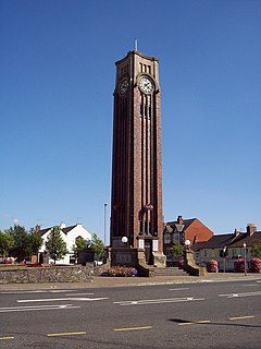
Coalville is a market town in North West Leicestershire, England, with a population at the 2011 census of 34,575. It lies on the A511 trunk road between Leicester and Burton-upon-Trent, close to junction 22 of the M1 motorway where the A511 meets the A50 between Ashby-de-la-Zouch and Leicester. It borders the upland area of Charnwood Forest to the east of the town.

Ashby-de-la-Zouch A small market town in Leicestershire, England

Ashby-de-la-Zouch, often shortened to Ashby, is a market town and civil parish in North West Leicestershire, England, close to the Derbyshire border. It is twinned with Pithiviers in north-central France. The 2001 census gave a population of 11,410, which increased to 12,370 in the 2011 census. Ashby-de-la-Zouch Castle had importance in the 15th to 17th centuries. In the 19th century the town's main industries were ribbon manufacture, coal mining, and brickmaking. It was served by the Leicester to Burton upon Trent Line of the Midland Railway from 1849. The civil parish includes the hamlets of Shellbrook to the west and Boundary to the north-west. Nearby villages include Lount, Normanton le Heath, Smisby, Packington, Donisthorpe, Oakthorpe, Moira, Measham and Coleorton. Swadlincote, Burton-upon-Trent, Melbourne and Coalville are within 10 miles (16 km), with Derby 11 12 miles (19 km) due north. Ashby lies at the heart of The National Forest, about 24 miles (39 km) south of the Peak District National Park, on the A42 between Tamworth and Nottingham.

North West Leicestershire District in England

North West Leicestershire is a local government district in Leicestershire, England. The population of the Local Authority at the 2011 census was 93,348. Its main towns are Ashby-de-la-Zouch and Coalville.

The earliest documentation of the village is found in the Domesday Book where it appears as Heletone. [1] The land was rented out to someone by Hugh de Grandmesnil, and had a total value of 60 shillings. There were 25 villagers, 1 being a man at arms and 4 smallholders. There were 8 ploughs, 1 mill, 4 acres of meadow, woodland 1 league long. The name is probably derived from ald, and the suffix tūn, meaning "old settlement". [2]

Domesday Book 11th-century survey of landholding in England as well as the surviving manuscripts of the survey

Domesday Book is a manuscript record of the "Great Survey" of much of England and parts of Wales completed in 1086 by order of King William the Conqueror. The Anglo-Saxon Chronicle states:

Then, at the midwinter [1085], was the king in Gloucester with his council .... After this had the king a large meeting, and very deep consultation with his council, about this land; how it was occupied, and by what sort of men. Then sent he his men over all England into each shire; commissioning them to find out "How many hundreds of hides were in the shire, what land the king himself had, and what stock upon the land; or, what dues he ought to have by the year from the shire."

Hugh de Grandmesnil, also known as Hugues or Hugo de Grentmesnil or Grentemesnil, is one of the very few proven companions of William the Conqueror known to have fought at the Battle of Hastings in 1066. Subsequently, he became a great landowner in England.

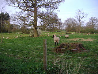
It is one of only four villages in Leicestershire that seems to have been deserted as a result of grange formation, the others being Dishley, Ringlethorp and Weston. [3] The most important possessor of granges in Leicestershire was the Cistercian Garendon Abbey whose economy was largely based on sheep farming.

Monastic grange manor or other centre of an outlying farming estate belonging to a monastery

Monastic granges were outlying landholdings held by monasteries independent of the manorial system. The first granges were owned by the Cistercians and other orders followed. Wealthy monastic houses had many granges, most of which were largely agricultural providing food for the monastic community. A grange might be established adjacent to the monastery but others were established wherever it held lands, some at a considerable distance. Some granges were worked by lay-brothers belonging to the order, others by paid labourers.

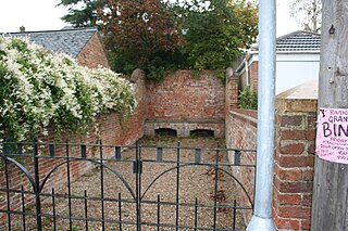
Nothing remains of the village other than a few vague topographical features. [4]

Related Research Articles

Shepshed town in Leicestershire, England

Shepshed, often known until 1888 as Sheepshed, is a town in Leicestershire, England with a population of around 14,000 people, measured at 13,505 at the 2011 census. It sits within the borough of Charnwood local authority, where Shepshed is the second biggest settlement after the town of Loughborough.

Charnwood Forest picturesque upland area in north-western Leicestershire, England

Charnwood Forest is an upland tract in north-western Leicestershire, England, bounded by Leicester, Loughborough and Coalville. The area is undulating, rocky and picturesque, with barren areas. It also has some extensive tracts of woodland; its elevation is generally 600 ft and upwards, the area exceeding this height being about 6,100 acres (25 km2). The highest point, Bardon Hill, is 912 ft. On its western flank lies an abandoned coalfield, with Coalville and other former mining villages, now being regenerated and replanted as part of the National Forest. The M1 motorway, between junctions 22 and 23, cuts through Charnwood Forest.

Elkington is a deserted medieval village and civil parish in the Daventry district of the county of Northamptonshire in England. Any remaining population is included in the civil parish of Clay Coton.

Newbold Verdon is a village and civil parish in the county of Leicestershire, England. The parish includes Newbold Heath to the north and Brascote to the south. Originally an agricultural centre Newbold Verdon grew in size during the 1850s with the expansion of coal mining in the area. That industry has now ceased leaving Newbold Verdon as primarily a commuter village. The 2001 census recorded a population of 3,193, which had reduced to 3,012 at the 2011 census.

Barton in the Beans human settlement in United Kingdom

Barton in the Beans is a hamlet in the Hinckley and Bosworth district of Leicestershire, England and forms part of the Shackerstone civil parish. There are no shops or pubs here, only a Baptist Church and a post box. It was in the 18th century an important centre for the Baptist Church and the minister at Barton was the notable clockmaker Samuel Deacon (1746-1816). The population ca. 1830 was 177.

Knaptoft is a civil parish in the Harborough district of Leicestershire, England, with a population of around 50. The population was still less the 100 at the 2011 census and the population is now included in the civil parish of Mowsley. It is also a deserted village in this parish. Knaptoft is just off the A5199 near Husbands Bosworth. Knaptoft House Farm is a nearby bed and breakfast and stud farm. The medieval fish ponds were restored from 1976 to 1982 and are now run commercially.

Ravenstone, Leicestershire village in United Kingdom

Ravenstone is a small rural cluster village with a population of 2149, situated just off the A511 road between Coalville and Ashby-de-la-Zouch, in North West Leicestershire, and within the National Forest, England. From the 2011 census the population was included in the civil parish of Ravenstone with Snibston.

Seagrave village in Leicestershire, England

Seagrave is a village and civil parish in the Charnwood district of Leicestershire, England. It has a population of around 500, measured at the 2011 census as 546, It is north of Sileby and close to Thrussington and Barrow upon Soar.

Great Wilne village in the United Kingdom

Great Wilne is a small village in Derbyshire, England on the border with Leicestershire. It is 7 miles (11 km) south east of Derby. It is a village split from its church of St Chad's by the river. The church is at the very small hamlet of Church Wilne which can only be approached by a short walk via the bridge over the River Derwent, or by a fair car journey which necessitates travelling out of the county. The population at the 2011 Census is included in the civil parish of Shardlow and Great Wilne.

Bittesby village in the United Kingdom

Bittesby is a deserted village and former civil parish, now in the parish of Bitteswell with Bittesby, in the Harborough district of Leicestershire, England. It is near the A5 Watling Street, great central about three miles from Lutterworth. The site of the village was adjacent to theroute of the now disused Great Central Railway. According to the 2001 census the parish had a population of 6.

Burton Overy is a village and civil parish in the Harborough district of Leicestershire, about nine miles south-east of Leicester city centre, and not far from Great Glen. According to the 2001 census, the parish had a population of 289., increasing at the 2011 census to 440.

Stockerston human settlement in United Kingdom

Stockerston is a village and civil parish in the Harborough district of Leicestershire, England, located on the border with Rutland, by the Eye Brook. According to the 2001 census the parish had a population of 35. The population remained less than 100 at the 2011 census and is included in the civil parish of Horninghold.

Ashby Folville village in United Kingdom

Ashby Folville is a village in the Melton district of Leicestershire, south west of Melton Mowbray. The civil parish of Ashby Folville was abolished in 1936 and its 1,796 acres (727 ha) were merged with Gaddesby.

Thorpe Arnold village in United Kingdom

Thorpe Arnold is a small farming village in the English county of Leicestershire.

Alethorpe human settlement in United Kingdom

Alethorpe is a deserted medieval village site in the English county of Norfolk. The site is within the parish of Little Snoring in North Norfolk. It lies south-east of Little Snoring, around 2 miles (3.2 km) north-east of the town Fakenham and 23 miles (37 km) north-west of Norwich to the north of the A148 road. The village, which is one of around 200 lost settlements in Norfolk, was abandoned in the 16th century, probably as the consequence of the land being enclosed by the landlord of that time. It is occasionally referred to as Althorp in historical literature.

Ingarsby is one of the best preserved deserted medieval villages in England. It is situated about six miles to the east of Leicester, and a little to the north of Houghton on the Hill. The majority of the site, which is situated on a west facing slope and lies on both sides of the Houghton to Hungarton road, is now a scheduled monument.

The identification of Deserted Villages and Lost Places in Leicestershire owes much to the pioneering work of William George Hoskins during his time at the University of Leicester.

Stoughton Grange was a country house in the parish of Stoughton in Leicestershire and the family seat of the Farnham and Beaumont family. The house dated back to 15th century but was demolished in 1926, after being a successful family home for over five hundred years.

Lubbesthorpe civil parish in Blaby, Leicestershire, England

Lubbesthorpe is a hamlet and parish in the district of Blaby within Enderby on the outskirts of Leicester, on the west side of the M1 motorway and the River Soar.

References

  1. G. Martin & A. Williams (2003) Domesday Book: A Complete Translation, Penguin Books Ltd., United Kingdom. ISBN   0-14-143994-7
  2. Watts, Victor et al., (2004) The Cambridge Dictionary of Place Names, Cambridge University Press, Cambridge. ISBN   0-521-36209-1
  3. "The Monastic Granges of Leicestershire" (PDF). University of Leicester. Retrieved 2010-08-07.
  4. "Provisional List of Deserted Medieval Villages in Leicestershire" (PDF). University of Leicester. Retrieved 2010-08-09.

Coordinates: 52°43′52″N1°25′23″W / 52.731°N 1.423°W / 52.731; -1.423

Geographic coordinate system Coordinate system

A geographic coordinate system is a coordinate system that enables every location on Earth to be specified by a set of numbers, letters or symbols. The coordinates are often chosen such that one of the numbers represents a vertical position and two or three of the numbers represent a horizontal position; alternatively, a geographic position may be expressed in a combined three-dimensional Cartesian vector. A common choice of coordinates is latitude, longitude and elevation. To specify a location on a plane requires a map projection.