Aminga | |
|---|---|
Municipality and village | |
| Country | |
| Province | La Rioja Province |
| Time zone | UTC−3 (ART) |
Aminga is a municipality and village in La Rioja Province in northwestern Argentina. [1]
Aminga | |
|---|---|
Municipality and village | |
| Country | |
| Province | La Rioja Province |
| Time zone | UTC−3 (ART) |
Aminga is a municipality and village in La Rioja Province in northwestern Argentina. [1]

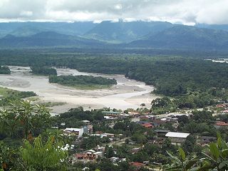
Chapare (Spanish:[tʃaˈpaɾe], also called The Chapare, is a rural province in the northern region of Cochabamba Department in central Bolivia. Most of the territory consists of valley rainforests that surround the area's main waterway, the Chapare River, which is also a tributary of the Amazon River. The provincial capital is Sacaba, 11 km east of Cochabamba. Its principal town is Villa Tunari, a popular tourist destination.

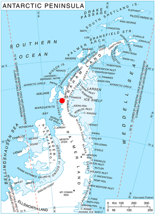
Palmer Land is the portion of the Antarctic Peninsula, Antarctica that lies south of a line joining Cape Jeremy and Cape Agassiz. This application of Palmer Land is consistent with the 1964 agreement between the Advisory Committee on Antarctic Names and the UK Antarctic Place-Names Committee, in which the name Antarctic Peninsula was approved for the major peninsula of Antarctica, and the names Graham Land and Palmer Land for the northern and southern portions, respectively. The line dividing them is roughly 69° S.

Shackleton Glacier is a major Antarctic glacier, over 60 nautical miles long and from 5 to 10 nautical miles wide, descending from the Antarctic Plateau from the vicinity of Roberts Massif and flowing north through the Queen Maud Mountains to enter the Ross Ice Shelf between Mount Speed and Waldron Spurs. Discovered by the United States Antarctic Service (USAS) (1939–41) and named by the Advisory Committee on Antarctic Names (US-ACAN) for Sir Ernest Shackleton, British Antarctic explorer.

Esteban Arze is a province in Cochabamba Department, Bolivia. Its capital is Tarata. Many people from the Esteban Arze province have migrated abroad,mainly to Argentina and to the Washington DC area https://pulitzercenter.org/reporting/only-bridge-matters-now
Borchgrevink Glacier is a large glacier in the Victory Mountains, Victoria Land, Antarctica. It drains south between Malta Plateau and Daniell Peninsula, and thence projects into Glacier Strait, Ross Sea, as a floating glacier tongue.
Torresandino is a municipality and town located in the province of Burgos, Castile and León, Spain. According to the 2004 census (INE), the municipality has a population of 808 inhabitants.

Il Polo Glacier is a small glacier draining northward between Polar Times Glacier and Polarforschung Glacier into the Publications Ice Shelf, Antarctica. It was delineated in 1952 by John H. Roscoe from air photos taken by U.S. Navy Operation Highjump, 1946–47, and was named by Roscoe for Il Polo, a polar journal published by the Istituto Geografico, Forlì, Italy.
The canton of Vervins is an administrative division in northern France. At the French canton reorganisation which came into effect in March 2015, the canton was expanded from 24 to 66 communes:
The Land Glacier is a broad, heavily crevassed glacier, about 35 nautical miles long, descending into Land Bay in Marie Byrd Land, Antarctica. It was discovered by the United States Antarctic Service (1939–41) and named for Rear Admiral Emory S. Land, Chairman of the United States Maritime Commission.
On the continent of Antarctica, the Aramis Range is the third range south in the Prince Charles Mountains, situated 11 miles southeast of the Porthos Range and extending for about 30 miles in a southwest–northeast direction. It was first visited in January 1957 by Australian National Antarctic Research Expeditions (ANARE) southern party led by W.G. Bewsher, who named it for a character in Alexandre Dumas' novel The Three Musketeers, the most popular book read on the southern journey.

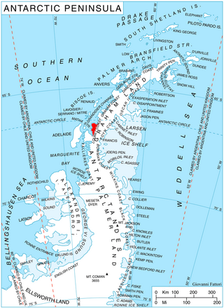
Wilkinson Glacier is a glacier on the south side of Protector Heights on Pernik Peninsula, Loubet Coast in Graham Land, flowing westward into Lallemand Fjord to the south of Holdfast Point. Mapped from air photos taken by Falkland Islands and Dependencies Aerial Survey Expedition (FIDASE) (1956–57). Named by United Kingdom Antarctic Place-Names Committee (UK-APC) for Captain John V. Wilkinson, Royal Navy, captain of HMS Protector in these waters, 1955–56 and 1956–57.
Balch Glacier is a glacier 9 nautical miles (17 km) long, on the east coast of Graham Land, flowing southeast into Mill Inlet, to the south of Gould Glacier.

Bucher Glacier is a small glacier draining the west slopes of Rudozem Heights and flowing to Bourgeois Fjord just north of Bottrill Head on the German Peninsula, Fallières Coast on the west side of Graham Land, Antarctica. It was named by the UK Antarctic Place-Names Committee in 1958 for Edwin Bucher, Swiss glaciologist and author of many publications on snow and avalanches.
Nimbus Hills is a rugged line of hills and peaks about 14 nautical miles (26 km) long, forming the southeast part of Pioneer Heights in the Heritage Range, Ellsworth Mountains. Mapped by United States Geological Survey (USGS) from ground surveys and U.S. Navy air photos, 1961–66. Named by Advisory Committee on Antarctic Names (US-ACAN) after the National Aeronautics and Space Administration weather satellite, Nimbus, which took photographs of Antarctica from approximately 500 nautical miles (900 km) above earth on September 13, 1964.
The Whitmer Peninsula is a broad ice-capped peninsula, about 7 nautical miles long and wide, between Cheetham Ice Tongue and Harbord Glacier Tongue on the coast of Victoria Land, Antarctica.

Mitterling Glacier is a glacier on the east coast of Graham Land, Antarctica, draining between Mount Vartdal and Mount Hayes into the northern part of Mill Inlet. It was named by the UK Antarctic Place-Names Committee after American historian Philip I. Mitterling, the author of America in the Antarctic to 1840.
Mount Hawkes is, at 1,975 metres (6,480 ft), the highest mountain along the Washington Escarpment, standing at the east side of Jones Valley in the Neptune Range of the Pensacola Mountains, Antarctica.
The Mackin Table is an ice-topped, wedge-shaped plateau, about 20 nautical miles long, standing just north of Patuxent Ice Stream in the Patuxent Range of the Pensacola Mountains, Antarctica.
Landen Ridge is a narrow rock ridge at the east end of Cole Peninsula in Graham Land, Antarctica. During December 1947 it was charted by the Falkland Islands Dependencies Survey and photographed from the air by the Ronne Antarctic Research Expedition (RARE) under Finn Ronne. It was named by Ronne for David Landen of the United States Geological Survey, who assisted in planning the RARE photographic program and in correlating photographs after the expedition returned.