
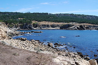
Anacapa Island is a small volcanic island located about 11 miles off Port Hueneme in Ventura County, California. The island is composed of a series of narrow islets 6 mi (10 km) long, oriented generally east–west and 5 mi (8 km) east of Santa Cruz Island. The three main islets, East, Middle and West Anacapa, have precipitous cliffs, dropping off steeply into the sea.

Channel Islands National Park consists of five of the eight Channel Islands off the Pacific coast of the U.S. state of California. Although the islands are close to the shore of the densely populated state, they have been relatively undeveloped. The park covers 249,561 acres (100,994 ha), of which 79,019 acres (31,978 ha) are federal land.

The Channel Islands National Marine Sanctuary is a sanctuary off the coast of Santa Barbara and Ventura counties in Southern California 350 miles south of San Francisco and 95 miles north of Los Angeles. It was designated in 1980 by the National Oceanic and Atmospheric Administration.

Asilomar State Marine Reserve (SMR) is one of four small marine protected areas (MPAs) located near the cities of Monterey and Pacific Grove, at the southern end of Monterey Bay on California’s central coast. The four MPAs together encompass 2.96 square miles (7.7 km2). The SMR protects all marine life within its boundaries. Fishing and take of all living marine resources is prohibited.

Carmel Bay State Marine Conservation Area (SMCA) is a marine protected area in Carmel Bay. Carmel Bay is adjacent to the city of Carmel-by-the-Sea and is near Monterey, on California’s central coast. The marine protected area covers 2.12 square miles. Recreational fishing of finfish and limited commercial taking of kelp is permitted within the SMCA.
Moro Cojo Estuary State Marine Reserve (SMR) is a marine protected area established to protect the wildlife and habitats in Moro Cojo Slough. Moro Cojo Slough is located inland from Monterey Bay on the central coast of California, directly south of the more widely known Elkhorn Slough. The area covers 0.46 square miles (1.2 km2). The SMR protects all marine life within its boundaries. Fishing and take of all living marine resources is prohibited.
Gerstle Cove State Marine Reserve (SMR) is a marine protected area that lies onshore from Salt Point State Park, within the Salt Point State Marine Conservation Area, in Sonoma County on California’s north central coast. The marine protected area covers 0.1 square miles. Gerstle Cove SMR prohibits the take of all living resources.

Cambria State Marine Conservation Area (SMCA) is a marine protected area located off the coast of the city of Cambria, California on California’s central coast in San Luis Obispo County, California. The marine protected area covers 6.26 square miles (16.2 km2). Within the SMCA recreational fishing and take is allowed while commercial fishing and take of all living marine resources is prohibited.

Edward F. Ricketts State Marine Conservation Area is one of four small marine protected areas located near the cities of Monterey and Pacific Grove, at the southern end of Monterey Bay on California’s central coast. The four areas together encompass 2.96 square miles (7.7 km2). Within SMCAs fishing and take of all living marine resources is prohibited except the recreational take of finfish by hook-and-line and the commercial take of giant and bull kelp under certain conditions.
Lovers Point State Marine Reserve (SMR) is one of four small marine protected areas located near the cities of Monterey and Pacific Grove, at the southern end of Monterey Bay on California’s central coast. The four MPAs together encompass 2.96 square miles (7.7 km2). The SMR protects all marine life within its boundaries. Fishing and take of all living marine resources is prohibited.

Pacific Grove Marine Gardens State Marine Conservation Area is one of four small marine protected areas located near the cities of Monterey and Pacific Grove, at the southern end of Monterey Bay on California’s central coast. The four MPAs together encompass 2.96 square miles (7.7 km2). Within the SMCA fishing and take of all living marine resources is prohibited except the recreational take of finfish and the commercial take of giant and bull kelp by hand under certain conditions. According to the Frommer's guide, the Marine Gardens area is "renowned for ocean views, flowers, and tide-pool seaweed beds."
Portuguese Ledge State Marine Conservation Area (SMCA) is an offshore marine protected area in Monterey Bay. Monterey Bay is on California's central coast with the city of Monterey at its south end and the city of Santa Cruz at its north end. The SMCA covers 10.9 square miles (28 km2). Within the SMCA fishing and take of all living marine resources is prohibited except the commercial and recreational take of pelagic finfish.

Soquel Canyon State Marine Conservation Area (SMCA) is an offshore marine protected area in Monterey Bay. Monterey Bay is on California’s central coast with the city of Monterey at its south end and the city of Santa Cruz at its north end. The SMCA covers 23.41 square miles (60.6 km2). Within the SMCA, fishing and taking of any living marine resources is prohibited except the commercial and recreational take of pelagic finfish.

Vandenberg State Marine Reserve (SMR) is a marine protected area located offshore of Vandenberg Air Force Base, near the city of Lompoc on California's central coast. The marine protected area covers 32.84 square miles (85.1 km2). Vandenberg SMR protects all marine life within its boundaries. Fishing and take of all living marine resources is prohibited.
White Rock (Cambria) State Marine Conservation Area (SMCA) is a marine protected area located off the coast of the city of Cambria, California on California’s central coast. The marine protected area covers 2.32 square miles (6.0 km2). Within the SMCA the take of all living marine resources is prohibited except the commercial take of giant kelp and bull kelp under certain conditions.
Naples State Marine Conservation Area (SMCA) is a marine protected area that protects Naples Reef which is about three-quarters of a mile offshore along the middle of the pristine and rural Gaviota Coast in Santa Barbara County on California’s south coast. The SMCA covers 2.58 square miles. The MPAs protects marine life by limiting the removal of wildlife from within its borders.
San Diego-Scripps Coastal Marine Conservation Area (SMCA) and Matlahuayl State Marine Reserve (SMR) are adjoining marine protected areas that extend offshore from La Jolla in San Diego County on California's south coast. The two marine protected areas cover 2.51 square miles (6.5 km2). San Diego-Scripps Coastal SMCA prohibits the take of all living marine resources except that coastal pelagic species, not including market squid, may be taken recreationally by hook and line. Matlahuayl SMR prohibits the take of all living marine resources.

Laguna Beach State Marine Reserve (SMR) and Laguna Beach State Marine Conservation Area (SMCA) are two adjoining marine protected areas that extend offshore of Laguna Beach in Orange County on California’s south coast. The SMR covers 6.27 square miles, and the SMCA covers an additional 3.44 square miles. These two MPAs are part of a four-MPA complex on the coast of southern Orange County. Each protects marine life by prohibiting or limiting the removal of marine wildlife from within its borders.
Goleta Slough State Marine Conservation Area (SMCA) is a marine protected area in Goleta in Santa Barbara County on California's south coast. The SMCA covers 0.25 square miles (0.65 km2). The SMCA protects marine life by limiting the removal of marine wildlife from within its borders. Goleta Slough SMCA prohibits take of all living marine resources except for take pursuant to routine maintenance, dredging, habitat restoration, research and education, maintenance of artificial structures, and operation and maintenance of existing facilities in the conservation area per any required federal, state and local permits, or activities pursuant to Section 630, or as otherwise authorized by the department.

The Anacapa State Marine Reserve (SMR) is a protected marine reserve located off the coast of Southern California, encompassing the area of water immediately north of Anacapa Island. Established to safeguard the marine ecosystems and biodiversity of the region, the reserve is one of the thirteen Marine Protected Areas (MPAs) of the larger Channel Islands National Park network.
