Frobisher Bay is an inlet of the Labrador Sea in the Qikiqtaaluk Region of Nunavut, Canada. It is located in the southeastern corner of Baffin Island. Its length is about 230 km (140 mi) and its width varies from about 40 km (25 mi) at its outlet into the Labrador Sea to roughly 20 km (12 mi) towards its inner end.

Syosset is a hamlet and census-designated place (CDP) in Nassau County, New York, United States, in the northeastern section of the Town of Oyster Bay, on the North Shore of Long Island. Syosset is an affluent community, well known for its school district, and is served by the Syosset railroad station, the Syosset Post Office, the Syosset Central School District, the Syosset Public Library, the Syosset Fire Department, and the Jericho Water District. The population was 18,829 at the 2010 census. == Syosset is located approximately 32 miles (50 km) east of Midtown Manhattan, 14 miles (20 km) east of eastern border with Queens, 23 miles (40 km) southeast of the Throgs Neck Bridge, and 168 miles (270 km) southeast of Albany, the state capital. It is also in close proximity to beaches, with Jones Beach only 19 miles (30 km) south of the town. It borders Oyster Bay and Laurel Hollow to the north, Woodbury to the east, Plainview and Hicksville to the south, and Jericho to the west, Service is accessible to New York City by the LIRR and the Long Island Expressway by car.

The Piper PA-28 Cherokee is a family of two- or four-seat light aircraft built by Piper Aircraft and designed for flight training, air taxi and personal use. The PA-28 family of aircraft comprises all-metal, unpressurized, single-engined, piston-powered airplanes with low-mounted wings and tricycle landing gear. They have a single door on the copilot side, which is entered by stepping on the wing.

The Middle Peninsula is the second of three large peninsulas on the western shore of Chesapeake Bay in Virginia, in the United States. It lies between the Northern Neck and the Virginia Peninsula. This peninsula is bounded by the Rappahannock River on the north and the York River on the south, with the Chesapeake Bay to the east. It encompasses six Virginia counties: Essex, Gloucester, King and Queen, King William, Mathews, and Middlesex. Developed for tobacco plantations in the colonial era, in the 21st century the Middle Peninsula is known for its quiet rural life, vegetable truck-farming, and fishing industry.

The Aichi B7A Ryusei was a large and powerful carrier-borne torpedo-dive bomber produced by Aichi Kokuki KK for the Imperial Japanese Navy Air Service during the Second World War. Built in only small numbers and deprived of the aircraft carriers it was intended to operate from, the type had little chance to distinguish itself in combat before the war ended in August 1945.

The Columbia-Shuswap Regional District is a regional district in the Canadian province of British Columbia, located in the Southern Interior region on the Trans-Canada Highway between Vancouver and Calgary, Alberta. The regional district borders the Province of Alberta across the Rocky Mountains.

Cumbernauld, Kilsyth and Kirkintilloch East is a constituency of the House of Commons of the Parliament of the United Kingdom. It was created for the 2005 general election, replacing Cumbernauld and Kilsyth and part of Strathkelvin and Bearsden.
The French Antarctic Expedition is any of several French expeditions in Antarctica.
Kekuli Bay Provincial Park, formerly Kalamalka West Provincial Park, is a provincial park in British Columbia, Canada, located on the west shore of Kalamalka Lake on BC Highway 97 south of Vernon. The lake is popular for waterskiing and boating, and the park includes a boat launch, as well as a campground with a view of the lake. The park was established in 1990. Its size is about 57 hectares.
German submarine U-140 was a Type IID U-boat of Nazi Germany's Kriegsmarine during World War II. She carried out only one combat patrol, but still managed to see action as a training boat in the summer of 1941. Built at the Kiel shipyards during 1939 and 1940, as a Type IID U-boat, she was too small for major operational work in the Atlantic Ocean, which was now required by the Kriegsmarine as the Battle of the Atlantic expanded.

Cocalico Creek is a 27.2-mile-long (43.8 km) tributary of the Conestoga River in Lebanon and Lancaster counties in Pennsylvania in the United States. The source is at an elevation of 1,320 feet (400 m) near Stricklerstown in Millcreek Township, Lebanon County. The mouth is the confluence with the Conestoga River at an elevation of 278 feet (85 m) at Talmage in West Earl Township, Lancaster County.

San Juan de Rontoy District is one of six districts of the province Antonio Raymondi in Peru.

The AGO C.II was a German reconnaissance biplane of World War I. It was essentially a slightly redesigned version of the manufacturer's C.I design with a more powerful engine.

Auburn Bay is a new suburban residential neighbourhood in the south-east quadrant of Calgary, Alberta. It is located at the south-eastern edge of the city, and is bounded by Seton Boulevard to the south, Deerfoot Trail to the west, 52 Street E to the east and Stoney Trail to the north.
Route 360 is a provincial highway in Newfoundland and Labrador. It runs from the Bishop's Falls area to Bay d'Espoir and Harbour Breton. The road is very isolated for at least 140 kilometres (87 mi), where there are no communities or stops to refuel.

The Farman F.160 was a heavy bomber aircraft developed in France in the late 1920s. It was essentially an attempt by Farman Aviation Works to modernise its tremendously successful F.60 Goliath design of the immediately postwar years. The most noticeable external difference was the larger tailfin of the new aircraft. Like its predecessor, it was a large three-bay biplane of conventional configuration with unstaggered wings of equal span. Initially conceived as a heavy night bomber, most examples built were float-equipped torpedo bombers for the Aéronautique Maritime, which operated some 40 of the F.165 variant and 200 of the F.168. One of the original F.160 night bombers was exported to Italy, and one to Japan. Plans to develop airliner versions did not progress past the prototype stage.

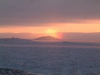
Telefon Bay is a small bay on the north-west coast of Port Foster, Deception Island, in the South Shetland Islands of Antarctica. It is surmounted by Telefon Ridge. The name appears on the chart of the French Antarctic Expedition under Charcot, 1908–10, and derives from the ship SS Telefon, which sat here awaiting repairs.

The Great Lakes Sport Trainer is an American biplane trainer and aerobatic aircraft. It was originally produced in large numbers before the company building it went bankrupt in the Great Depression in 1933. Owing to its continuing popularity, however, it was eventually placed back into production in the 1970s and again in 2011 by WACO Classic Aircraft.
In mobile telephony GSM 03.38 or 3GPP 23.038 is a character encoding used in GSM networks for SMS, CB and USSD. The 3GPP TS 23.038 standard defines GSM 7-bit default alphabet which is mandatory for GSM handsets and network elements, but the character set is suitable only for English and a number of Western-European languages. Languages such as Chinese, Korean or Japanese must be transferred using the 16-bit UCS-2 character encoding. A limited number of languages, like Portuguese, Spanish, Turkish and a number of languages used in India written with a Brahmic scripts may use 7-bit encoding with national language shift table defined in 3GPP 23.038. For binary messages, 8-bit encoding is used.

The SAN Jodel D.140 Mousquetaire (Musketeer) is a French five-seat light touring monoplane based on the earlier Jodel D.117 and built by Société Aéronautique Normande (SAN) at Bernay.


