Anhalter Platz is a square in Munich's district 11 Milbertshofen-Am Hart in the district Am Riesenfeld.

Anhalter Platz is a square in Munich's district 11 Milbertshofen-Am Hart in the district Am Riesenfeld.
It is located between Moosacher Straße, Riesenfeldstraße and Motorstraße. There is a playground next to it. [1] At Anhalter Platz 3 lies the architectural monument Hochbunker Anhalter Platz. [2]
It was named after the province of Anhalt, today part of the federal state of Saxony-Anhalt.
Until May 1972 the tram line 7, coming from Petuelring ended at Anhalter Platz.

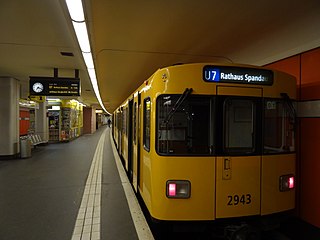
The U7 is a rail line on the Berlin U-Bahn. It runs completely underground for a length of 31.8 kilometres (19.8 mi) through 40 stations and connects Spandau, via Neukölln, to Gropiusstadt and Rudow. The U7 was originally the south-eastern branch of the Nord-Süd-Bahn (U6) that ran between the branching point at Belle-Alliance-Straße (Mehringdamm) and Grenzallee; however, in the 1960s, this stretch was separated from the rest of the line and extended at each end to form a new line.

Möckernbrücke is a station of the Berlin U-Bahn network in the western Kreuzberg district, in the vicinity of Potsdamer Platz, named after a nearby bridge crossing the Landwehrkanal. It is served by lines U1, U3, and U7.

The Potsdamer Bahnhof is a former railway terminus in Berlin, Germany. It was the first railway station in Berlin, opening in 1838. It was located at Potsdamer Platz, about 1 km south of the Brandenburg Gate, and kick-started the transformation of Potsdamer Platz from an area of quiet villas near the south-east corner of the Tiergarten park into the bustling focal point that it eventually became. For more than a century it was the terminus for long-distance and suburban trains. Also located at this spot were underground stations on the Berlin U-Bahn and S-Bahn, and today's new underground Regionalbahnhof, known as Bahnhof Potsdamer Platz, while the short-lived M-Bahn crossed the site of the former terminus.

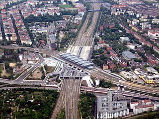
The Anhalter Bahnhof is a former railway terminus in Berlin, Germany, approximately 600 m (2,000 ft) southeast of Potsdamer Platz. Once one of Berlin's most important railway stations, it was severely damaged in World War II, and finally closed for traffic in 1952, when the GDR-owned Deutsche Reichsbahn rerouted all railway traffic between Berlin and places in the GDR avoiding the West Berlin area. The station's name lives on in the Berlin S-Bahn station of the same name, opened in October 1939 as part of the North-South S-Bahn link.

Hotel Excelsior was a hotel in Berlin, Germany. It occupied number 112/113, Königgrätzer Straße on Askanischer Platz in the Berlin district of Kreuzberg. It was one of the largest and most luxurious hotels in Europe, until its destruction during World War II.

Berlin Südkreuz station is a railway station in the German capital Berlin. The station was originally opened in 1898 and is an interchange station. The Berlin Ringbahn line of the Berlin S-Bahn metro railway is situated on the upper level and connects to the east and west, whilst the Anhalter Bahn and Dresdner Bahn intercity railway routes reach the station on the lower, north-south level. The station was extensively rebuilt between the late 1990s and 2006, and was renamed Berlin Südkreuz on 28 May 2006.
The Berlin-Anhalt Railway Company was a railway company in Prussia. The railway connection between Berlin and Köthen, built by the BAE, was one of the first long-distance railways in Germany.

The Berlin–Halle railway, sometimes called the Anhalt railway, is a twin-track, electrified main line found in the German city and state of Berlin, and the states of Brandenburg and Sachsen-Anhalt. The railway was originally built and managed by the Berlin-Anhaltische Eisenbahn-Gesellschaft.

Berlin-Lichterfelde Ost station is on the Anhalt Suburban Line in Lichterfelde in the Berlin borough of Steglitz-Zehlendorf. It is served by S-Bahn line S25, S-Bahn line S26, and Regional-Express lines 3, 4 and 5.

The Anhalter Steg is a footbridge over the Landwehr Canal between the Möckern and Schoneberg Bridges, in Kreuzberg, on the southern side of Berlin city centre. Opened in February 2001, it links the German Museum of Technology with the Hallesches Ufer. It rests on the foundations of the railway bridge leading south from the Anhalter Bahnhof, which was destroyed by bombing in World War II.

The North–South S-Bahn Tunnel is the central section of the North–South transversal Berlin S-Bahn connection crossing the city centre. It is not to be confused with the Tunnel Nord-Süd-Fernbahn, the central tunnel part of the North–South main line used by intercity and regional trains. The S-Bahn North–South line encompasses the route from Bornholmer Straße and Gesundbrunnen via Friedrichstraße and Anhalter Bahnhof to Papestraße and Schöneberg.

The Berlin North-South main line, also called the North-South link (Nord-Süd-Verbindung) is an electrified railway line in Berlin which was opened in 2006. It is an important component of the “mushroom concept” (Pilzkonzept) adopted for long-distance and regional rail services through the city. Its core is an approximately 3.5 km (2.2 mi) long Tiergarten tunnel under the Tiergarten in Berlin. The tunnel section includes the underground level of Berlin Hauptbahnhof and the Potsdamer Platz regional station. The above-ground section of the line includes the Berlin Südkreuz station.
The Anhalt suburban line is a suburban railway in Berlin and Brandenburg. It originally ran from Potsdamer Ringbahnhof in Berlin over the Berlin–Halle railway. With the opening of the Berlin Nord-Süd Tunnel in 1939, this service was abandoned. Subsequently, the electric services ran to the south parallel with the long-distance tracks of the Anhalt Railway. Its terminus was at Berlin-Lichterfelde Ost until the 1940s. In 1943, it was extended to Lichterfelde Süd for electric trains and to Ludwigsfelde for steam trains. The construction of the Berlin Wall in 1961 stopped services at the outskirts of Berlin. In 2005, a new Berlin-Lichterfelde Süd–Teltow Stadt S-Bahn line was opened.

The Berlin Customs Wall was a ring wall around the historic city of Berlin, between 1737 and 1860; the wall itself had no defence function but was used to facilitate the levying of taxes on the import and export of goods (tariffs) which was the primary income of many cities at the time.

S15 is a planned second north-south route for the Berlin S-Bahn, which will connect Berlin Hauptbahnhof to the Berlin Ringbahn to both north and south. The first section is under construction and is expected to go into operation in 2024.

Am Riesenfeld is the westernmost of the three subdistricts of the Munich city district 11 Milbertshofen-Am Hart.

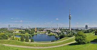
The Moosacher Straße is an approximately 1.5 kilometres (0.93 mi) long street in the district Am Riesenfeld of Munich, Germany, north of the Olympiapark. It is the extension of the Frankfurter Ring.

Alter St.-Georgs-Platz is a square in Munich's Milbertshofen-Am Hart district.

Bernd-Eichinger-Platz is a square in the Munich district of Maxvorstadt. It refers to the area in front of the entrance to the University of Television and Film Munich and then to Gabelsbergerstraße.

Weißenburger Platz is a square in Munich's Franzosenviertel in the Haidhausen district. In the middle of the concentrically arranged square is the Glaspalast-Brunnen, designed by August von Voit in 1853. This was initially located in the Glaspalast in the Alter Botanischer Garten - hence the name. At the end of the 19th century the fountain was moved to Orleansplatz. When the Ostbahnhof there was rebuilt, the Glaspalast-Brunnen had to make room and was moved to the nearby Weißenburger Platz. After dusk the fountains water feature is illuminated.
48°11′14″N11°33′42″E / 48.1873°N 11.5616°E