
Moturoa / Rabbit Island is a small island that lies across the southernmost part of Tasman Bay / Te Tai-o-Aorere, on the northern coast of New Zealand's South Island. The long narrow island runs east–west for 8 kilometres (5 mi), and covers 15 km2 (5.8 sq mi).

The Firth of Thames is a large bay located in the north of the North Island of New Zealand. It is the firth of the rivers Waihou and Piako, the former of which was formerly named the Thames River, and the town of Thames lies on its southeastern coast.
The Thames Valley is a non-administrative region in the North Island of New Zealand. Broadly, it is the valley component of the Waihou River catchment. The lower part of the valley is more commonly known as the Hauraki Plains. Geographically the valley extends as far as the Hinuera Gap, although this is not often referred to as such. In geographical history of New Zealand, the Thames Valley was the path of the ancestral Waikato River when it discharged into the Firth of Thames over 20,000 years ago.
Mangateparu is a farming service community located close to the west bank of the Piako River, eight kilometres north of Morrinsville in the Waikato region of New Zealand. It has a population of about 400 people. The local school was forced to close in 2004.

The Kopuatai Peat Dome is a large peatland complex on the Hauraki Plains in the North Island of New Zealand. It consists of two raised domes, one in the north and the other in the south, that are up to three metres higher at the center than at the edge. The 10,201 hectares wetland contains the largest intact raised bog in New Zealand and was listed under the Ramsar Convention in 1989 as a Wetland of International Importance. Most of the wetland is ombrotrophic, meaning it receives water and nutrient inputs solely from rain and is hydrologically isolated from the surrounding canals and rivers. Locally, a popular misconception persists that water flows from the nearby Piako River into the bog and that the wetland acts as a significant store for floodwater.
The Hikutaia River is a river of New Zealand's North Island. It has its source in several streams which flow west from the Coromandel Range, the longest of which is the Waipaheke Stream. The river generally flows west, reaching its outflow into the Waihou River 10 kilometres (6 mi) north of Paeroa on the edge of the Hauraki Plains.
The Kauaeranga River is a river of New Zealand's North Island. One of the main rivers on the Coromandel Peninsula, it rises in the Coromandel Range which forms the backbone of the peninsula, flowing southwest through the Kauaeranga Valley to reach the Firth of Thames at Thames.

The Komata River is a river of New Zealand's North Island. It flows west from the Coromandel Range, reaching the Waihou River just north of Paeroa.

The Mangatāwhiri River is a river of the Waikato region of New Zealand's North Island. It flows generally southwest from its sources in the Hunua Ranges southeast of Clevedon before flowing through a system of irrigation canals at the northern edge of the Waikato Plains close to the town of Pōkeno. It reaches the Waikato River close to the township of Mercer.
The Maramarua River is in the north-eastern part of the Waikato District of New Zealand. It is formed by the confluence of the Mangatangi River and the Ruaotehuia Stream just north of State Highway 2 between Mangatāwhiri and Maramarua. It flows through the northern part of the Whangamarino Wetland and joins the Whangamarino River shortly before that river flows into the Waikato River.
The Otahu River is a river of the Coromandel Peninsula, in the Waikato Region of New Zealand's North Island. It flows generally northeast from several streams with watersheds in the Coromandel Range, most notably the Wharekirauponga Stream. The Otahu reaches the sea immediately to the south of the town of Whangamatā.
The Waitekauri River is a river of the Waikato Region of New Zealand's North Island. It flows south from the Coromandel Range at the foot of the Coromandel Peninsula to reach the Ohinemuri River six kilometres west of Waihi.
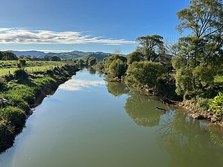
The Waitoa River is a major river of the Waikato Region of New Zealand's North Island. It flows initially northeast from its origins at Piarere, before veering north through the Hinuera Gap and across the Hinuera Plains to pass to the west of Matamata, Walton and Waharoa before running through the settlement of Waitoa and reaching the southern edge of the Hauraki Plains. It converges with the Piako River in the Kopuatai Peat Dome wetland, approximately 15 kilometres north of Morrinsville.
The Wentworth River is a river of the Coromandel Peninsula, in the Waikato Region of New Zealand's North Island. It flows northeast from the Coromandel Range to reach the Bay of Plenty at Whangamatā.
The Whangamarino River is a lowland river of the Waikato Region of New Zealand's North Island, draining the Whangamarino Wetland and associated farmland catchment. The river converges with the Waikato River just north of Meremere. The main tributary is the Maramarua River, which starts in the Hunua Ranges and forms the northern catchment of the Whangamarino River.
The Wharekawa River is a river of the Coromandel Peninsula, in the Waikato Region of New Zealand's North Island. It flows northeast to reach the Wharekawa Harbour halfway between Pauanui and Whangamatā.

Ranana is a settlement 60 kilometres (37 mi) up the Whanganui River from Whanganui, New Zealand.
Piarere is a locality in the Waikato region of New Zealand's North Island. It is situated on State Highway 29 close to its junction with State Highway 1, close to the shore of Lake Karapiro. The nearest towns are Tīrau, six kilometres to the southeast, Matamata, 10 kilometres to the northeast, and Cambridge, 10 kilometres to the northwest.

The Waikato District Health Board was a district health board that provided healthcare to the Waikato region of New Zealand.
Aongatete is a settlement and rural community in the Western Bay of Plenty District and Bay of Plenty Region of New Zealand's North Island. It is located on State Highway 2, south of Katikati and north-west of Ōmokoroa. The landscape consists of a long valley descending into the Tauranga Harbour.
