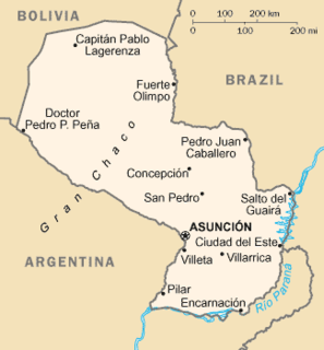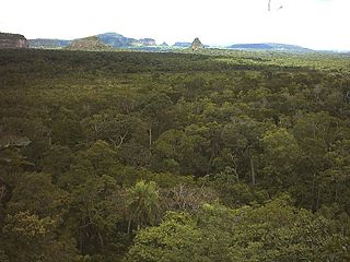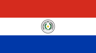
Paraguay is a landlocked country in South America, bordering Brazil, Argentina and Bolivia. The Paraguay River divides the country into strikingly different eastern and western regions. Both the eastern region and the western region gently slope toward and are drained into the Paraguay River, which separates and unifies the two regions. With the Paraneña region reaching southward and the Chaco extending to the north, Paraguay straddles the Tropic of Capricorn and experiences both subtropical and tropical climates.

Concepción is a department of Paraguay. The capital is the city of Concepción.

Estadio Defensores del Chaco is a multi-purpose stadium in Asunción, Paraguay. It is currently used mostly for football matches. The stadium once had a 50,000+ capacity, however over the years the stadium has undergone remodeling, dropping the capacity to 42,354. The stadium was again renovated in 2015.
Dyal is an unincorporated community in Nassau County, Florida, United States. It is located between U.S. 1 and County Road 115, in the western part of the county.

The Battle of Cerro Corá was fought on 1 March 1870 on a hill-surrounded valley of the same name, in the north-east of Paraguay. This was the last battle in the Paraguayan War.

Ricardo Brugada, mostly known as La Chacarita, is a neighbourhood of Asunción, the capital of Paraguay. It is a shanty town and one of the poorest locations in the entire country. Approximately 20,000 people live there. It is located along the banks of the Paraguay River, starting at the Bernardino Caballero Park until the port of Asuncion.
Sajonia is a barrio (neighbourhood) of Asunción, the capital of Paraguay. It is located next to the Paraguay River and has a population of 14,873 people. This barrio is home to different social classes, but most predominantly middle- to upper-class families. The Carlos Antonio López Avenue runs through Sajonia.

Guarambaré is a town in the Central Department of Paraguay. Guarambaré was the name of a Guaraní tribe in North-Eastern Paraguay at the time of the founding of the Spanish colony during the 16th century. A Franciscan reduction was founded between 1580 and 1600 in the modern-day department of Concepción, south of the river Aquidabán. The reduction was relocated in 1673 to the current location, south-east of Asunción.

Horqueta is a city of Paraguay, in the department of Concepción, located 50 kilometers from Concepción City and 428 kilometers from Asunción. It is established in a hill.

Cerro Cora National Park is the largest protected area in Paraguay with 5,538 hectares. It is located in Amambay Department, 45 km from the departmental capital, Pedro Juan Caballero and the border with Brazil. Established on February 11, 1976, it is a nature reserve, as well as a major historical site. This place was the setting where last battle of the Paraguayan War took place, on March 1, 1870.

The Battle of Estero Bellaco was one of the bloodiest battles of the Paraguayan War (1865–1870), with the Republic of Argentina, the Empire of Brazil and the Oriental Republic of Uruguay banded together against the Paraguayan government of Marshal Francisco Solano López.

The Ypané River is a river of Paraguay. It is a tributary of the Paraguay River.

The Apa River is a river of Paraguay and Brazil. It is a tributary of the Paraguay River, which in turn is a tributary of the Paraná River. It starts in the Amambai Mountains of the Brazilian state of Mato Grosso do Sul. The Apa forms part of the border between Paraguay and Brazil beginning at the twin cities of Bella Vista Norte and Bela Vista.
There are two rivers named Aquidabã River.
Aquidaban or Aquidabán may refer to:
Víctor Genes is a retired football (soccer) attacking midfielder from Paraguay. He played professional football in Paraguay for Cerro Porteño. He is the football manager of Paraguay.
Zeballos Cué is a neighbourhood (barrio) of Asunción, Paraguay.


