Colonialism is the policy of a foreign polity seeking to extend or retain its authority over other people or territories, generally with the aim of opening trade opportunities. The colonizing country seeks to benefit from the colonized country or land mass. In the process, colonizers imposed their religion, economics, and medicinal practices on the natives. Some argue this was a positive move toward modernization, while other scholars refute this theory as being biased and Eurocentric, noting that modernization is a concept introduced by Europeans. Colonialism is largely regarded as a relationship of domination of an indigenous majority by a minority of foreign invaders where the latter rule in pursuit of its interests.

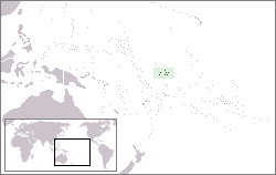
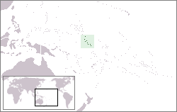
Kiribati, officially the Republic of Kiribati, is a sovereign state in Micronesia in the central Pacific Ocean. The permanent population is just over 110,000 (2015), more than half of whom live on Tarawa Atoll. The state comprises 32 atolls and reef islands and one raised coral island, Banaba. They have a total land area of 800 square kilometres (310 sq mi) and are dispersed over 3.5 million square kilometres. Their spread straddles both the equator and the 180th meridian, although the International Date Line goes round Kiribati and swings far to the east, almost reaching the 150°W meridian. This brings the Line Islands into the same day as the Kiribati Islands. Kiribati's easternmost islands, the southern Line Islands, south of Hawaii, have the most advanced time on Earth: UTC+14 hours.

The islands which now form the Republic of Kiribati have been inhabited for at least seven hundred years, and possibly much longer. The initial Micronesian population, which remains the overwhelming majority today, was visited by Polynesian and Melanesian invaders before the first European sailors visited the islands in the 17th century. For much of the subsequent period, the main island chain, the Gilbert Islands, was ruled as part of the British Empire. The country gained its independence in 1979 and has since been known as Kiribati.
The Gilbert Islands are a chain of sixteen atolls and coral islands in the Pacific Ocean about halfway between Papua New Guinea and Hawaii. They form the main part of Kiribati.

Nikumaroro, or Gardner Island, is part of the Phoenix Islands, Kiribati, in the western Pacific Ocean. It is a remote, elongated, triangular coral atoll with profuse vegetation and a large central marine lagoon. Nikumaroro is about 7.5 km (4.7 mi) long by 2.5 km (1.6 mi) wide. The rim has two narrow entrances, both of which are blocked by a wide reef, which is dry at low tide. The ocean beyond the reef is very deep, and the only anchorage is at the island's west end, across the reef from the ruins of a mid-20th-century British colonial village, but this is safe only with the southeast trade winds. Landing has always been difficult and is most often done south of the anchorage. Although occupied at various times during the past, the island is uninhabited today.

Butaritari is an atoll in the Pacific Ocean island nation of Kiribati. The atoll is roughly four-sided. The south and southeast portion of the atoll comprises a nearly continuous islet. The atoll reef is continuous but almost without islets along the north side. Bikati and Bikatieta islets occupy a corner of the reef at the extreme northwest tip of the atoll. Small islets are found on reef sections between channels on the west side. The lagoon of Butaritari is deep and can accommodate large ships, though the entrance passages are relatively narrow. It is the most fertile of the Gilbert Islands, with relatively good soils and high rainfall. Butaritari atoll has a land area of 13.49 km2 (5.21 sq mi) and a population of 4,346 as of 2010. During World War II, Butaritari was known by US forces as Makin Atoll, and was the site of the Battle of Makin. Locally, Makin is the name of a separate atoll three kilometers to the northeast of Butaritari.

Enderbury Island is a small, uninhabited atoll 63 km ESE of Kanton Island in the Pacific Ocean at 3°08′S171°05′W. It is about 1 mile (1.6 km) wide and 3 miles (4.8 km) long, with a reef stretching out 60–200 metres. Forming a part of the Canton and Enderbury Islands condominium from 1939–79, the island is now a possession of the Republic of Kiribati.
Gerald Bernard Gallagher is noted as the first officer-in-charge of the Phoenix Islands Settlement Scheme, the last colonial expansion of the British Empire.
Birnie Island is a small, uninhabited coral island, 20 hectares in area, part of the Phoenix Island group, that is part of the Republic of Kiribati. It is located about 100 km SE of Kanton Island and 90 km WNW of Rawaki Island, formerly known as Phoenix Island. It lies at 03°35′S171°33′W. Birnie island measures only 1.2 km long and 0.5 km wide. There is no anchorage, but landing can be made on the lee beach.

Nikunau is a low coral atoll in the Gilbert Islands and forms a council district of the Republic of Kiribati. It consists of two parts,, joined by an isthmus about 150 metres (490 ft) wide.

McKean Island is a small, uninhabited island in the Phoenix Islands, Republic of Kiribati. It is located at 3°36′S174°07′W. Its area is 57 hectares.

Manra Island or Sydney Island, is one of the Phoenix Islands in the Republic of Kiribati. It lies at 4°27′S171°16′W. longitude, and has an area of 4.4 km2. and an elevation of approximately six meters. Together with the seven other Phoenix Islands, it forms part of the Phoenix Islands Protected Area,. Charles Darwin visited the island during his five-year voyage (1831-1836), following which in 1842 he published an explanation for the creation of coral atolls in the South Pacific.

Neiafu is a village on the island of Savai'i in Samoa. It is in the Alataua Sisifo electoral district and located at the south west corner of the island. The population of Neiafu Uta is 598 and Neiafu Tai is 313.
The Coffin family were a group of whalers operating out of Nantucket, Massachusetts, from the seventeenth to the nineteenth centuries. Some members of the family gained wider exposure due to their discovery of various islands in the Pacific Ocean.
Ghizo Island, home to Gizo, the capital of the Western Province, Solomon Islands. The island is named after an infamous local head-hunter. It is located west of New Georgia and Kolombangara. Ghizo is home to a substantial number of people of I-Kiribati descent. These people were relocated there by the British administration of the British Solomon Islands Protectorate in the 1950s. They had previously spent 20 years on the islands of Orona and Nikumaroro, having been resettled on these previously uninhabited islands in the Phoenix Group from various islands in the Gilberts archipelago in the 1930s. The original resettlement in the 1930s was on alleged grounds of overcrowding, particularly on drought prone islands in the southern Gilberts. The second resettlement was on alleged grounds of the islands in the Phoenix group having harsh living conditions and also prone to drought, although remoteness and costs falling on the colonial administration also played parts. See also Wagina Island.
Kukutin is a settlement in Kiribati. It is located on the Orona atoll; the nearest locations, to the west, are Noriti and Ritiati, both about 138 nautical miles (256 km) away.

Wagina Island—or as spelled in colonial times, Vaghena Island—is a small island in the Solomon Islands with 1636 inhabitants, most of whom live along the shores of Kenli Bay, where a small docking station is built for both residents and visitors. The easiest way to reach Wagina is by plane to Kaghau Airport, Choiseul Province, from Honiara. From Kagau it takes only 45 – 60 minutes by OBM to Wagina.