Related Research Articles

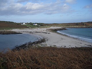
An archipelago, sometimes called an island group or island chain, is a chain, cluster, or collection of islands, or sometimes a sea containing a small number of scattered islands.

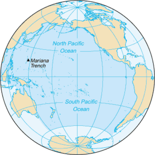
The Pacific Ocean is the largest and deepest of Earth's five oceanic divisions. It extends from the Arctic Ocean in the north to the Southern Ocean in the south, and is bounded by the continents of Asia and Australia in the west and the Americas in the east.

A lagoon is a shallow body of water separated from a larger body of water by a narrow landform, such as reefs, barrier islands, barrier peninsulas, or isthmuses. Lagoons are commonly divided into coastal lagoons and atoll lagoons. They have also been identified as occurring on mixed-sand and gravel coastlines. There is an overlap between bodies of water classified as coastal lagoons and bodies of water classified as estuaries. Lagoons are common coastal features around many parts of the world.

Monterey Bay is a bay of the Pacific Ocean located on the coast of the U.S. state of California, south of the San Francisco Bay Area. San Francisco itself is further north along the coast, by about 75 miles, accessible via CA 1 and US 101.

Oceanic trenches are prominent, long, narrow topographic depressions of the ocean floor. They are typically 50 to 100 kilometers wide and 3 to 4 km below the level of the surrounding oceanic floor, but can be thousands of kilometers in length. There are about 50,000 km (31,000 mi) of oceanic trenches worldwide, mostly around the Pacific Ocean, but also in the eastern Indian Ocean and a few other locations. The greatest ocean depth measured is in the Challenger Deep of the Mariana Trench, at a depth of 10,994 m (36,070 ft) below sea level.

In oceanography, geomorphology, and geoscience, a shoal is a natural submerged ridge, bank, or bar that consists of, or is covered by, sand or other unconsolidated material, and rises from the bed of a body of water close to the surface or above it, which poses a danger to navigation. Shoals are also known as sandbanks, sandbars, or gravelbars. Two or more shoals that are either separated by shared troughs or interconnected by past or present sedimentary and hydrographic processes are referred to as a shoal complex.

Barrier islands are a coastal landform, a type of dune system and sand island, where an area of sand has been formed by wave and tidal action parallel to the mainland coast. They usually occur in chains, consisting of anything from a few islands to more than a dozen. They are subject to change during storms and other action, but absorb energy and protect the coastlines and create areas of protected waters where wetlands may flourish. A barrier chain may extend for hundreds of kilometers, with islands periodically separated by tidal inlets. The largest barrier island in the world is Padre Island of Texas, United States, at 113 miles (182 km) long. Sometimes an important inlet may close permanently, transforming an island into a peninsula, thus creating a barrier peninsula, often including a beach, barrier beach. Though many are long and narrow, the length and width of barriers and overall morphology of barrier coasts are related to parameters including tidal range, wave energy, sediment supply, sea-level trends, and basement controls. The amount of vegetation on the barrier has a large impact on the height and evolution of the island.

A continental shelf is a portion of a continent that is submerged under an area of relatively shallow water, known as a shelf sea. Much of these shelves were exposed by drops in sea level during glacial periods. The shelf surrounding an island is known as an insular shelf.

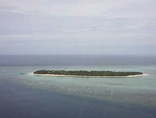
A cay, also spelled caye or key, is a small, low-elevation, sandy island on the surface of a coral reef. Cays occur in tropical environments throughout the Pacific, Atlantic, and Indian oceans, including in the Caribbean and on the Great Barrier Reef and Belize Barrier Reef.

Oceanic crust is the uppermost layer of the oceanic portion of the tectonic plates. It is composed of the upper oceanic crust, with pillow lavas and a dike complex, and the lower oceanic crust, composed of troctolite, gabbro and ultramafic cumulates. The crust overlies the rigid uppermost layer of the mantle. The crust and the rigid upper mantle layer together constitute oceanic lithosphere.

The seabed is the bottom of the ocean. All floors of the ocean are known as 'seabeds'.

Geologically, a volcanic island is an island of volcanic origin. The term high island can be used to distinguish such islands from low islands, which are formed from sedimentation or the uplifting of coral reefs.

Marine sediment, or ocean sediment, or seafloor sediment, are deposits of insoluble particles that have accumulated on the seafloor. These particles either have their origins in soil and rocks and have been transported from the land to the sea, mainly by rivers but also by dust carried by wind and by the flow of glaciers into the sea, or they are biogenic deposits from marine organisms or from chemical precipitation in seawater, as well as from underwater volcanoes and meteorite debris.

Henry William Menard was an American geologist.

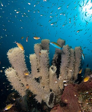
A marine habitat is a habitat that supports marine life. Marine life depends in some way on the saltwater that is in the sea. A habitat is an ecological or environmental area inhabited by one or more living species. The marine environment supports many kinds of these habitats.
The Mid-Pacific Mountains (MPM) is a large oceanic plateau located in the central North Pacific Ocean or south of the Hawaiian–Emperor seamount chain. Of volcanic origin and Mesozoic in age, it is located on the oldest part of the Pacific Plate and rises up to 2 km (1.2 mi) above the surrounding ocean floor and is covered with several layers of thick sedimentary sequences that differ from those of other plateaux in the North Pacific. About 50 seamounts are distributed over the MPM. Some of the highest points in the range are above sea level which include Wake Island and Marcus Island.

Wōdejebato is a Cretaceous guyot or tablemount in the northern Marshall Islands, Pacific Ocean. Wōdejebato is probably a shield volcano and is connected through a submarine ridge to the smaller Pikinni Atoll 74 kilometres (46 mi) southeast of the guyot; unlike Wōdejebato, Pikinni rises above sea level. The seamount rises for 4,420 metres (14,500 ft) to 1,335 metres (4,380 ft) depth and is formed by basaltic rocks. The name Wōdejebato refers to a sea god of Pikinni.
Alexa Bank is a seamount in Samoa, northwest of Rotuma. The seamount reaches a depth of 18–21 metres (59–69 ft) below sea level and has the appearance of an atoll with a flat top and steep slopes. Some active coral growth takes place at its top, but if it ever was an active atoll it has now drowned. It was probably formed by the Samoa hotspot 24 million years ago, although older volcanism about 40 million years ago has also been identified.
Takuyo-Daisan is a guyot in the Western Pacific Ocean off Japan. It is 1,409 metres (4,623 ft) deep and has a square-shaped flat top surrounded by a perimeter ridge. Several other seamounts lie nearby.

Horizon Guyot is a presumably Cretaceous guyot (tablemount) in the Mid-Pacific Mountains, Pacific Ocean. It is an elongated ridge, over 300 kilometres (190 mi) long and 4.3 kilometres (2.7 mi) high, that stretches in a northeast–southwest direction and has two flat tops; it rises to a minimum depth of 1,443 metres (4,730 ft). The Mid-Pacific Mountains lie west of Hawaii and northeast of the Line Islands.
References
- ↑ Hill, M. N. (1963). The Earth Beneath the Sea. The Sea: Ideas and Observations on Progress in the Study of the Seas. Vol. 3. Harvard University Press. p. 336. ISBN 978-0-674-01730-6.
- ↑ Menard, Henry W. (1956). "Archipelagic Aprons". Bulletin of the American Association of Petroleum Geologists. 40. doi:10.1306/5CEAE56B-16BB-11D7-8645000102C1865D.
- ↑ Leyrit, Hervé; Montenat, Christian (2000). Volcaniclastic rocks, from magmas to sediments. CRC Press. p. 27. ISBN 978-90-5699-278-1.