Swords in County Dublin, the county town of the local government area of Fingal, is a large suburban town on the east coast of Ireland, situated ten kilometres north of Dublin city centre. It is the eighth largest urban area in Ireland, with a population of 40,776 as of the 2022 census. The town was reputedly founded c. AD 560. Located on the Ward River, Swords features Swords Castle, a restored medieval castle, a holy well from which it takes its name, a round tower and a Norman tower. Facilities in the area include the Pavilions shopping centre, one of the largest in the Dublin region, a range of civic offices, some light industries, the main storage facility and archive of the National Museum of Ireland and several parks. Dublin Airport is located nearby.

Carrick-on-Shannon is the county town of County Leitrim in Ireland. It is the largest town in the county. A smaller part of the town located on the west bank of the River Shannon lies in County Roscommon and is home to the town's main train station. As of the 2022 census, the population of the town was 4,743. It is situated on a strategic crossing point of the River Shannon. The main part of the town, the County Leitrim part, is in the civil parish of Kiltoghert, which is in the barony of Leitrim, while Cortober, which is the County Roscommon side of the town, is in the civil parish of Killukin, in the barony of Boyle.

Westport is a town in County Mayo in Ireland. It is at the south-east corner of Clew Bay, an inlet of the Atlantic Ocean on the west coast of Ireland. Westport is a tourist destination and scores highly for quality of life. It won the Irish Tidy Towns Competition three times in 2001, 2006 and 2008. In 2012 it won the Best Place to Live in Ireland competition run by The Irish Times.

Castlebar is the county town of County Mayo, Ireland. Developing around a 13th-century castle of the de Barry family, from which the town got its name, the town now acts as a social and economic focal point for the surrounding hinterland. With a population of 13,054 in the 2022 census, Castlebar was one of the fastest growing towns in Ireland in the early 21st century.
Ballyhaunis is a town in County Mayo, Ireland. It is at the crossroads of the N60 and N83 National secondary roads and on the railway line linking Dublin to Westport and Ballina.

Lifford is the county town of County Donegal, Ireland, the administrative centre of the county and the seat of Donegal County Council, although the town of Letterkenny is often mistaken as holding this role.

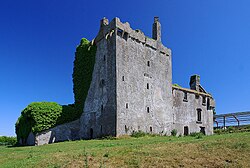
Newcastle West or simply Newcastle is a town in west County Limerick, Ireland. It is the largest town in the county, excluding Limerick city. It is also the county town, and sits on the River Arra which flows into the River Deel. Newcastle West is in the middle of a great bowl-shaped valley in West Limerick, known one time as the valley of the Wild Boar, apparently due to the abundance of this animal here when the area was thickly wooded. The crest of the town carries the image of a wild boar. The town is partly in the civil parish of Newcastle.
Crossmolina is a town in the historical barony of Tyrawley in County Mayo, Ireland, as well as the name of the civil parish and Catholic parish in which the town is situated. The town sits on the River Deel near the northern shore of Lough Conn. Crossmolina is about 9 km (5.6 mi) west of Ballina on the N59 road. Surrounding the town, there are a number of agriculturally important townlands, including Enaghbeg, Rathmore, and Tooreen.

The Mayo County Board of the Gaelic Athletic Association (GAA) or Mayo GAA is one of the 32 county boards of the GAA in Ireland, and is responsible for Gaelic games in County Mayo and the Mayo county teams.

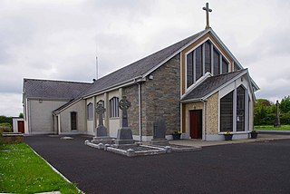
Ardagh is a village in County Longford, Ireland. Ardagh is located towards the south of County Longford, 10 kilometres (6.2 mi) southwest of Longford town, located off the N4 road. Originally a site of pre-Christian worship, Ardagh became a site of Christian settlement with the arrival of Saint Patrick sometime between 434 and 435. The bulk of the village was laid-out in the mid-19th century. The barony of Ardagh is named for the village. There is a civil parish of Ardagh.

The Diocese of Ardagh and Clonmacnoise is a Latin Church diocese of the Catholic Church in Ireland.

Kilmovee is a village and civil parish in County Mayo, Ireland. It is a mainly rural parish on the R325 road, midway between Kilkelly and Ballaghaderreen.
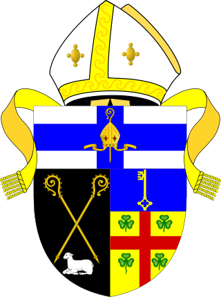
The United Dioceses of Kilmore, Elphin and Ardagh is a diocese of the Church of Ireland located in central Ireland. It is in the ecclesiastical province of Armagh.
The Bishop of Kilmore, Elphin and Ardagh is the Ordinary of the Church of Ireland Diocese of Kilmore, Elphin and Ardagh in the Province of Armagh.

Brickens, officially Brickeens, is a village and townland on the N60 road between Ballyhaunis and Claremorris in southeast County Mayo in Ireland. The River Robe flows through the village which is 65 metres above sea level, and old ordnance survey maps show the townland with an area of 368 acres and 23 perches – equivalent to nearly 150 hectares.
Ardagh is a village and civil parish in County Limerick, Ireland. The village is situated round the junctions of the R523 and R521 roads. The nearest town is Newcastle West, 5 kilometres (3 mi) to the south. Primary level education for the village and its surroundings is provided by St Molua's National School. The parish is bounded to the west by Athea, to the north by the parish of Coolcappa, to the east Rathkeale and to the south by Newcastle West. The local GAA club is St. Kierans which represents both the parish of Ardagh-Carrigkerry as well as Coolcappagh-Kilcolman.
Ardagh GAA is a Gaelic Athletic Association club located in County Mayo, Ireland. The club, which is based in Cloonkee in Ardagh, plays Gaelic football and is a member of the North division of Mayo GAA. As of 2024, the club was fielding teams in the Mayo Junior Football Championship.
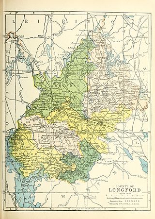
Ardagh is a barony in County Longford, Ireland.

Carrigkerry is a village and townland in County Limerick, Ireland. The village is located in the civil parish of Ardagh, on the R523 regional road. Carrigkerry is a census town, and had a population of 184 as of the 2016 census.