
Argishti I, was the sixth known king of Urartu, reigning from 786 BC to 764 BC. He founded the citadel of Erebuni in 782 BC, which is the present capital of Armenia, Yerevan. Alternate transliterations of the name include Argishtis, Argisti, Argišti, and Argishtish.

Erebuni Fortress, also known as Arin Berd, is an Urartian fortified city, located in Yerevan, Armenia. It is 1,017 metres (3,337 ft) above sea level. It was one of several fortresses built along the northern Urartian border and was one of the most important political, economic and cultural centers of the vast kingdom. The name Yerevan itself is derived from Erebuni.

Abovyan or Abovian, is a town and urban municipal community in Armenia within the Kotayk Province. It is located 16 kilometres northeast of Yerevan and 32 kilometres southeast of the province centre Hrazdan. As of the 2011 census, the population of the town is 43,495, down from 59,000 reported at the 1989 census. Currently, the town has an approximate population of 35,400 as per the 2016 official estimate.

The National Library of Armenia is a national public library in Yerevan, Armenia. It was founded in 1832 as part of the state gymnasium-school of Yerevan. It is the official cultural deposit for the entire republic.
Hatsavan is a town in the Kotayk Province of Armenia.

Nork-Marash, is one of the 12 districts of Yerevan, the capital of Armenia. It is located to the east of the city centre. It is bordered by the Kentron District form the west and the north, Nor Nork from the east and Erebuni from the south. The name of the district is derived from the Nork neighbourhood of Yerevan and the ancient major Armenian settlement of Marash in modern-day Republic of Turkey. The district is unofficially divided into smaller neighborhoods such as Nork and Nor Marash.

Nor Nork, is one of the 12 districts of Yerevan, the capital of Armenia. It is located at the eastern part of the city. It is bordered by the districts of Nork-Marash, Kentron and Kanaker-Zeytun from the west, Avan from the north and Erebuni from the south. Kotayk Province forms the eastern border of the district.
Vardenis is a town in the Aragatsotn Province of Armenia. The town has a 19th-century church.

Verin Jrashen, is a neighbourhood in the Erebuni District of the Armenian capital Yerevan. It is very close by Argishti.

Erebuni Museum was established in 1968. The opening of the museum was timed to coincide with the 2750th anniversary of Yerevan. The Museum stands at the foot of the Arin Berd hill, on top of which the Urartian Fortress Erebouni has stood since 782 BCE. The City-Fortress was excavated, some parts of the structure were reinforced and restored, and the fortress was turned into an outdoor Museum.

Armenian National Agrarian University (ANAU), is a state university and higher educational institution based in Yerevan, the capital of Armenia.The university trains and prepares specialists for the agricultural sphere.

The Yerevan City Council is the lawmaking body of the city of Yerevan. It has 65 members elected by Party-list proportional representation system, headed by the Mayor of Yerevan. The Council serves as a check against the mayor in a mayor-council government model.

Yerevan Velodrome, is an outdoor velodrome or track cycling venue in Yerevan, Armenia. Located on Admiral Isakov Avenue and owned by the municipality of Yerevan, the 250-metre (820 ft) long track is able to host international events. The velodrome has a capacity of 650 seats with lamelled wood roof and covers a total area of 3,200 square metres (34,000 sq ft). It was built to replace the old cycling track which was later demolished in 2012.
Mashtots Avenue, known as Lenin Avenue between 1924 and 1990, is an avenue in the central Kentron district of Yerevan, Armenia.

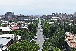
Liberty Avenue, is an avenue separating the Kanaker-Zeytun District from the Arabkir District in the Armenian capital Yerevan.

Khachatur Abovyan Park, is a park located in the Kentron district of Yerevan, Armenia, at the north of Abovyan Street. It forms the starting point of the Abovyan Street. The Yerevan State Medical University is located at the southern edge of the park.
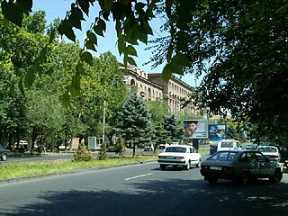
Sayat-Nova Avenue, is an avenue in the central Kentron District of Yerevan, Armenia. It is named after the 18th-century Armenian poet and musician Sayat-Nova. It was officially inaugurated on October 27, 1963.
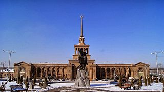
Yerevan railway station is the central station of Yerevan, the capital of Armenia, located south of downtown Yerevan, approximately 2.8km from Republic Square.


