Arlobi menhir

Last updated

The Arlobi menhir is an archaeological heritage located at the Gorbea Natural Park, in Zuia, Álava (Basque part of Spain). It was found by Oier Suárez Hernando, Miguel Martínez Fernández and Luis M. Martínez Torres on 20 March 2004. The menhir was probably placed there in the Albian Age (Cretaceous 112–98 m.a.) and is basically made of stones coming from the Southern slope of Gorbea, Odoriaga and Usoteguieta mountains. It is the most visited tourist attraction at the Gorbea Natural Park due to its peculiarity. The discovery was very important because of the lack of menhirs in Álava. In fact, the most common ancient sculptures are dolmens, usually as funerary monuments used to bury people in religious ceremonies.

Gorbea Natural Park

Gorbea Natural Park is a protected area that is located between the provinces of Alava and Vizcaya in the Basque Country (Spain), the largest Basque natural park with an area of 20,008 hectares. It covers Villaro municipalities, Castillo and Elejabeitia, Orozco, and Ceberio Ceánuri in Vizcaya and Cigoitia, Zuya and Urcabustaiz in Álava. Gorbea Natural Park, along with the nearby natural park of Urkiola, form an important environmental unit. Natural Park was declared by the Basque Government Decree on 21 June 1994 with the purpose of protecting their natural heritage while promoting rural development, understanding and enjoyment. It takes its name from its highest peak, the Gorbea of 1,482 metres (4,862 ft). Other peaks of interest are Aldamin Peña of 1,373 metres (4,505 ft) and the Peñas de Itxina.

Zuia municipality in the province of Álava, Basque Country, Spain

Zuia is a town and municipality located in the province of Álava, in the Basque Country, northern Spain.

Álava Province of Spain

Álava or Araba, officially Araba/Álava, is a province of Spain and a historical territory of the Basque Country, heir of the ancient Lordship of Álava, former medieval Catholic bishopric and now Latin titular see.

Contents

Description

When the menhir was discovered it was composed by three orthogonal fragments of sandstone, headed NE-SW. After studying them, it was concluded that the three pieces could be put together and fitted perfectly to form the original menhir. Despite the impacts the rocks had due to the clearing labours, the menhir is preserved in good conditions. The stones measure 480x60x60 cm and it is considered that its density could reach 2500 kg/m3; so the menhir weights over 4250 kg. Lithologically, its stones are siliceous sandstone which probably come from Illumbe, the slope of Usoteguieta mountain. As the distance between Illumbe and the menhir is over 100m, archaeologists have assumed that the stones were carried by taking advantage of the slope. It was believed that the menhir could be an anthropomorphic sculpture but this discovery has not been verified.

Menhir Large upright standing stone

A menhir, standing stone, orthostat, or lith is a large man-made upright stone, typically dating from the European middle Bronze Age. They can be found solely as monoliths, or as part of a group of similar stones. Menhirs' size can vary considerably, but they are generally uneven and squared, often tapering towards the top.

Sandstone A clastic sedimentary rock composed mostly of sand-sized particles

Sandstone is a clastic sedimentary rock composed mainly of sand-sized mineral particles or rock fragments.

The archaeological excavation

The menhir has been under examination since August 2004. Archaeologists have been able to find where the stone was originally placed. It was discovered that the menhir laid where the South-Western piece of rock was found. In fact, part of that stone was still stuck in the ground. It was also discovered that there was another element that could be part of the menhir: a ring made of rocks which surrounded the main stone. It has been also considered that this ring could be part of the archaeological remains of a human settlement. Besides, there were many other objects such as silex tools that could be related to a human settlement. Archaeologists also found remains that showed humans had been there: sharpening tools and stone hammers (that were probably used in the construction of the menhir).

Restoration of the menhir

The menhir was moved to the Park House in order to be restored. So the pieces were put together again, by introducing four iron bars into the stone. Once the menhir was complete they took it back to the place it belonged. It was placed with a crane in the direction archaeologists thought it had been originally and, after that, it was underpinned. The holes left in the ground because of the archaeological excavation were filled with concrete, which later would be covered with the natural earth that had been removed in the excavations. The landscape is expected to recover its natural moss and lichen so that the remains of the building work will not be spotted.

Investigations in progress

Some other investigations will be held in order to discover more things about this ancient monument. The main structure is going to be delimited and interpreted so as to know more about the building method they used to create this menhir. Other investigations are going to be carried out to work out the chronological and cultural environment there was at the time when it was built. After all this information is gathered, didactic and informative material will be created to inform tourists about the importance of this archeological heritage.

Route

The menhir can be reached from the Centre of the Gorbea Natural Park. The way is 7 km long and it is well indicated by signals. The walk can be done in two hours more or less and is easy to follow.

Related Research Articles

Archaeological site Place in which evidence of past activity is preserved

An archaeological site is a place in which evidence of past activity is preserved, and which has been, or may be, investigated using the discipline of archaeology and represents a part of the archaeological record. Sites may range from those with few or no remains visible above ground, to buildings and other structures still in use.

Megalith Large stone used to build a structure or monument

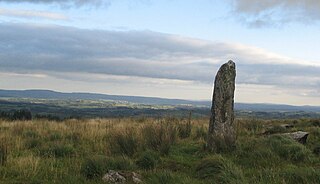
A megalith is a large stone that has been used to construct a structure or monument, either alone or together with other stones. The word megalithic describes structures made of such large stones without the use of mortar or concrete, representing periods of prehistory characterised by such constructions. For later periods, the word monolith, with an overlapping meaning, is more likely to be used.

Artifact (archaeology) Something made by humans and of archaeological interest

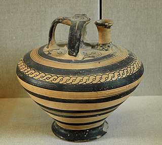
An artifact, or artefact, is something made or given shape by humans, such as a tool or a work of art, especially an object of archaeological interest.

Coldrum Long Barrow A neolithic chambered long barrow near Trottiscliffe, Kent, England

The Coldrum Long Barrow, also known as the Coldrum Stones and the Adscombe Stones, is a chambered long barrow located near the village of Trottiscliffe in the south-eastern English county of Kent. Probably constructed in the fourth millennium BCE, during Britain's Early Neolithic period, today it survives only in a state of ruin.

Rock art human-made markings on natural stone

In archaeology, rock art is human-made markings placed on natural stone; it is largely synonymous with parietal art. A global phenomenon, rock art is found in many culturally diverse regions of the world. It has been produced in many contexts throughout human history, although the majority of rock art that has been ethnographically recorded has been produced as a part of ritual. Such artworks are often divided into three forms: petroglyphs, which are carved into the rock surface, pictographs, which are painted onto the surface, and earth figures, formed on the ground. The oldest known rock art dates from the Upper Palaeolithic period, having been found in Europe, Australia, Asia and Africa. Archaeologists studying these artworks believe that they likely had magico-religious significance.

Bosnian pyramid claims mountain

The 'Bosnian pyramid complex' is a pseudoarchaeological notion to explain the formation of a cluster of natural hills in central Bosnia and Herzegovina. Since 2005, Semir Osmanagić, also known as Sam Osmanagich, a Bosnian businessman now based in Houston, Texas, has claimed that these hills are the largest human-made ancient pyramids on Earth. His claims have been overwhelmingly refuted by scientists but he has proceeded to promote the area as a tourist attraction.

Jersey dolmens neolithic sites, including dolmens, in Jersey

The dolmens of Jersey are neolithic sites, including dolmens, in Jersey. They range over a wide period, from around 4800 BC to 2250 BC, these dates covering the periods roughly designated as Neolithic, or “new stone age”, to Chalcolithic, or “copper age”.

Parc Cwm long cairn Burial chamber in Wales

Parc Cwm long cairn, also known as Parc le Breos burial chamber, is a partly restored Neolithic chambered tomb, identified in 1937 as a Severn-Cotswold type of chambered long barrow. The cromlech, a megalithic burial chamber, was built around 5850 years before present (BP), during the early Neolithic. It is about seven ​12 miles (12 km) west south–west of Swansea, Wales, in what is now known as Coed y Parc Cwm at Parc le Breos, on the Gower Peninsula.

Risovača Cave Cave and archaeological site in Serbia

Risovača Cave, is situated at the very entrance of the town of Aranđelovac in central Serbia around 17 m (56 ft) above the Kubršnica river valley. It is one of the most important archaeological sites of the Palaeolithic in Serbia besides the Gradac Cave near Kragujevac. Its discovery confirmed the assumed existence of the Paleolithic culture south of the Sava-Danube line and provided new information on the life of prehistoric humans in Europe.

The Palace Site is a ca. 7,000-year-old archeological site in Des Moines, Iowa with evidence for some of the oldest houses west of the Mississippi valley and the oldest human burial in Iowa. Since 2011, the site has yielded 6,000 or more artifacts, as well as the remains of two humans, a woman and an infant, that are the oldest human bones to be found in the state. A spear point found beneath the woman's lower back appears to have been intentionally placed there during burial. Also found in the grave were a small polished stone, a flint chip from stone tool making, and wood charcoal. The OSA Burial Protection Program is legally responsible for investigating, preserving, and re-interring ancient human remains.

Sisyphus Shelter is an archaeological site that was uncovered in Colorado when the Colorado Department of Highways was working on I-70. The excavation of this site became a joint project between the Colorado Department of Highways and the Bureau of Land Management. Fieldwork on the site was completed in 1980. Archaeologists John Gooding and Wm. Lane Shields as well as many others completed the excavation and prepared a comprehensive site report. Over the course of the fieldwork on Sisyphus Shelter, twenty-six features of human origin were discovered as well as numerous stone artifacts and two perishable items. The artifacts appeared to be all Late Archaic in origin. Dating indicated a range of occupations from modern times to 4400 B.P. being the oldest sample. Gooding and Shields (1985) suggest that the occupations of the shelter were not consistent and affected by seasonal changes.

The Anzick Site (24PA506) in Park County, Montana, United States, is the only known Clovis burial site in the New World.

Wotanstein (Hesse)

The Wotanstein, also known as 'Wodanstein' or earlier on 'Malstein', is a small megalith or menhir situated close to the village of Maden, Schwalm-Eder-Kreis, Hesse, Germany.

Mladeč caves Cave and archaeological site in the Czech Republic

The Mladeč caves are a cave complex in the Czech Republic situated to the west of the village of Mladeč in the Litovelské Pomoraví Protected Landscape Area.

Dewil Valley, located in the northernmost part of Palawan, an island province of the Philippines that is located in the MIMAROPA region, is an archaeological site composed of thousands of artifacts and features. According to the University of the Philippines Archaeological Studies Program, or UP-ASP, the closest settlement can be found in New Ibajay, which is covered by the town capital of El Nido, which is located around 9 km (5.6 mi) south-east of Dewil Valley. Physically it measures around 7 km (4.3 mi) long, and 4 km (2.5 mi) wide. It is in this place which the Ille Cave, one of the main archaeological sites, can be found. It is actually a network of 3 cave mouths located at its base. It has been discovered that this site in particular has been used and occupied by humans over multiple time periods.

Archaeology of the Channel Islands

Archaeology is promoted in Jersey by the Société Jersiaise and by Jersey Heritage. Promotion in the Bailiwick of Guernsey being undertaken by La Société Guernesiaise, Guernsey Museums, the Alderney Society with World War II work also undertaken by Festung Guernsey.

This page is a glossary of archaeology, the study of the human past from material remains.

References

Coordinates: 43°01′54″N2°49′43″W / 43.03156°N 2.82865°W / 43.03156; -2.82865

Geographic coordinate system Coordinate system

A geographic coordinate system is a coordinate system that enables every location on Earth to be specified by a set of numbers, letters or symbols. The coordinates are often chosen such that one of the numbers represents a vertical position and two or three of the numbers represent a horizontal position; alternatively, a geographic position may be expressed in a combined three-dimensional Cartesian vector. A common choice of coordinates is latitude, longitude and elevation. To specify a location on a plane requires a map projection.