Related Research Articles
Floyd County is a county in the Northwest region of the U.S. state of Georgia. As of the 2020 United States Census, the population was 98,584. The county seat is Rome. Floyd County comprises the Rome, Georgia metropolitan statistical area.

Chattooga County is a county in the Northwest region of the U.S. state of Georgia. As of the 2020 census, the population was 24,965. The county seat is Summerville. The county was created on December 28, 1838. Chattooga County comprises the Summerville, GA Micropolitan Statistical Area, which is included in the Rome-Summerville Combined Statistical Area. Summerville is the site of the Chattooga County Courthouse. The county is home to several properties listed on the National Register of Historic Places.

The Etowah River is a 164-mile-long (264 km) waterway that rises northwest of Dahlonega, Georgia, north of Atlanta. On Matthew Carey's 1795 map the river was labeled "High Town River". On later maps, such as the 1839 Cass County map, it was referred to as "Hightower River", a name that was used in most early Cherokee records.
The Tugaloo River is a 45.9-mile-long (73.9 km) river that forms part of the border between the U.S. states of Georgia and South Carolina. It was named for the historic Cherokee town of Tugaloo at the mouth of Toccoa Creek, south of present-day Toccoa, Georgia and Travelers Rest State Historic Site in Stephens County, Georgia.
The Chestatee River is a 32.76-mile-long (52.72 km) river in the Appalachian Mountains of northern Georgia, US.
Willstown was an important Cherokee town of the late 18th and early 19th century, located in the southwesternmost part of the Cherokee Nation, in what is now DeKalb County, Alabama. It was near Lookout or Little Wills Creek. It was in Wills Valley, which also incorporated Big Wills Creek. This was within the territory of the Lower Creek, who had crossed into this area in an effort to avoid European-American encroachment.

State Route 140 (SR 140) is a 78.6-mile-long (126.5 km) state highway in the northwestern part of the U.S. state of Georgia. It connects the Armuchee and Peachtree Corners areas, within portions of Floyd, Bartow, Cherokee, Fulton, Gwinnett counties.

The Little River is a 29.3-mile-long (47.2 km) tributary of the Etowah River in the U.S. state of Georgia in the United States.
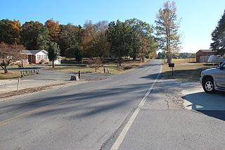
Villanow is an unincorporated community in Walker County, Georgia, United States, which lies between Dalton and LaFayette. There are currently no schools that serve the community of Villanow. Armuchee Valley Elementary School was closed in 1992, following a fire that destroyed the classrooms and offices. In 1993, a separate fire destroyed what remained of the school, to include the cafeteria. In September 2010, the Armuchee Valley Community Center opened. The community center houses Walker County's No. 14 fire station, in addition to a sheriff's office, and voting precinct.

The Seaborn Jones Memorial Park, formerly known as Wayside Park, was renamed in 2002 after Seaborn Jones because of his generosity and other significant contributions that he made to the city. The park sits in the middle of the Historical Downtown district of the City of Rockmart, Georgia along the banks of the Euharlee Creek. The name Euharlee comes from the Cherokee or Creek Indians and means "she laughs as she runs."
Taylor Ridge is the most northwestern ridge in the state of Georgia within the Ridge and Valley physiographic region and is approximately 40 miles (64 km) in length. To the west the ridge is bordered by the Cumberland Plateau region and to the north Taylor Ridge becomes White Oak Mountain at Ringgold Gap although technically part of the same ridge. The western foothills of Taylor Ridge are also the western border of the Chattahoochee National Forest. Taylor Ridge is part of the Armuchee Ridges which also consist of Little Sand Mountain, Dicks Ridge, Johns Ridge, Horn Mountain and Rocky Face. Taylor Ridge runs south to north through Chattooga, Walker, Whitfield, and Catoosa counties along the towns of Summerville, Trion, Lafayette and Ringgold. The highpoint of the ridge is 1,665 feet (507 m) where the ridge buckles with Dicks Ridge. An area labeled high point is 1,432 feet (436 m) at the ridges southern terminus along GA highway 100.
Tiger Creek is a stream in Catoosa County and Whitfield County, Georgia, in the United States.
Oostanaula is an unincorporated community in Gordon County, in the U.S. state of Georgia.
Fish Creek is a stream in Polk County, in the U.S. state of Georgia.
East Armuchee is an unincorporated community in Walker County, in the U.S. state of Georgia.
Frogtown Creek is a stream in Lumpkin County, Georgia, in the United States.
Cherokee Branch is a stream in the U.S. state of Georgia. It is a tributary to Hurricane Creek.
Crawfish Creek is a stream in the U.S. state of Georgia. It is a tributary to West Chickamauga Creek.

Toccoa Creek is a stream in the U.S. state of Georgia.
Wauhatchie Branch is a stream in the U.S. states of Georgia and Tennessee. It is a tributary to Lookout Creek.
References
- 1 2 3 U.S. Geological Survey Geographic Names Information System: Armuchee Creek
- ↑ Krakow, Kenneth K. (1975). Georgia Place-Names: Their History and Origins (PDF). Macon, GA: Winship Press. p. 7. ISBN 0-915430-00-2.
34°20′43″N85°07′20″W / 34.34528°N 85.12222°W