
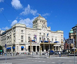
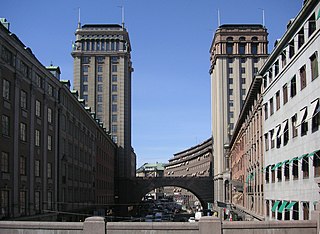
Arsenalsgatan is a street on Blasieholmen peninsula in central Stockholm. Arsenalsgatan passes through Blasieholmstorg and is a partly pedestrianised street. [1]
Arsenalsgatan is a street on Blasieholmen peninsula in central Stockholm. Arsenalsgatan passes through Blasieholmstorg and is a partly pedestrianised street. [1]

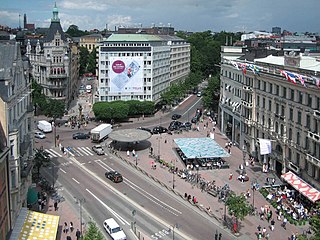
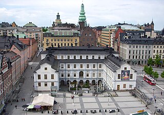
Norrmalmstorg is a town square in central Stockholm, Sweden. It connects shopping streets Hamngatan and Biblioteksgatan and is the starting point for tram travellers with the Djurgården line. Close to the southwest is the park Kungsträdgården.

Östermalm is a 2.56 km2 large district in central Stockholm, Sweden. With 71,802 inhabitants, it is one of Sweden's most populous and exclusive districts. It is an expensive area, having the highest housing prices in Sweden.

Kungsträdgården is a park in central Stockholm, Sweden. It is colloquially known as Kungsan.

The Strindberg Museum is a museum in Stockholm, Sweden. It is dedicated to the writer August Strindberg (1849-1912) and located in his last dwelling. The site is in the building he nicknamed "Blå tornet" at Drottninggatan 85 on the corner of Drottninggatan and Tegnérgatan in the borough of Norrmalm in central Stockholm.
Nybroplan is a public space in central Stockholm, Sweden. Located on the border between the city districts Norrmalm and Östermalm, Nybroplan connects a number of major streets, including Birger Jarlsgatan, Strandvägen, Hamngatan, and Nybrogatan. The squares Norrmalmstorg, Stureplan, and Östermalmstorg are located within 500 metres, as is the park Kungsträdgården.

Strandvägen is a street on Östermalm in central Stockholm, Sweden. Completed just in time for the Stockholm World's Fair 1897, it quickly became known as one of the most prestigious addresses in town.
Birger Jarlsgatan is one of the longest streets in central Stockholm, Sweden. The street forms the border between Östermalm and the two neighbouring districts Norrmalm and Vasastaden.

Sveavägen is a major street in Stockholm, Sweden.

Svartmangatan "Black Man Street") is a street in Gamla stan, the old town of Stockholm, Sweden. Stretching south-east from the central square Stortorget to Södra Benickebrinken and Norra Benickebrinken leading to the eastern main street Österlånggatan, it is intercepted by Kindstugatan, Tyska Skolgränd, Tyska Brunnsplan, Själagårdsgatan, Tyska Stallplan, and Baggensgatan, while forming a parallel street to Skomakargatan and Prästgatan. The name refers to the Blackfriar monastery once located at the southern end of the street.

Köpmangatan is a street in Gamla stan, the old town of Stockholm, Sweden. A parallel street to Trädgårdsgatan, it stretches from the central square Stortorget to Köpmantorget, intercepted by Trädgårdstvärgränd, Skeppar Olofs Gränd, Peder Fredags Gränd, Själagårdsgatan, Staffan Sasses Gränd, Baggensgatan, and Bollhusgränd.
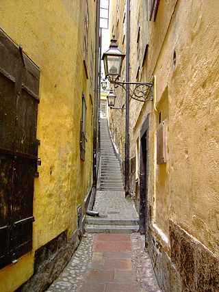
Mårten Trotzigs gränd is an alley in Gamla stan, the old town of Stockholm, Sweden. Leading from Västerlånggatan and Järntorget up to Prästgatan and Tyska Stallplan, the width of its 37 steps tapers down to a mere 90 centimetres (35 in), making the alley the narrowest street in Stockholm.
Skeppsbron is both a street and a quay in Gamla stan, the old town of Stockholm, capital of Sweden, stretching from the bridge Strömbron in front of the Royal Palace southward to Slussen.

Drottninggatan in Stockholm, Sweden, is a major pedestrian street. It stretches north from the bridge Riksbron at Norrström, in the district of Norrmalm, to Observatorielunden in the district of Vasastaden.
Kungsgatan is a street address in central Stockholm, Sweden.

Vasagatan is a major street in central Stockholm named after King Gustav Vasa.

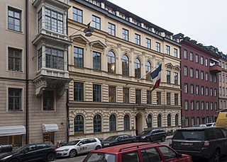
The Embassy of France in Stockholm is the diplomatic mission of the French Republic in Sweden. The chancery is located at Kommendörsgatan 13.
The Stockholm City Museum is a museum documenting, preserving and exhibiting the history of Stockholm. The museum is housed in Södra Stadshuset at Slussen on Södermalm.

Västra Trädgårdsgatan is a street at Norrmalm in Stockholm, Sweden. The street stretches from Kungsträdgården to Hamngatan and to Jakobsgatan.

The Fjäderholmarna are a group of small islands in the Stockholm archipelago close to downtown Stockholm, Sweden. The Fjäderholmarna consist of the four named islands of Stora Fjäderholmen, Ängsholmen, Libertas and Rövarns holme, together with a number of smaller islets. The Fjäderholmarna are located within the municipality of Lidingö, and are administered as part of the Royal National City Park.
Palmgrenska samskolan, originally Praktiska arbetsskolan för barn och ungdom, in Stockholm, Sweden, was the first school in Scandinavia to offer coeducation up to the studentexamen. It was also the first to offer sloyd, a handicraft-based education, in addition to theoretical subjects. The school changed its name to Palmgrenska samskolan in 1891–1892.
59°19′50″N18°04′23″E / 59.3306°N 18.0731°E
| | This Stockholm road or road transport-related article is a stub. You can help Wikipedia by expanding it. |