
U.S. Route 195 (US 195) is a north–south United States Highway, of which all but 0.65 miles of its 94.02 miles are within the state of Washington. The highway starts in rural Idaho north of the city of Lewiston as a state highway in an interchange with US 95. As the road crosses into Washington it becomes a state highway that connects communities in the Palouse region of Eastern Washington. US 195 travels north, serving the cities of Pullman, Colfax and Rosalia in Whitman County before continuing into Spokane County to its terminus in the city of Spokane at an interchange with Interstate 90 (I-90).

The Washington State Legislature is the state legislature of the U.S. state of Washington. It is a bicameral body, composed of the lower Washington House of Representatives, composed of 98 Representatives, and the upper Washington State Senate, with 49 Senators plus the Lieutenant Governor acting as president. The state is divided into 49 legislative districts, each of which elect one senator and two representatives.

State Route 970 (SR 970) is a 10.31-mile-long (16.59 km) state highway serving rural Kittitas County in the U.S. state of Washington. The highway connects Cle Elum to Blewett Pass and begins at an interchange with Interstate 90 (I-90) in Cle Elum. Traveling east, SR 970 intersects SR 903 north of the interchange and SR 10 in Teanaway before ending at U.S. Route 97 (US 97) in Virden. The highway was first added to the state highway system in 1909 as part of the Snoqualmie Pass Road and State Road 7. It was later signed as the Sunset Highway in 1913 and State Road 2 in 1923 before becoming part of US 97 and US 10. State Road 2 became Primary State Highway 2 (PSH 2) in 1937 and was replaced by US 97 during the 1964 highway renumbering. US 97 was realigned onto SR 131 between Thorp and Virden in 1975 and SR 970 was created on the former route.

State Route 10 (SR 10) is a 16.16-mile-long (26.01 km) state highway in the U.S. state of Washington. The highway is a remnant of U.S. Route 10 (US 10) in Kittitas County, traveling southeast along the Yakima River from SR 970 in Teanaway to US 97 northwest of Ellensburg. SR 10 was established in 1970 as the successor to US 10 after the completion of I-90 across the Snoqualmie Pass in 1968. The highway was previously part of State Road 3 from 1923 to 1937 and Primary State Highway 3 (PSH 3) until the 1964 highway renumbering.

State Route 27 (SR 27) is a 90-mile-long (145 km) state highway serving Whitman and Spokane counties, located in the eastern region of the U.S. state of Washington. The highway travels generally north from U.S. Route 195 (US 195) through Pullman, Palouse, Tekoa, and Spokane Valley to SR 290 north of an interchange with Interstate 90 (I-90). SR 27 serves the Palouse region as part of the Palouse Scenic Byway and travels between US 195 to the west and US 95 to the east in Idaho, with several auxiliary routes connecting to the two other highways.
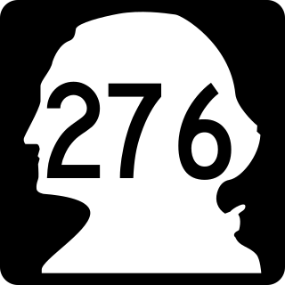
State Route 276 (SR 276) was a legislated, but not constructed, state highway located in the U.S. state of Washington. The highway was meant to serve as a northern bypass of Pullman in Whitman County, traveling east from U.S. Route 195 (US 195) west of the city to SR 270 east of the city. Proposals were first drawn in 1969 for a complete ring road around Pullman, with the west side built and signed as US 195 in 1975. The northern segment of the ring road was codified in law in 1973 as SR 276, however no construction has occurred; in 2016, the highway was removed via legislative action.

State Route 110 (SR 110) is a 11.10-mile-long (17.86 km) state highway serving Olympic National Park and the Quileute Indian Reservation within Clallam County, located in the U.S. state of Washington. The highway travels west from U.S. Route 101 (US 101) in Forks as La Push Road along the Quileute and Sol Duc rivers to the boundary of Olympic National Park east of La Push. La Push Road was originally added to the state highway system in 1937 as Secondary State Highway 9B (SSH 9B), but was removed in 1955. SR 110 was later established on the route in 1991 after a previous highway with the same designation was removed. A spur route extending west to Mora was originally added with SSH 9B and re-added with SR 110 in 1991.

The State Highways of Washington in the U.S. state of Washington comprise a network of over 7,000 miles (11,270 km) of state highways, including all Interstate and U.S. Highways that pass through the state, maintained by the Washington State Department of Transportation (WSDOT). The system spans 8.5% of the state's public road mileage, but carries over half of the traffic. All other public roads in the state are either inside incorporated places or are maintained by the county. The state highway symbol is a white silhouette of George Washington's head.
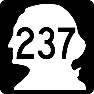
State Route 237 was a 9.07-mile (14.60 km) Washington state highway that ran from SR 20 in Fredonia, through Edison and ending at SR 11 east of Edison. The roadway was established in 1937 as Secondary State Highway 1C and was renumbered to State Route 537 in 1964, before being renumbered to SR 237 in 1975. The road was decommissioned in 1991.

State Route 211 (SR 211) is a Washington state highway located in Pend Oreille County. The 15.18-mile (24.43 km) long route that begins at an intersection with U.S. Route 2 (US 2) east of Diamond Lake. The highway extends north to end at SR 20 in Usk, a small community south of Cusick. The roadway serves as a bypass of Newport. The route originally was established as Secondary State Highway 6B (SSH 6B) in 1937. SSH 6B was later renumbered to SR 311 in 1964 during the highway renumbering. After SR 20 was extended east over SR 31, the highway was renumbered to SR 211.

Wayne Ehlers is an American former politician in the state of Washington. He was the Washington state Representative for the 2nd district from 1975 to 1979. He was also Speaker of the Washington state House from 1983 to 1987.

Alan Bluechel was an American politician in the state of Washington. He served in the Washington House of Representatives from 1967 to 1975 and in the Senate from 1975 to 1995. He was also a former president pro tempore of the Senate. He was a Republican.
A public transportation benefit area, abbreviated as PTBA, is a type of public-benefit corporation for public transit operators in the U.S. state of Washington.
Michigan's 8th Senate district is one of 38 districts in the Michigan Senate.

The 12th Assembly District of Wisconsin is one of 99 districts in the Wisconsin State Assembly. Located in southeast Wisconsin, the district is entirely contained within northwest Milwaukee County. It comprises much of the north side of the city of Milwaukee, as well as part of northern Wauwatosa. The district is represented by Democrat LaKeshia Myers, since January 2019.

The 18th Assembly District of Wisconsin is one of 99 districts in the Wisconsin State Assembly. Located in southeast Wisconsin, the district is entirely contained within the boundaries of the city of Milwaukee in central Milwaukee County. It comprises neighborhoods of Milwaukee's west side, including Washington Heights and Sherman Park. It includes landmarks such as the Miller Brewing Company and Washington Park. The district is represented by Democrat Evan Goyke, since January 2013.
