Related Research Articles

Rock County is a county located in the southwestern corner of the U.S. state of Minnesota. According to the 2020 census, its population was 9,704. The county seat is Luverne. It is located within the Sioux Falls MSA.
Pipestone County is a county in the U.S. state of Minnesota. As of the 2020 census, the population was 9,424. Its county seat is Pipestone.

Martin County is a county in Minnesota, United States. As of the 2020 census, the population was 20,025. Its county seat is Fairmont.

Lyon County is the most northwesterly county of the U.S. state of Iowa. As of the 2020 census, the population was 11,934. The county seat is Rock Rapids.

Allamakee County is the northeasternmost county in the U.S. state of Iowa. As of the 2020 census, the population was 14,061. Its county seat is Waukon.

Magnolia is a town in Rock County, Minnesota, United States. The population was 222 at the 2010 census. According to the United States Census Bureau, the city has a total area of 0.78 square miles (2.02 km2), all land.

The Great Northern Railway was an American Class I railroad. Running from Saint Paul, Minnesota, to Seattle, Washington, it was the creation of 19th-century railroad entrepreneur James J. Hill and was developed from the Saint Paul & Pacific Railroad. The Great Northern's route was the northernmost transcontinental railroad route in the U.S.

White Rock Creek is a 30 miles (48 km) creek occupying a chain of four sub-watersheds within the Trinity River watershed. From its source near Frisco, Texas at 33°07′54″N96°46′50″W, this creek runs south-by-south-east through suburban Dallas for 23.5 miles (37.8 km) where it widens into White Rock Lake, then continues south for another 8 miles (13 km) to its mouth on the East Fork of the Trinity River, of which it is a major tributary.

The Elroy-Sparta State Trail is a 32.5-mile (52.3 km) Wisconsin State rail trail between Elroy and Sparta, Wisconsin. Considered to be the first rail trail when it opened in 1967, it was designed for foot, bicycle, equestrian and light motorized traffic. Designated a multi-use trail, it offers recreational access to the routes and is open to the public. The trail is part of the larger Wisconsin bike trail system operated by the state of Wisconsin. It passes through rural scenery and three tunnels. It is one of six connecting trails in west-central Wisconsin. It was added to the Rails-to-Trails Conservancy hall of Fame in September 2008. It is one of the most popular trails in Wisconsin.
Rock Creek is a 19.1-mile-long (30.7 km) tributary of the Elkhorn River that flows south of Wisner and enters the Elkhorn one mile west of Beemer. The railway water stop and original plats where the village of Beemer is now located were named "Rock Creek" before Beemer was incorporated as a village in 1886.
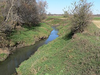
Ash Creek is an unincorporated community in Clinton Township, Rock County, Minnesota, United States. The community took its name from nearby Ash Creek, a tributary of the Rock River.
Lime Creek is a 28.6-mile-long (46.0 km) waterway of Minnesota and tributary of the Des Moines River.

Minnesota Junction is an unincorporated community located, in the town of Oak Grove, in Dodge County, Wisconsin, United States. Minnesota Junction is located on Wisconsin Highway 26. It is located at latitude 43.452 and longitude -88.697 at 925 feet above mean sea level.
Bell Creek is a stream in Washington, Dodge and Burt counties, Nebraska, in the United States.
Elm Creek is a stream in Fall River and Custer counties, South Dakota, in the United States. It is a tributary of the Cheyenne River.
Plum Creek is a stream in Kossuth and Hancock counties, in the U.S. state of Hancock County, Iowa. It is a tributary of the east fork of the Des Moines River.
Plum Creek is a ghost town in Kossuth County, in the U.S. state of Iowa. A railroad station was once located at Plum Creek.

Beaver Creek is a stream in Rock County, Minnesota and Minnehaha County, South Dakota. It is a tributary of Split Rock Creek.
Brandon Township is a township in Minnehaha County, in the U.S. state of South Dakota.
Elk Creek is a stream in Nobles and Rock counties, in the U.S. state of Minnesota. It is a tributary of the Rock River.
References
- ↑ U.S. Geological Survey Geographic Names Information System: Ash Creek (Minnesota)
- ↑ Chicago and North Western Railway Company (1908). A History of the Origin of the Place Names Connected with the Chicago & North Western and Chicago, St. Paul, Minneapolis & Omaha Railways. p. 167.
43°32′28.14″N96°11′14.5″W / 43.5411500°N 96.187361°W
| | This article related to a river or creek in Minnesota is a stub. You can help Wikipedia by expanding it. |