 | |
| Geography | |
|---|---|
| Coordinates | 35°54′44″S175°05′54″E / 35.912339°S 175.098442°E |
| Administration | |
New Zealand | |
| Region | Auckland |
| Demographics | |
| Population | uninhabited |
Atihau Island is an island which lays on the west of the Mokohinau Islands in New Zealand. [1]
 | |
| Geography | |
|---|---|
| Coordinates | 35°54′44″S175°05′54″E / 35.912339°S 175.098442°E |
| Administration | |
New Zealand | |
| Region | Auckland |
| Demographics | |
| Population | uninhabited |
Atihau Island is an island which lays on the west of the Mokohinau Islands in New Zealand. [1]

The Cook Islands is a self-governing island country in the South Pacific Ocean in free association with New Zealand. It comprises 15 islands whose total land area is 236.7 square kilometres (91 sq mi). The Cook Islands' Exclusive Economic Zone (EEZ) covers 1,960,027 square kilometres (756,771 sq mi) of ocean.

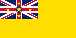
Niue is a self-governing island country in free association with New Zealand. It is situated in the South Pacific Ocean and is part of Polynesia, and predominantly inhabited by Polynesians. The island is commonly referred to as "The Rock", which comes from the traditional name "Rock of Polynesia".

Oceania is a geographical region comprising Australasia, Melanesia, Micronesia, and Polynesia. Outside of the English-speaking world, Oceania is generally considered a continent, while Australia is regarded as an island or a continental landmass contained inside of the larger continent of Oceania. Spanning the Eastern and Western hemispheres, at the center of the water hemisphere, Oceania is estimated to have a land area of about 9,000,000 square kilometres (3,500,000 sq mi) and a population of around 44.4 million as of 2022. When compared to the other continents, Oceania is the smallest in land area and the second-least populated after Antarctica.

Samoa, officially the Independent State of Samoa and until 1997 known as Western Samoa, is a Polynesian island country consisting of two main islands ; two smaller, inhabited islands ; and several smaller, uninhabited islands, including the Aleipata Islands. Samoa is located 64 km (40 mi) west of American Samoa, 889 km (552 mi) northeast of Tonga, 1,152 km (716 mi) northeast of Fiji, 483 km (300 mi) east of Wallis and Futuna, 1,151 km (715 mi) southeast of Tuvalu, 519 km (322 mi) south of Tokelau, 4,190 km (2,600 mi) southwest of Hawaii, and 610 km (380 mi) northwest of Niue. The capital and largest city is Apia. The Lapita people discovered and settled the Samoan Islands around 3,500 years ago. They developed a Samoan language and Samoan cultural identity.

Tokelau is a dependent territory of New Zealand in the southern Pacific Ocean. It consists of three tropical coral atolls: Atafu, Nukunonu, and Fakaofo. They have a combined land area of 10 km2 (4 sq mi). The capital rotates yearly among the three atolls. In addition to these three, Swains Island, which forms part of the same archipelago, is the subject of an ongoing territorial dispute; it is currently administered by the United States as part of American Samoa. Tokelau lies north of the Samoan Islands, east of Tuvalu, south of the Phoenix Islands, southwest of the more distant Line Islands, and northwest of the Cook Islands.

Tuatara are reptiles endemic to New Zealand. Despite their close resemblance to lizards, they are part of a distinct lineage, the order Rhynchocephalia. The name tuatara is derived from the Māori language and means "peaks on the back".

Zealand at 7,031 km2 is the largest and most populous island in Denmark proper. Zealand had a population of 2,319,705 on 1 January 2020.

The North Island, also officially named Te Ika-a-Māui, is one of the two main islands of New Zealand, separated from the larger but less populous South Island by Cook Strait. With an area of 113,729 km2 (43,911 sq mi), it is the world's 14th-largest island, constituting 44% of New Zealand's land area. It has a population of 3,997,300, which is 77% of New Zealand's residents, making it the most populous island in Polynesia and the 28th-most-populous island in the world.

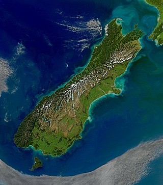
The South Island, also officially named Te Waipounamu, is the larger of the two major islands of New Zealand in surface area, the other being the smaller but more populous North Island. It is bordered to the north by Cook Strait, to the west by the Tasman Sea, and to the south and east by the Pacific Ocean. The South Island covers 150,437 square kilometres (58,084 sq mi), making it the world's 12th-largest island, constituting 56% of New Zealand's land area. At low altitude, it has an oceanic climate.

Moa are an extinct group of flightless birds formerly endemic to New Zealand. During the Late Pleistocene-Holocene, there were nine species. The two largest species, Dinornis robustus and Dinornis novaezelandiae, reached about 3.6 metres (12 ft) in height with neck outstretched, and weighed about 230 kilograms (510 lb) while the smallest, the bush moa, was around the size of a turkey. Estimates of the moa population when Polynesians settled New Zealand circa 1300 vary between 58,000 and approximately 2.5 million.

The Auckland Islands are an archipelago of New Zealand, lying 465 kilometres (290 mi) south of the South Island. The main Auckland Island, occupying 510 km2 (200 sq mi), is surrounded by smaller Adams Island, Enderby Island, Disappointment Island, Ewing Island, Rose Island, Dundas Island, and Green Island, with a combined area of 626 km2 (240 sq mi). The islands have no permanent human inhabitants.

The Chatham Islands are an archipelago in the Pacific Ocean about 800 km (430 nmi) east of New Zealand's South Island. They are administered as part of New Zealand. The archipelago consists of about 10 islands within an approximate 60 km (30 nmi) radius, the largest of which are Chatham Island and Pitt Island (Rangiauria). They include New Zealand's easternmost point, the Forty-Fours. Some of the islands, formerly cleared for farming, are now preserved as nature reserves to conserve some of the unique flora and fauna.

Territorial authorities are the second tier of local government in New Zealand, below regional councils. There are 67 territorial authorities: 13 city councils, 53 district councils and the Chatham Islands Council. District councils serve a combination of rural and urban communities, while city councils administer the larger urban areas. Five territorial authorities also perform the functions of a regional council and thus are unitary authorities. The Chatham Islands Council is a sui generis territorial authority that is similar to a unitary authority.

Pacific Islanders, Pasifika, Pasefika, Pacificans or rarely Pacificers are the peoples of the Pacific Islands. As an ethnic/racial term, it is used to describe the original peoples—inhabitants and diasporas—of any of the three major subregions of Oceania.
The Kermadec Islands are a subtropical island arc in the South Pacific Ocean 800–1,000 km (500–620 mi) northeast of New Zealand's North Island, and a similar distance southwest of Tonga. The islands are part of New Zealand. They are 33.6 km2 (13.0 sq mi) in total area and uninhabited, except for the permanently staffed Raoul Island Station, the northernmost outpost of New Zealand.

The Asia–Pacific (APAC) is the region of the world adjoining the western Pacific Ocean. The region's precise boundaries vary depending on context, but countries in East Asia, Southeast Asia, and Oceania are oft-included. In a wider context, parts of Northern and Southern Asian and Central Asia and West Asia regions, and even Pacific-adjoining countries in the Americas can be considered: the Asia-Pacific Economic Cooperation, for example, includes many New World countries. The term has become popular since the late 1980s in commerce, finance, and politics. Despite the heterogeneity of the regions' economies, most individual nations within the zone are emerging markets experiencing rapid growth. Sometimes, the notion of "Asia–Pacific excluding Japan" (APEJ) is considered useful.

The Realm of New Zealand is the area over which the monarch of New Zealand is head of state. The realm is not a federation but is a collection of states and territories united under its monarch. New Zealand is an independent and sovereign state that has one territory in Antarctica, one dependent territory (Tokelau), and two associated states. The Realm of New Zealand encompasses the three autonomous jurisdictions of New Zealand, the Cook Islands, and Niue.

New Zealand is an island country in the southwestern Pacific Ocean. It consists of two main landmasses—the North Island and the South Island —and over 700 smaller islands. It is the sixth-largest island country by area and lies east of Australia across the Tasman Sea and south of the islands of New Caledonia, Fiji, and Tonga. The country's varied topography and sharp mountain peaks, including the Southern Alps, owe much to tectonic uplift and volcanic eruptions. New Zealand's capital city is Wellington, and its most populous city is Auckland.

Polynesia is a subregion of Oceania, made up of more than 1,000 islands scattered over the central and southern Pacific Ocean. The indigenous people who inhabit the islands of Polynesia are called Polynesians. They have many things in common, including language relatedness, cultural practices, and traditional beliefs. In centuries past, they had a strong shared tradition of sailing and using stars to navigate at night.

Stewart Island is New Zealand's third-largest island, located 30 kilometres south of the South Island, across the Foveaux Strait. It is a roughly triangular island with a total land area of 1,746 km2 (674 sq mi). Its 164-kilometre (102 mi) coastline is deeply creased by Paterson Inlet (east), Port Pegasus (south), and Mason Bay (west). The island is generally hilly and densely forested. Flightless birds, including penguins, thrive because there are few introduced predators. Almost all the island is owned by the New Zealand government, and over 80 per cent of the island is set aside as the Rakiura National Park.