
Route 54 is a state highway located in Atlantic County in New Jersey, United States. It is considered to be a southern extension of U.S. Route 206, running 11.86 mi (19.09 km) from an intersection with US 206 and US 30 in Hammonton to an intersection with US 40 in Buena Vista Township. The road passes through the center of Hammonton before running into rural areas. It intersects US 322 and Route 73 in Folsom and the Atlantic City Expressway in Hammonton.

Buena is a borough in Atlantic County, New Jersey, United States. As of the 2020 United States Census, the borough's population was 4,501, a decrease of 102 (−2.2%) from the 2010 census count of 4,603, which in turn reflected an increase of 730 (+18.8%) from the 3,873 counted in the 2000 census.

Buena Vista Township is a township located in Atlantic County, New Jersey, United States. As of the 2020 United States Census, the township's population was 7,033, a decrease of 537 (−7.1%) from the 2010 census count of 7,570, which in turn reflected an increase of 134 (+1.8%) from the 7,436 counted in the 2000 census.

The Minuteman Bikeway is a 10-mile (16-kilometre) paved multi-use rail trail located in the Greater Boston area of Massachusetts. It runs from Bedford to Alewife station, at the northern end of the Red Line in Cambridge, passing through the towns of Lexington and Arlington along the way. Also along the route are several notable regional sites, including Alewife Brook Reservation, the Cyrus Dallin Art Museum, Spy Pond, "Arlington’s Great Meadows", the Battle Green in Lexington, and Hanscom Air Force Base.

Cape May Seashore Lines is a short line railroad in southern New Jersey. It offers two excursion services: a 30-mile (48 km) round trip between Richland and Tuckahoe and a 14-mile (23 km) round trip between Rio Grande, Cold Spring Village, and Cape May City. The track is owned by NJ Transit and leased to the Seashore Lines. Connections are provided with Conrail's Beesley's Point Secondary, owned jointly by CSX and Norfolk Southern, at the north end in Tuckahoe. Tony Macrie has been president of the Seashore Lines since he formed the railroad in 1984.

The Henry Hudson Trail is a rail trail in western and northern Monmouth County, New Jersey. The trail is named for Henry Hudson, who explored the harbor at Atlantic Highlands and the Raritan Bayshore coastline in the early 1600s. The trail is not near the Hudson River.

County Route 557 is a county highway in the U.S. state of New Jersey. The highway extends 36.00 miles (57.94 km) from Delsea Drive in Dennis Township to Main Street in Franklin Township. It is also referred to as Tuckahoe Road.

County Route 540 is a county highway in the U.S. state of New Jersey. The highway extends 43.16 miles (69.46 km) from the intersection of U.S. Route 130 (US 130) and Route 140 in Carneys Point Township to Harding Highway (US 40) in Buena Vista Township.

The Ozaukee - Sheboygan Interurban Trail is a roughly 40-mile (64 km) long rail trail in Ozaukee, and Sheboygan Counties, in Wisconsin. The south end of the trail is in Milwaukee County but only runs 1 mile through the county.

Richland is an unincorporated community located within Buena Vista Township in Atlantic County, New Jersey, United States. The area is served as United States Postal Service ZIP Code 08350.
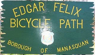
The Edgar Felix Bikeway is a 5.4 miles (8.7 km) rail trail in New Jersey between Manasquan and Allaire State Park. The trail was constructed on a former roadbed of the Farmingdale and Squan Village Railroad and the Freehold and Jamesburg Agricultural Railroad.
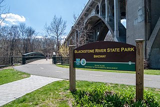
The Blackstone River Greenway is a partially completed 48-mile (77 km) paved rail trail defining the course of the East Coast Greenway through the Blackstone Valley from Worcester, Massachusetts to Providence, Rhode Island.
The Chessie Nature Trail is a rail trail linking Buena Vista, Virginia with Lexington, Virginia along the Maury River. The six-mile (9.7 km) trail follows the roadbed of a former Chesapeake and Ohio Railway (C&O) branch line which extended from Glasgow, Virginia, to Lexington, primarily following the Maury River.
The Palmer Bikeway is a system of trails in Palmer Township, Pennsylvania. These include a towpath adjacent to the Lehigh River, along with extensions that go up through residential areas of the township. The bikeway is connected to other trails which extend into the cities of Easton and Bethlehem, and goes through a corner of Wilson Borough. The northern portion of the trail, which extends from Penn Pump Park to Tatamy Borough parallel to the Bushkill Creek, will eventually be linked to the rest of the Bikeway via an unbuilt section between Northwood Avenue and Bushkill Park Drive. Once an undeveloped portion of trail between Tatamy and Stockertown Borough is completed, the Palmer Bikeway will connect with the Plainfield Township Trail, creating a regional trail system.
The Ghost Town Trail is a rail trail in Western Pennsylvania that runs 36 miles (58 km) between Black Lick, Indiana County, and Ebensburg, Cambria County. Established in 1991 on the right-of-way of the former Ebensburg and Black Lick Railroad, the trail follows the Blacklick Creek and passes through many ghost towns that were abandoned in the early 1900s with the decline of the local coal mining industry. Open year-round to cycling, hiking, and cross-country skiing, the trail is designated a National Recreation Trail by the United States Department of the Interior.
The Athens Conservancy is a 501 (c) (3) land trust based in Athens County, Ohio. It was founded in 2002. It is an all-volunteer organization.
Cumberland Valley Rail Trail (CVRT) is a National Recreation Trail rail trail that follows the former Cumberland Valley Railroad rail corridor for 9.5 miles, from Shippensburg to Newville, through the farmlands of western Cumberland County in south-central Pennsylvania.
