Atlantic Hotel (Spanish Point, Ireland)

Last updated

Atlantic Hotel (from a postcard held by the Limerick Museum) Atlantic Hotel. Courtesy of Limerick Museum.jpg
Atlantic Hotel (from a postcard held by the Limerick Museum)
Remaining ruins of the Atlantic Hotel from the seaside. In the background is the Armada Hotel. Ruine Atlantic Hotel.jpg
Remaining ruins of the Atlantic Hotel from the seaside. In the background is the Armada Hotel.

The Atlantic Hotel was a hotel in Spanish Point, County Clare, Ireland. It was built around 1810 by Thomas Moroney, a member of the family of local landlords. For several years it was described as the "largest hotel in the British Isles". [1] The hotel closed in the 1930s and, with the exception of one section which continued to operate for a period as a licensed premises, was demolished in the 1940s. [2] A new hotel, the Armada Hotel, was later built on the site. [2]

Contents

History

The hotel was originally built in the early 19th century. By c.1845, Thomas Moroney had extended the hotel to sixty rooms with hot and cold baths and "spacious halls". [3] The quietness and luxury made it a popular destination for Irish and English gentry. [4]

Auxiliary workhouse

In 1838, the British Government passed the Irish Poor Laws, and Spanish Point fell under the Poor Law Union of Ennistymon. This Poor Law Union set up a workhouse between Ennistymon and Lahinch. During the Great Famine, this workhouse became overwhelmed and the Poor Law Union leased several other big buildings to serve as auxiliary workhouses. Among these was the Atlantic Hotel, which housed 500 women and children from September 1848. [5] [6]

1890s

By 1893, the hotel was owned by Mrs. E.L. Moroney. [7] A nine-hole golf course was established at Spanish Point in the mid-1890s. As of 1897, guests of the hotel could play at this course for free, while others had to pay a green fee of 2 shillings 6 pence. [8]

Medal ceremony

Ruins of the Atlantic Hotel Ruins of Atlantic Hotel Spanish Point - geograph.org.uk - 2068696.jpg
Ruins of the Atlantic Hotel

The hotel was tangentially involved in the story of the 1907 rescue of the French three-masted ship Leon XIII . During a severe storm in October 1907, the vessel ran aground near Quilty, County Clare. Despite the heavy seas, several fishermen from Quilty manned their currachs and, over three days, saved most of the French crew members.[ citation needed ] At an event in the Atlantic Hotel, the French Government presented the rescuers with medals. [9]

Closure and demolition

By the 1930s, the hotel had permanently closed. It had previously depended on business from the English gentry, and they did not travel to Spanish Point after the Irish War of Independence and the Civil War. [10] The building was still mentioned in the 1942 ITA Survey, but not as a hotel. [11]

After the closure of the hotel, the site eventually became derelict, and the hotel was largely demolished in the 1940s. [2] As of the 21st century, only some ruined remains are visible. [4]

Armada Hotel

A new building, the Armada Hotel, was built on the site in the 1970s Burkesarmadahotel.jpg
A new building, the Armada Hotel, was built on the site in the 1970s

In the 1970s a new hotel, the 85-room Armada Hotel, was built on the site at Spanish Point. [12]

Related Research Articles

<span class="mw-page-title-main">County Clare</span> County in Ireland

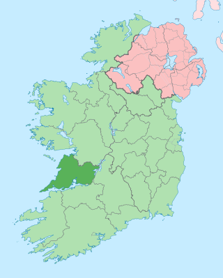
County Clare is a county in the province of Munster in the Southern part of the republic of Ireland, bordered on the west by the Atlantic Ocean. Clare County Council is the local authority. The county had a population of 127,938 at the 2022 census. The county seat and largest settlement is Ennis.

<span class="mw-page-title-main">Ballyvaughan</span> Harbour village in County Clare, Ireland

Ballyvaughan or Ballyvaghan is a small harbour village in County Clare, Ireland. It is located on the N67 road on the south shores of Galway Bay, in the northwest corner of The Burren. This position on the coast road and the close proximity to many of the area's sights has turned the village into a local center of tourism activity. At the time of the 2011 census Ballyvaughan had a population of 258. The area was officially classified as part of the West Clare Gaeltacht, an Irish-speaking community, until 1956.

<span class="mw-page-title-main">Ennistymon</span> Town in County Clare, Ireland

Ennistymon or Ennistimon is a country market town in County Clare, near the west coast of Ireland. The River Inagh, with its small rapids known as the Cascades, runs through the town, behind the main street. A bridge across the river leads to nearby Lahinch. The town is at the junction of the N67 and N85 roads.

<span class="mw-page-title-main">Lahinch</span> Seaside town in County Clare, Ireland

Lahinch or Lehinch is a small town on Liscannor Bay, on the northwest coast of County Clare, Ireland. It lies on the N67 national secondary road, between Milltown Malbay and Ennistymon, roughly 75 kilometres (47 mi) by road southwest of Galway and 68 kilometres (42 mi) northwest of Limerick. The town is a seaside resort and is home to the Lahinch Golf Club. It has become a popular surfing location.

<span class="mw-page-title-main">Spanish Point, County Clare</span> Seaside resort in County Clare, Ireland

Spanish Point is a village in the parish of Milltown Malbay in County Clare on the west coast of Ireland. It has many holiday homes, and in winter a significantly smaller population. The Beach, over a kilometre long, has Blue Flag Status and is suitable for swimming and surfing. It is also one of the better known surf breaks in County Clare. The name refers to the wrecking of some ships of the Spanish Armada off the coast.

<span class="mw-page-title-main">Scarriff</span> Village in County Clare, Ireland

Scarriff or Scariff is a large village in east County Clare, Ireland, situated in the midwest of Ireland. The town is on the West end of Lough Derg and is best known for its harbour. The Scarriff Market House is easily recognisable, and it is therefore often used to represent the town.

Johnny Doran was an Irish uilleann piper.

<span class="mw-page-title-main">Milltown Malbay</span> Town in County Clare, Ireland

Milltown Malbay, also Miltown Malbay, is a town in the west of County Clare, Ireland, near Spanish Point. The population was 829 at the 2016 census.

Mullagh is a village in County Clare, Ireland. It lies not far from the Atlantic coast, some 5 km southeast of Quilty and 6.5 km south-southeast of Spanish Point. Nearby towns include Milltown Malbay and Kilrush.

<span class="mw-page-title-main">Quilty, County Clare</span> Fishing village in County Clare, Ireland

Quilty, historically Killty, is a small fishing village between Milltown Malbay and Doonbeg in County Clare, Ireland. Lobster, salmon, bass, herring and mackerel are landed at Quilty, formerly known for its curing industry. The area was officially classified as part of the west Clare Gaeltacht, an Irish-speaking community, until 1956.

<span class="mw-page-title-main">Glin, County Limerick</span> Village in County Limerick, Ireland

Glin is a village in the northwest of County Limerick, Ireland. It is on the south shore of the River Shannon's estuary, on the N69 road between Foynes and Tarbert. The population of the village at the 2022 census was 644.

Nonie Lynch was an Irish traditional singer from Milltown Malbay, County Clare.

<span class="mw-page-title-main">Burren and Cliffs of Moher Geopark</span> Area of geological interest including the Burren and Cliffs of Moher

The Burren and Cliffs of Moher Geopark is an internationally designated area of geological interest in The Burren region of County Clare, Ireland. It is the third Geopark to be designated in Ireland, and is recognised at both European and global levels.

The Laichtín Naofa Céilí Band is a former céilí band based in Milltown Malbay, County Clare, Ireland.

<span class="mw-page-title-main">Garret Barry (piper)</span>

Garret(t) Barry was a blind Irish uilleann piper from Inagh, County Clare, among the most famous players of the 19th century.

<span class="mw-page-title-main">Kilmurry Ibrickane (Catholic parish)</span> Parish in County Clare, Ireland

Kilmurry Ibrickane (Irish: Cill Mhuire Uí Bhreacáin), also known as Mullagh (Kilmurry Ibrickane), is a parish of the Roman Catholic Diocese of Killaloe that is located in west County Clare, Ireland. A civil parish of the same name also exists which is part of the historic barony of Ibrickane. The parish derives its name from the tiny settlement of Kilmurry in Ibrickane, the location of the church before Cromwellian times.

<span class="mw-page-title-main">Ennistymon House</span> Country house in County Clare, Ireland

Ennistymon House was a former country house in the village of Ennistymon, County Clare in Ireland. Built on the elevated site of a medieval castle it has now been incorporated into the Falls Hotel.

Kilmoon is a civil parish of County Clare, Ireland, 7 miles (11 km) north of Ennistymon. The parish contains the town of Lisdoonvarna.

<span class="mw-page-title-main">Doonbeg (Killard)</span> Parish in County Clare, Ireland

Doonbeg (Killard) (Irish: Cill Ard) is a civil parish on the Atlantic coast of County Clare in Ireland. It is also an ecclesiastical parish in the Roman Catholic Diocese of Killaloe. The largest population centre in the parish is the village of Doonbeg.

Kilfarboy is a civil parish in County Clare in Ireland. There is also a Catholic parish with the same name. The largest population centre in the parish is Milltown Malbay.

References

  1. "Historical Background". Clare Library. 14 April 1920. Retrieved 20 March 2012.
  2. 1 2 3 "The History of Spanish Point". visitspanishpoint.ie. Retrieved 19 June 2024.
  3. "Parliamentary Gazetteer of Ireland 1845" . Retrieved 20 March 2012.
  4. 1 2 "Clare-tour". Clare-tour. Retrieved 20 March 2012.
  5. From a letter of Harriet Martineau, dated 22 September 1852, published in Harrington, John (ed.), The English Traveller in Ireland, Dublin, Wolfhound Press, 1991
  6. "Overcrowding in workhouses". Clare Library. Retrieved 20 March 2012.
  7. "Guy's Postal Directory 1893". Clare Library. Retrieved 20 March 2012.
  8. "Golf course Spanish Point". Golfinginireland.ie. Archived from the original on 9 March 2012. Retrieved 20 March 2012.
  9. "Plaque unveiled for Quilty fishermen". Irishfrenchconnection.com. Archived from the original on 23 March 2012. Retrieved 20 March 2012.
  10. Paddy Casey, lecture for the Kilfarboy Historical Society, 13 October 2009
    - Talty, Brid (2013). As We Met... Local and Cultural History Kilfarboy 1880-1980 Told through the life of Martin Talty. Milltown Malbay: Brid Talty. p. 95. ISBN   9780957574304.
  11. I.T.A. Topographical and General Survey 1942/3
  12. "Armada Hotel". Armada Hotel. 22 September 2008. Retrieved 23 March 2012.

52°50′41.28″N9°26′13.39″W / 52.8448000°N 9.4370528°W / 52.8448000; -9.4370528