Attunga, Toorak Gardens

Last updated

The official handover of "Attunga" by Otto von Rieben to the City of Burnside. Attunga.jpg
The official handover of "Attunga" by Otto von Rieben to the City of Burnside.
Official party at "Attunga" to inspect the gift of Otto von Rieben to the City of Burnside: l-r Rt. Hon Lord Mayor, Mr. R. Walker; Chief Sec. Mr. Lyell McEwin; Premier Mr. Thomas Playford; Mayor Mr. Philip R. Claridge; Mr Otto Von Rieben; Miss Gertrude Engelhart (von Rieben's niece); Mrs Philip R. Claridge; Cr. T.R. Mellor Attunga 1944 B49775.jpg
Official party at "Attunga" to inspect the gift of Otto von Rieben to the City of Burnside: l-r Rt. Hon Lord Mayor, Mr. R. Walker; Chief Sec. Mr. Lyell McEwin; Premier Mr. Thomas Playford; Mayor Mr. Philip R. Claridge; Mr Otto Von Rieben; Miss Gertrude Engelhart (von Rieben's niece); Mrs Philip R. Claridge; Cr. T.R. Mellor

Attunga was a mansion which now forms part of a hospital.

The mansion was built by Benjamin Burford in 1900 on 4.5 acres (1.8ha) at 120 Kensington Road, in what was then Rose Park, (an inner eastern suburb of Adelaide, South Australia). Containing 14 rooms, the two storey house is the largest and most extravagant mansion built in the area that became known as the suburb of Toorak Gardens. With Burford's death in 1905, the property was bought by an investor from Broken Hill, Otto Georg Ludwig von Rieben. While maintaining and paying particular attention to the property, von Rieben eventually settled at "Pomona" at Mt Lofty in the Adelaide Hills. [1] [2]

Kensington Road is a main road in the South Australian capital city of Adelaide. It serves the eastern suburbs, primarily the northern side of the City of Burnside and the southern side of the City of Norwood, Payneham & St Peters. Its western end, on the edge of the city centre, is at the Britannia Roundabout on the City Ring Route. Kensington Road continues into the city centre as Wakefield Road

Rose Park, South Australia Suburb of Adelaide, South Australia

Rose Park is a suburb with a population of 1,293 in the South Australian capital city of Adelaide. It is located one kilometre east of Adelaide's central business district (CBD). Rose Park is a leafy, tree-lined and wealthy inner suburb containing a number of historical and contemporary attractions. Much of the area's 19th Century housing stock has been recognised with heritage protection.

Toorak Gardens, South Australia Suburb of Adelaide, South Australia

Toorak Gardens is a leafy, mainly residential inner eastern suburb of Adelaide, South Australia, located 2 km east of the Adelaide city centre. It is characterised by tree-lined streets and detached single story villas and bungalows built in the 1920s and 1930s on allotments of around 0.25 acres.

In 1944, almost forty years after he purchased it, and having lived in it for 37 years, von Rieben (then aged 82) offered Attunga to the Burnside Council free of charge, for use as a hospital, with the stipulation that the house and gardens be preserved. [3] (In August 1943, a committee of the Council had suggested building a community hospital as part of the Council's Post-War Reconstruction and Development Plan. In November 1943, the Council adopted the committee's recommendation to spend up to £100,000 on the building of a hospital, and that the hospital was intended to be the district's principle memorial to honour Burnside's war dead. In February 1944, Mayor P.R. Claridge announced von Rieben's donation. The council subsequently unanimously accepted the donation.) [4]

City of Burnside Local government area in South Australia

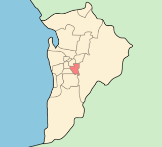
The City of Burnside is a local government area in the South Australian city of Adelaide stretching from the Adelaide Parklands into the Adelaide foothills with an area of 2,753 hectares. It was founded in August 1856 as the District Council of Burnside, the name of a property of an early settler, and was classed as a city in 1943. The LGA is bounded by Adelaide, Adelaide Hills Council, Campbelltown, Mitcham, Norwood Payneham and St Peters and Unley.

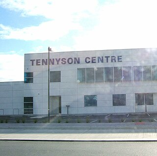
By April 1949, the first stage of the conversion of the mansion had been completed, with Attunga having been converted into a convalescent hospital caring for 21 patients. When it closed in September 1956 it had cared for over 1,400 patients. In October 1956, the adjacent new 45-bed Burnside War Memorial Hospital, built at a cost of £145,000, was opened. [4] [5] The mansion has subsequently been used for a number of medical support purposes - for example, since March 1989 it has used as the "Attunga Medical Centre".

Burnside War Memorial Hospital hospital

The Burnside War Memorial Hospital is the only private community hospital in the City of Burnside, Adelaide, South Australia.

In the 21st century, the mansion and its well-kept formal gardens continue to occupy nearly all of the western half of the original 4.5 acres, with multi-story hospital buildings covering most of the eastern half of the original area.

Related Research Articles

Adelaide Park Lands

The Adelaide Park Lands are the figure-eight of land spanning both banks of the River Torrens between Hackney and Thebarton and separating the City of Adelaide from the surrounding suburbia of greater Metropolitan Adelaide, the capital city of South Australia. They were laid out by Colonel William Light in his design for the city, and originally consisted of 2,300 acres (930 ha) "exclusive of 32 acres (13 ha) for a public cemetery". One copy of Light's plan shows areas for a cemetery and a Post and Telegraph Store on West Tce, a small Government Domain and Barracks on the central part of North Tce, a hospital on East Tce, a Botanical Garden on the River Torrens west of North Adelaide, and a school and a storehouse southwest of North Adelaide.

Prospect, South Australia Suburb of Adelaide, South Australia

Prospect is the seat of the City of Prospect and an inner northern suburb of greater Adelaide. It is located 5 km (3.1 mi) north of Adelaide's centre.

Glenside is a suburb in the local government area known as the City of Burnside, Adelaide, South Australia. The suburb is 4.9 kilometres south-east of the Adelaide city centre, home to 2,422 people in a total land area of 1.40 km².

Holy Trinity Church, Adelaide

Trinity City, is an evangelical Anglican church located at 88 North Terrace, in the city of Adelaide, South Australia. Trinity City has four gatherings at the North Terrace location each Sunday, as well as various other meetings throughout the week.

Dulwich is a suburb in the City of Burnside, Adelaide, South Australia with a census area population of 2,663 people. The suburb is adjacent to Adelaide's east parklands, and forms part of the western boundary of the City of Burnside. Dulwich is a mix of residential housing and commercial activity–corporate offices and businesses line Fullarton and Greenhill Roads. The suburb is bordered by Rose Park to the north, Toorak Gardens to the east, Glenside to the south and the Adelaide Parklands to the west.

Frewville is a small suburb in the South Australian city of Adelaide. It is three kilometres south-east of Adelaide's central business district (CBD).

Hazelwood Park, South Australia Suburb of Adelaide, South Australia

Hazelwood Park is an upper class suburb in the City of Burnside, Adelaide, South Australia with a census area population of 1,717 people. The suburb is about 5 kilometres east of the Central business district. Hazelwood Park, a suburban park inside the suburb, is the major attraction in the suburb. This includes the Burnside Swimming Centre, a popular site in the summer. Much of the remainder of the suburb is residential but there is a small shopping area along Glynburn Road on the eastern edge. The area was first settled by Europeans in 1848 but has seen many community changes over the years.

Kensington Gardens is a suburb of Adelaide in the City of Burnside.

Marryatville is a suburb to the east of Adelaide's central business district. Along with neighbouring Heathpool, it is part of the City of Norwood Payneham St Peters whereas all the suburbs around it, with the exception of Kensington are in Burnside City Council.

History of Burnside Area in Adelaide, Australia

The history of Burnside, a local government area in the metropolitan area of Adelaide, South Australia, spans three centuries. Burnside was inhabited by the Kaurna Indigenous people prior to European settlement, living around the creeks of the River Torrens during the winter and in the Adelaide Hills during the summer. The area was first settled in 1839 by Peter Anderson, a Scots migrant, who named it Burnside after his property's location adjacent to Second Creek. The village of Burnside was established shortly after, and the District Council of Burnside was gazetted in 1856, separating itself from the larger East Torrens Council.

Kurralta Park, South Australia Suburb of Adelaide, South Australia

Kurralta Park is a suburb of Adelaide, South Australia in the City of West Torrens. In the 2011 census, Kurralta Park recorded a population of 2,574 people, 50.7% female and 49.3% male

Glenelg East, South Australia Suburb of Adelaide, South Australia

Glenelg East is a residential suburb 9 kilometres (5.6 mi) south west of the centre of Adelaide, South Australia. It is characterised by quarter-acre blocks with heritage homes and parks intermingled with contemporary modern homes and low-rise multi-dwelling units.

The Regal Theatre, formerly known as the Chelsea is a single screen cinema in Kensington Park, a suburb of Adelaide, South Australia. The front entrance faces the Marryatville suburb and is seen as being part of the Marryatville business community. It was built in the Art Deco style, completed in 1925.

Grenfell Street, Adelaide street in Adelaide

Grenfell Street is a major street in the north-east quarter of the centre of the city of Adelaide, South Australia. The street runs west-east from King William Street to East Terrace. On the other side of King William Street, it continues as Currie Street. Its intersection with Pulteney Street is encircled by Hindmarsh Square.

Benacre, Glen Osmond

Benacre is a house in Glen Osmond,, which is listed on the Register of the National Estate. It is located at 6 Benacre Place.

North Adelaide Suburb of Adelaide, South Australia

North Adelaide is a predominantly residential precinct and suburb of the City of Adelaide in South Australia, situated north of the River Torrens and within the Adelaide Park Lands.

W. H. Burford and Sons was a soap and candle-making business founded in Adelaide in 1840 by William Henville Burford (1807–1895), an English butcher who arrived in the new colony in 1838. It was one of the earliest soapmakers in Australia, and up to the 1960s when it closed, the oldest. In 1878 he took his two sons Benjamin and William into partnership as W. H. Burford & Sons. Its expansion, accompanied by a number of takeovers, made it the dominant soap manufacturer in South Australia and Western Australia. Its founders were noted public figures in the young city of Adelaide.

References

  1. Death of O. von Rieben, The Advertiser, 9 May 1949.
  2. von Rieben is also the name of a noble family from Mecklenburg, Germany; see: de:Rieben (Adelsgeschlecht) (in German)
  3. Darren Young and Chris Marks, Landmarks of Burnside Archived 14 October 2009 at the Wayback Machine ., Celebrating our city - 150 years, City of Burnside, August 2007, page 51
  4. 1 2 History in Brief Archived 28 September 2011 at the Wayback Machine ., "Patient Information Directory 2009-2010", page 3. Burnside War Memorial Hospital, www.burnsidehospital.asn.au
  5. Brief History, Burnside War Memorial Hospital, www.burnsidehospital.asn.au

Coordinates: 34°55′40″S138°38′17″E / 34.92778°S 138.63806°E / -34.92778; 138.63806

Geographic coordinate system Coordinate system

A geographic coordinate system is a coordinate system that enables every location on Earth to be specified by a set of numbers, letters or symbols. The coordinates are often chosen such that one of the numbers represents a vertical position and two or three of the numbers represent a horizontal position; alternatively, a geographic position may be expressed in a combined three-dimensional Cartesian vector. A common choice of coordinates is latitude, longitude and elevation. To specify a location on a plane requires a map projection.