
Federal Highway 1 is a free (libre) part of the federal highway corridors of Mexico, and the highway follows the length of the Baja California Peninsula from Tijuana, Baja California, in the north to Cabo San Lucas, Baja California Sur, in the south. The road connects with Via Rapida, which merges into the American Interstate 5 (I-5) at the San Ysidro Port of Entry, which crosses the international border south of San Ysidro, California.
Toyota Motor Manufacturing de Baja California (TMMBC) is a Toyota automobile manufacturing facility located Tijuana, Baja California, Mexico that opened in 2002. The facility currently produces the Toyota Tacoma for the North American market and pickup truck beds. The plant is a 350,000 sq ft (33,000 m2) building on a site of 700 acres that has the capacity to produce 166,000 vehicles per year and employs 2,000 people.

The banderas monumentales are a collection of tall flagpoles containing large flags of Mexico located throughout Mexico. They are part of a program started in 1999 under President Ernesto Zedillo that is currently administered by the Secretariat of National Defense. The main feature of these monuments is a giant Mexican flag flying off a 50-meter-high (160-ft) flagpole. The size of the flag was 14.3 by 25 metres and it was flown on a pole that measured 50 metres (160 ft) high. In the time after the decree was issued, many more banderas monumentales have been installed throughout the country in various sizes. Many of the locations were chosen due to significant events in Mexican history that occurred there.
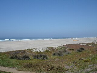
La Salina Del Mar is a gringo community in the Mexican state of Baja California. It is located on the beach 73 km south of Tijuana at 32° 03´36" N 116° 52´ 42" W. La Salina is the home of Puerto Salina, the first marina in Mexico south of the United States border on the Pacific Ocean. This harbor has become silted in over the past several years and is impassable to anything larger than a jet ski or a panga. At low tide no vessel of any sort can enter the harbor. The annual gray whale migration path is approx 1 km off the coast and they can often be seen surfacing from the beach. La Salina Del Mar is also home of Puerto Cielo, Baja's most diverse airsport venue. Paraglider and hang glider pilots come from throughout North America to enjoy the coastal mountain ridge that offers a strong thermal and one of the most spectacular ocean views available to glider pilots.
La Mesa prison is a penitentiary in Tijuana, Baja California, Mexico, near the Mexico–United States border. It is located in the La Mesa section of the city.
Valle de las Palmas is located between two hamlets Espuela and Seco in the municipalities of Tijuana and Tecate, Baja California, Mexico. It is the site of a long-term planned urban development which would take advantage of proximity to the existing cities of Tijuana to the north west and Mexicali to the north east to create a similar sized city of one million people by the year 2030, on Mexican Federal Highway 3 around an existing industrial park and university campus Unidad Valle De Las Palmas. The first project in Valle de las Palmas, named Valle San Pedro, is proposed by the Mexican Federal Government, the State of Baja California, Urbi and Banobras. It has been certified as the first Integral Sustainable Urban Development or DUIS in Mexico, which establishes criteria in collaboration with Interamerican Development Bank IDB to evaluate projects that will receive inter-secretarial technical support and public investment. The locality reported a population of 1,860 inhabitants in the 2010 federal census. It is located at an altitude of 282 m. above sea level.
Las Cruces Air Force Station is a closed United States Air Force General Surveillance Radar station. It is located 12.1 miles (19.5 km) west-southwest of Las Cruces, New Mexico. It was closed in 1963.
Las Delicias is a city in Baja California in Tijuana Municipality, Mexico. The city had a population of 15,486 as of 2010.
Terrazas del Valle – Terraces of the Valley – is a city in Baja California in Tijuana Municipality. The city had a population of 20,421 as of 2010.
Villa del Prado is a city in Baja California in Tijuana Municipality. The city had a population of 12,303 as of 2010.
Villa del Campo – Town of the Country – is a neighborhood in Baja California in Tijuana Municipality. The neighborhood had a population of 13,906 as of 2010.

The Tijuana Mexico Temple is a temple of the Church of Jesus Christ of Latter-day Saints in Tijuana, México. Completed in 2015, the intent to construct the temple was announced by church president Thomas S. Monson on October 2, 2010, during the church's semi-annual general conference. It is the thirteenth temple built in Mexico.

The Tijuana Zonkeys are a Mexican professional basketball team based in Tijuana, Baja California. The Zonkeys are part of the Circuito de Baloncesto de la Costa del Pacífico (CIBACOPA). They play their home games at the Auditorio Academia Zonkeys. The team was founded in 2010, and won back-to-back championships in 2014 and 2015.
Logan is an unincorporated community in Lawrence County, Indiana, in the United States.
Rio Alamar or Arroyo de Alamar is a river mainly in northern Baja California, Mexico with a small portion in California, United States. The stream is formed by the confluence of Cottonwood Creek and Tecate Creek a short distance north of the Mexico–United States border. It flows generally west for about 25 kilometres (16 mi) through the San Ysidro Mountains and the Tijuana urban area before joining with the Arroyo de las Palmas in central Tijuana, to form the Tijuana River.
Tecate Creek is a stream in northern Baja California, Mexico with its headwaters in southern San Diego County, California in the United States. It begins along the Tecate Divide in the In-Ko-Pah Mountains, near Live Oak Springs. The upper reaches of the stream in the US are known as Campo Creek. It flows southwest, crossing the Mexico–United States border at Canyon City, before flowing through the city of Tecate, Baja California. West of Tecate it flows through a gorge and briefly re-enters the US where it combines with Cottonwood Creek to form the Rio Alamar, a tributary of the Tijuana River which it joins in Central Tijuana.

La Cinco y Diez, is the name of an intersection, pedestrian overpass over that intersection, public transportation hub and major retail district in La Mesa borough, Tijuana, Mexico. The name exists because a branch of the Luján/Cardenas family's "La Cinco y Diez" five and dime store once stood here, and Tijuana residents taking taxis or buses would ask to be let off by "La Cinco y Diez".
Morelos Park is an ecological reserve in Tijuana, Mexico. It has a zoo, and an artificial lake with different species of fish and ducks. It also has 11 kiosks and 10 green areas for family parties and a barbecue area, which are free to use. It has a small train for children and adults, with its route circling all the way around the lake. There is a dock with small boats in which visitors can take a walk by the lake. two playgrounds, and also houses Baja Paintball, a paintball business which rents paintball equipment and markers and allows people to use its game zones, pedestrian walkways, and bicycles. The playgrounds contain some mechanical rides, along with some normal playground equipment, such as swingsets and slides.
Rocky Hill is an unincorporated community in Bloomfield Township, Jackson County, Ohio, United States. It is located southeast of Jackson along U.S. Route 35, next to Winchester at the intersection of C H & D Road and Dixon Run Road, at 38°59′20″N82°32′42″W.
Península is a mixed-use complex in Tijuana set to open in late 2022 along the Vía Rápida Oriente, the city's main east–west corridor, in the Colonia Chapultepec Alamar neighborhood of La Mesa borough.
