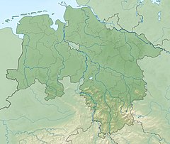
Lower Saxony is a German state (Land) situated in northwestern Germany. It is the second-largest state by land area, with 47,624 km2 (18,388 sq mi), and fourth-largest in population among the 16 Länder federated as the Federal Republic of Germany. In rural areas, Northern Low Saxon and Saterland Frisian are still spoken, but the number of speakers is declining.

Saxony, officially the Free State of Saxony, is a landlocked state of Germany, bordering the states of Brandenburg, Saxony-Anhalt, Thuringia, Bavaria, as well as the countries of Poland and the Czech Republic. Its capital is Dresden, and its largest city is Leipzig. Saxony is the tenth largest of Germany's sixteen states, with an area of 18,413 square kilometres (7,109 sq mi), and the sixth most populous, with more than 4 million inhabitants.

Westphalia is a region of northwestern Germany and one of the three historic parts of the state of North Rhine-Westphalia. It has an area of 20,210 km2 (7,803 sq mi) and 7.9 million inhabitants.

The Werra, a river in central Germany, is the right-bank headwater of the Weser. Weser is a synonym in an old dialect of German. The Werra has its source near Eisfeld in southern Thuringia. After 293 kilometres (182 mi) the Werra joins the river Fulda in the town of Hann. Münden, forming the Weser.
Stade is a district (Landkreis) in Lower Saxony, Germany. It has its seat in Stade and is part of the Hamburg Metropolitan Region.
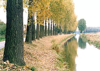
The Aller is a 215-kilometre (134 mi) long river in the states of Saxony-Anhalt and Lower Saxony in Germany. It is a right-hand, and hence eastern, tributary of the Weser and is also its largest tributary. Its last 117 kilometres (73 mi) form the Lower Aller federal waterway (Bundeswasserstraße). The Aller was extensively straightened, widened and, in places, dyked, during the 1960s to provide flood control of the river. In a 20-kilometre (12 mi) long section near Gifhorn, the river meanders in its natural river bed.
Landkreis Emsland is a district in Lower Saxony, Germany named after the river Ems. It is bounded by the districts of Leer, Cloppenburg and Osnabrück, the state of North Rhine-Westphalia, the district of Bentheim in Lower Saxony, and the Netherlands.
Schaumburg is a district (Landkreis) of Lower Saxony, Germany. It is bounded by the districts of Nienburg, Hanover and Hamelin-Pyrmont, and the state of North Rhine-Westphalia.

The Leine is a river in Thuringia and Lower Saxony, Germany. It is a left tributary of the Aller and the Weser and it is 281 km (175 mi) long.

The Oker is a river in Lower Saxony, Germany, that has historically formed an important political boundary. It is a left tributary of the River Aller, 128 kilometres (80 mi) in length and runs in a generally northerly direction.

Lusatia, also known as Sorbia, is a historical region in Central Europe, split between Germany and Poland. The region is the home of the ethnic group of Sorbs. It stretches from the Bóbr and Kwisa rivers in the east to the Pulsnitz and Black Elster in the west, today located within the German states of Saxony and Brandenburg as well as in the Lower Silesian and Lubusz voivodeships of western Poland.

The Fulda is a river of Hesse and Lower Saxony, Germany. It is one of two headstreams of the Weser. The Fulda is 220.4 kilometres (137.0 mi) long.
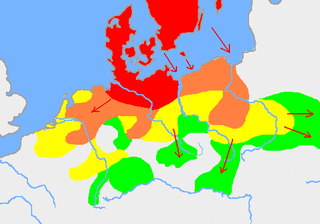
The Jastorf culture was an Iron Age material culture in what are now north Germany and Denmark, spanning the 6th to 1st centuries BC, forming the southern part of the Pre-Roman Iron Age. The culture evolved out of the Nordic Bronze Age, through influence from the Hallstatt culture farther south.

Wümme is a river in northern Germany, in the states Lower Saxony and Bremen, marking the border between the two states for part of its course. It is the main headstream of the Lesum.

Hunte is a 189-kilometre (117 mi) long river in north-western Germany, a left tributary of the Weser.
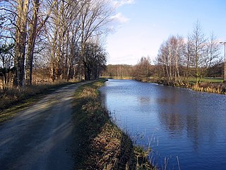
The Ohre is a river in northern Germany, left tributary to the Elbe. Its total length is 103 kilometres (64 mi). Its source is north of Wolfsburg, in Lower Saxony. It flows generally south-east, at first following the border of Lower Saxony and Saxony-Anhalt. After Buchhorst it flows completely through Saxony-Anhalt, along the Mittellandkanal. It flows into the Elbe in Rogätz, north of Magdeburg. The towns Brome, Calvörde, Haldensleben and Wolmirstedt lie along the river. The upper course of the Ohre is in the Drömling nature reserve.
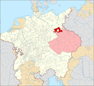
Lower Lusatia is a historical region in Central Europe, stretching from the southeast of the German state of Brandenburg to the southwest of Lubusz Voivodeship in Poland. Like adjacent Upper Lusatia in the south, Lower Lusatia is a settlement area of the West Slavic Sorbs whose endangered Lower Sorbian language is related to Upper Sorbian and Polish.

Old Saxony is the original homeland of the Saxons in the northwest corner of modern Germany and roughly corresponds today to the modern German state of Lower Saxony, Westphalia, Nordalbingia and western Saxony-Anhalt.
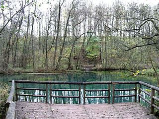
The Rhume is a 48 km (30 mi) long river in Lower Saxony, Germany. It is a right tributary of the Leine. Its source is the karstic spring of Rhume Spring in Rhumspringe, south of the Harz mountain range. The water drains with high pressure from the ground of the funnel-shaped well, known for its turquoise colour.
