Related Research Articles

Lovejoy is a city in Clayton County, Georgia, United States. As of the 2010 census, the city had a population of 6,422, up from 2,495 in 2000. During the American Civil War, it was the site of the Battle of Lovejoy's Station during the Atlanta Campaign of 1864.

Dallas is a city in, and the county seat of, Paulding County, Georgia, United States. The estimated population, as of 2010, was 11,544. Dallas is a northwestern suburb of Atlanta, located approximately 38 miles from downtown. It was named for George M. Dallas, Vice President of the United States of America, under James K. Polk.

The Battle of Atlanta was a battle of the Atlanta Campaign fought during the American Civil War on July 22, 1864, just southeast of Atlanta, Georgia. Continuing their summer campaign to seize the important rail and supply center of Atlanta, Union forces commanded by William Tecumseh Sherman overwhelmed and defeated Confederate forces defending the city under John Bell Hood. Union Maj. Gen. James B. McPherson was killed during the battle. Despite the implication of finality in its name, the battle occurred midway through the campaign, and the city did not fall until September 2, 1864, after a Union siege and various attempts to seize railroads and supply lines leading to Atlanta. After taking the city, Sherman's troops headed south-southeastward toward Milledgeville, the state capital, and on to Savannah with the March to the Sea.

Centennial Olympic Park is a 22-acre (89,000 m2) public park located in downtown Atlanta, Georgia owned and operated by the Georgia World Congress Center Authority. It was built by the Atlanta Committee for the Olympic Games (ACOG) as part of the infrastructure improvements for the 1996 Summer Olympics. It plays host to millions of visitors a year and several events, including a summer popular music concert series and an annual Independence Day concert and fireworks display.

Inman Park is an intown neighborhood on the east side of Atlanta, Georgia, and its first planned suburb. It was named for Samuel M. Inman.
East Atlanta is a neighborhood on the east side of Atlanta, Georgia, United States The name East Atlanta Village primarily refers to the neighborhood's commercial district.

The Battle of Ezra Church, also known as the Battle of Ezra Chapel and the Battle of the Poor House was fought on July 28, 1864, in Fulton County, Georgia, during the American Civil War. Part of the Atlanta Campaign, the battle featured Maj. Gen. William T. Sherman's Union Army of the Tennessee against the Army of Tennessee, commanded by Lt. Gen. John B. Hood, which was defending the Confederate stronghold of Atlanta, Georgia.

Atlanta History Center is a history museum and research center located in the Buckhead district of Atlanta, Georgia. The Museum was founded in 1926 and currently consists of nine permanent, and several temporary, exhibitions. Atlanta History Center’s campus is 33-acres and features historic gardens and houses located on the grounds, including Swan House, Smith Farm, and Wood Family Cabin. Atlanta History Center’s Midtown Campus includes the Margaret Mitchell House & Museum. The History Center’s research arm, Kenan Research Center, includes 3.5 million resources and a reproduction of historian Franklin Garrett's (1906–2000) office. Atlanta History Center holds one of the largest collections of Civil War artifacts in the United States.
Standing Peachtree was a Creek Indian village and the closest Indian settlement to what is now the Buckhead area of Atlanta, Georgia. It was located where Peachtree Creek flows into the Chattahoochee River, in today's Paces neighborhood. It was located in the borderlands of the Cherokee and Creek nations. It is referred to in several documents dating as far back as 1762.
The Battle of Utoy Creek was fought August 4–7, 1864, during the Atlanta Campaign of the American Civil War. Maj. Gen. William T. Sherman's Union armies had partially encircled the city of Atlanta, Georgia, which was being held by Confederate forces under the command of General John Bell Hood. Sherman had at this point adopted a strategy of attacking the railroad lines into Atlanta, hoping to cut off his enemies' supplies. This was the third direct attack on Confederate positions during the campaign and the effect of success would have ended the siege and won Atlanta on 6 August 1864.

The Battle of Jonesborough was fought August 31–September 1, 1864, during the Atlanta Campaign in the American Civil War. Two Union armies led by Maj. Gen. William T. Sherman maneuvered to draw the Army of Tennessee away from their defenses at Atlanta, Georgia, so it could be destroyed.

Poncey–Highland is an intown neighborhood on the east side of Atlanta, Georgia, located south of Virginia–Highland. It is so named because it is near the intersection of east/west Ponce de Leon Avenue and north/southwest North Highland Avenue. This Atlanta neighborhood was established between 1905 and 1930, and is bordered by Druid Hills and Candler Park across Moreland Avenue to the east, the Old Fourth Ward across the BeltLine Eastside Trail to the west, Inman Park across the eastern branch of Freedom Parkway to the south, and Virginia Highland to the north across Ponce de Leon Avenue. The Little Five Points area sits on the border of Poncey–Highland, Inman Park, and Candler Park.

Freedom Park is one of the largest city parks in Atlanta, Georgia, United States. The park forms a cross shape with the axes crossing at the Carter Center. The park stretches from west-east from Parkway Drive, just west of Boulevard, to the intersection with the north-south BeltLine Eastside Trail, to Candler Park, and north-south from Ponce de Leon Avenue to the Inman Park/Reynoldstown MARTA station. Freedom Parkway, a four-lane limited-access road, runs through the park west-to-east from the Downtown Connector to the Carter Center, where the main road turns north towards Ponce de Leon Avenue, with a branch continuing east towards Moreland Avenue.
Chattahoochee Technical College is a public technical college in the U.S. state of Georgia. It is governed by the Technical College System of Georgia and has eight campuses in the north-northwest metro-Atlanta area, and another just outside the region. It is accredited by the Southern Association of Colleges and Schools Commission on Colleges (SACS) to award technical certificates of credit, diplomas, and associate degrees. The college was formed in 2009 as the result of the merger of Appalachian Technical College, Chattahoochee Technical College, and North Metro Technical College.
The Battle of Noonday Creek was a series of combat events in the Atlanta Campaign of the American Civil War that took place between June 10 and July 3 of 1864.
Fort Walker was a Civil War redoubt located on what is now the southeastern corner of Grant Park in Atlanta, Georgia.

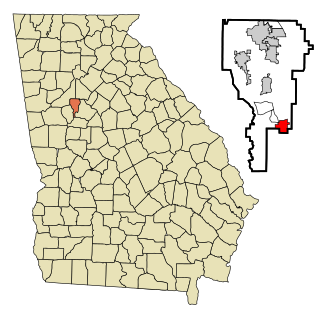
Lakewood Heights is a Black neighborhood in southeast Atlanta. It is bounded by:

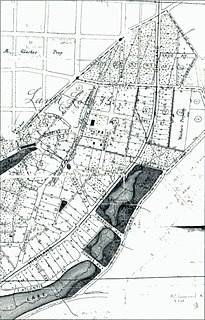
Copenhill, Copenhill Park, or Copen Hill was a neighborhood of Atlanta, Georgia which was located largely where the Carter Center now sits, and which now forms part of the Poncey-Highland neighborhood.

The Judge William Wilson House was an antebellum house in Atlanta, Georgia. It was built on land in a community west of Atlanta that was then called Adamsville which Wilson had inherited from his father William "Dollar Mill" Wilson (1775–1839) in 1839, and as the area around it developed came to be located in the Fairburn Heights neighborhood, a suburban area west of the Perimeter (I-285). At the end, it was one of only a few remaining antebellum structures still standing in its original location within the Atlanta city limits.

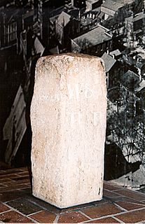
The Atlanta Zero Mile Post is a stone marker which marked the terminus of the Western and Atlantic Railroad in Atlanta. It was located in a disused building in Downtown Atlanta, within the Underground Atlanta Historic District, under the Central Ave. viaduct, between Alabama and Wall streets. The Zero Mile Post was recognized with a historical marker by the Georgia Historical Commission in 1958 and entered into the National Register of Historic Places in 1977. It was delisted in 2019.
References
- Augustus Hurt House, historical marker
- Augustus Hurt Plantation historical marker
Coordinates: 33°46′00″N84°21′20″W / 33.766758°N 84.355442°W
| This article about a building or structure in the U.S. state of Georgia is a stub. You can help Wikipedia by expanding it. |