Areography, also known as the geography of Mars, is a subfield of planetary science that entails the delineation and characterization of regions on Mars. Areography is mainly focused on what is called physical geography on Earth; that is the distribution of physical features across Mars and their cartographic representations. In April 2023, The New York Times reported an updated global map of Mars based on images from the Hope spacecraft. A related, but much more detailed, global Mars map was released by NASA on 16 April 2023.

Airy-0 is a crater inside the larger Airy Crater on Mars, whose location historically defined the Martian prime meridian. It is about 0.5 km (0.3 mile) across and lies within the dark region Sinus Meridiani, one of the early albedo features to be identified on Mars. In 2018, the IAU Working Group on Cartographic Coordinates and Rotational Elements recommended setting the longitude of the Viking 1 lander as the reference line. This definition maintains the position of the center of Airy-0 at 0° longitude, within the tolerance of current cartographic uncertainties.

Sinus Meridiani is an albedo feature on Mars stretching east-west just south of the planet's equator. It was named by the French astronomer Camille Flammarion in the late 1870s.

In planetary geology, an albedo feature is a large area on the surface of a planet which shows a contrast in brightness or darkness (albedo) with adjacent areas.

Sinus Roris is a dark, basaltic plain on the near side of the Moon that forms an extension of the northern edge of Oceanus Procellarum. The IAU-defined selenographic coordinates of this bay are 54.0° N, 56.6° W, and the diameter is 202 km.

Husband Hill is one of the Columbia Hills in Gusev crater, Mars, which are close to the landing site of NASA's Spirit rover. It was named in honor of Rick Husband, the commander of the Space Shuttle Columbia when it disintegrated upon atmospheric reentry.

The classical albedo features of Mars are the light and dark features that can be seen on the planet Mars through an Earth-based telescope. Before the age of space probes, several astronomers created maps of Mars on which they gave names to the features they could see. The most popular system of nomenclature was devised by Giovanni Schiaparelli, who used names from classical antiquity. Today, the improved understanding of Mars enabled by space probes has rendered many of the classical names obsolete for the purposes of cartography; however, some of the old names are still used to describe geographical features on the planet.

The Coprates quadrangle is one of a series of 30 quadrangle maps of Mars used by the United States Geological Survey (USGS) Astrogeology Research Program. The Coprates quadrangle is also referred to as MC-18. The Coprates quadrangle contains parts of many of the old classical regions of Mars: Sinai Planum, Solis Planum, Thaumasia Planum, Lunae Planum, Noachis Terra, and Xanthe Terra.

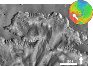
Eos Chaos is a rough, collapsed area in the Coprates quadrangle on Mars at 16.8° south latitude and 46.9° west longitude. It is about 490 km long and was named after the Greek name of Aurora, an albedo feature.

Capri Mensa is a mesa in the Coprates quadrangle of Mars at 14° south latitude and 47.4° west longitude. It is about 275 km long and was named after a classical albedo feature name.

Ophir Chasma is a canyon in the Coprates quadrangle of Mars at 4° south latitude and 72.5° west longitude. It is about 317 km long and was named after Ophir, a land mentioned in the Bible. In the Bible it was the land which King Solomon sent an expedition that returned with gold. It is a classical albedo feature name.

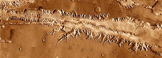
Ius Chasma is a large canyon in the Coprates quadrangle of Mars at 7° south latitude and 85.8° west longitude. It is about 938 km long and was named after a classical albedo feature name.
Tithonium Chasma is a large canyon in the Coprates quadrangle of Mars at 4.6° south latitude and 84.7° west longitude. It is about 810 km long and was named after a classical albedo feature.

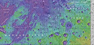
Aureum Chaos is a rough, collapsed region in the Margaritifer Sinus quadrangle (MC-19) portion of the planet Mars at approximately 4.4° south latitude and 27° west longitude, it is also in the west of Margaritifer Terra. It is 368 km across and was named after a classical albedo feature name.

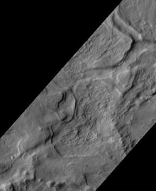
Chasma Boreale is a large canyon in Mars's north polar ice cap in the Mare Boreum quadrangle of Mars at 83° north latitude and 47.1° west longitude. It is about 560 km (350 mi) long and was named after a classical albedo feature name. The canyon's sides reveal layered features within the ice cap that result from seasonal melting and deposition of ice, together with dust deposits from Martian dust storms. Information about the past climate of Mars may eventually be revealed in these layers, just as tree ring patterns and ice core data do on Earth. Both polar caps also display grooved features, probably caused by wind flow patterns. The grooves are also influenced by the amount of dust. The more dust, the darker the surface. The darker the surface, the more melting as dark surfaces absorb more energy.

Dark slope streaks are narrow, avalanche-like features common on dust-covered slopes in the equatorial regions of Mars. They form in relatively steep terrain, such as along escarpments and crater walls. Although first recognized in Viking Orbiter images from the late 1970s, dark slope streaks were not studied in detail until higher-resolution images from the Mars Global Surveyor (MGS) and Mars Reconnaissance Orbiter (MRO) spacecraft became available in the late 1990s and 2000s.

The study of surface characteristics is a broad category of Mars science that examines the nature of the materials making up the Martian surface. The study evolved from telescopic and remote-sensing techniques developed by astronomers to study planetary surfaces. However, it has increasingly become a subdiscipline of geology as automated spacecraft bring ever-improving resolution and instrument capabilities. By using characteristics such as color, albedo, and thermal inertia and analytical tools such as reflectance spectroscopy and radar, scientists are able to study the chemistry and physical makeup of the Martian surface. The resulting data help scientists understand the planet's mineral composition and the nature of geological processes operating on the surface. Mars’ surface layer represents a tiny fraction of the total volume of the planet, yet plays a significant role in the planet's geologic history. Understanding physical surface properties is also very important in determining safe landing sites for spacecraft.

Aurorae Chaos is a region of chaos terrain on Mars at the eastern end of the outflow channels from Valles Marineris into Chryse Planitia, centered at approximately ~324°E, 9°S. It is in the Margaritifer Sinus quadrangle.

Aonia Terra is a region in the southern hemisphere of the planet Mars. It is named after a classical albedo feature Aonia, that was named after the ancient Greek region Aonia.


