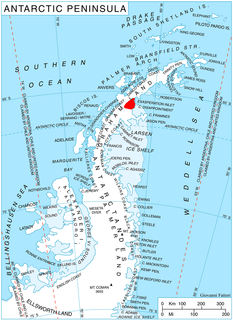
Pimpirev Glacier on Livingston Island in the South Shetland Islands, Antarctica is situated south of the glacial divide between the Drake Passage and Bransfield Strait, southeast of Tundzha Glacier, southwest of Saedinenie Snowfield, west of Perunika Glacier and east-northeast of Kamchiya Glacier. The feature extends 5.5 km in a southeast-northwest direction, and 1.8 km in northwest-southeast direction. The glacier drains southeastwards towards Pimpirev Beach, mostly terminating on the shore, and on several occasions penetrating the South Bay waters east-northeast of Ereby Point.
Gbehlay-Geh District is one of 17 districts located in Nimba County, Liberia. In 2008, the population was 32,176.
Clendinning Provincial Park is a provincial park in British Columbia, Canada. It surrounds the drainage of Clendinning Creek, which is a tributary of the Elaho River. Its name is shared by the Clendinning Range, of which Mount Clendinning is the highest summit.
Drewry Point Provincial Park is a provincial park in British Columbia, Canada on the west side of Kootenay Lake, southeast of the city of Nelson.
High Lakes Basin Provincial Park is a provincial park in British Columbia, Canada.
Jackman Flats Provincial Park is a provincial park in British Columbia, Canada, comprising approximately 615 ha. and located just southeast of Tête Jaune Cache in the Rocky Mountain Trench, near the Yellowhead Pass. The park features several hiking trails.
Spatsizi Plateau Wilderness Provincial Park is a provincial park in British Columbia, Canada, protecting most of the Spatsizi Plateau, the southeasternmost subplateau of the Stikine Plateau, and the upper reaches of the basin of the Stikine River.
The Lytton First Nation, a First Nations government, has its headquarters at Lytton in the Fraser Canyon region of the Canadian province of British Columbia. While it is the largest of all Nlaka'pamux bands, unlike all other governments of the Nlaka'pamux (Thompson) people, it is not a member of any of the three Nlaka'pamux tribal councils, which are the Nicola Tribal Association, the Fraser Canyon Indian Administration and the Nlaka'pamux Nation Tribal Council.
The Tŝideldel First Nation is the band government of the Tsi Del Del subgroup of the Tsilhqot'in people, located in the Chilcotin District in the western Central Interior region of the Canadian province of British Columbia. It is a member of the Tsilhqot'in National Government.
Magaz de Pisuerga is a municipality located in the province of Palencia, Castile and León, Spain. According to the 2004 census (INE), the municipality has a population of 755 inhabitants.

Moro District is one of nine districts of the province Santa in Peru.
Cacuso is a town in Malanje Province, Angola.
The Hartley Bay Indian Band, also known as the Hartley Bay First Nation, Hartley Bay Band, Gitga'at Nation and Gitga'at First Nation, is the band government of the Gitga'ata people of Hartley Bay, British Columbia, Canada.
Naye is a town in Senegal on the border with Mali
Yale First Nation is a First Nations government located at Yale, British Columbia. Yale has 16 distinct reserves stretching from near Sawmill Creek to American Creek, with the most southern reserve situated at Ruby Creek in the District of Kent.
Donnelley Wildlife Management Area or Donnelley WMA is an undeveloped 8,048-acre (32.57 km2) natural area in Colleton County, South Carolina near the unincorporated area of Green Pond. Named after Gaylord and Dorothy Donnelley who were instrumental in leading land preservation efforts in the ACE Basin, Donnelley WMA is owned private individuals and managed by scdnr.

Kokora Glacier is the 13 km long and 1.5 km wide glacier in Stevrek Ridge, Aristotle Mountains on Oscar II Coast in Graham Land. It flows 11 km eastwards between two parallel branches of the ridge, then turns southeast to join Melville Glacier. Named after the settlement of Kokora in Southern Bulgaria.
Glazunov Glacier is a glacier flowing north into Stravinsky Inlet from Monteverdi Peninsula, Alexander Island. Named by the USSR Academy of Sciences in 1987 after Alexander Glazunov (1865-1936), Russian composer.
Varlamov Glacier is a glacier on Beethoven Peninsula, Alexander Island, flowing northwest into the head of Brahms Inlet. It was named by the USSR Academy of Sciences in 1987 after Alexander Egorovich Varlamov (1801-48), the Russian composer.


