The Upper Similkameen Indian Band or Upper Smelqmix, is a First Nations band government in the Canadian province of British Columbia, whose head offices are located in town of Hedley in the Similkameen Country. They are a member of the Okanagan Nation Alliance.
The Alkali Lake Indian Band, also known as the Esketemc First Nation, is a First Nations government of the Secwepemc (Shuswap) people, located at Alkali Lake in the Cariboo region of the Central Interior of the Canadian province of British Columbia. It was created when the government of the then-Colony of British Columbia established an Indian Reserve system in the 1860s. It is one of three Secwepemc bands that is not a member of either the Shuswap Nation Tribal Council or the Northern Shuswap Tribal Council.

Aghavnatun is a village in the Armavir Province of Armenia. it is home to ruins of an iron-age fortress, a 13th-century tomb and a chapel.
Merdzavan, is a village in the Armavir Province of Armenia, located at the western suburbs of the capital Yerevan, north of the Parakar village.
Agamzalu is a town in the Ararat Province of Armenia.
Agarakavan is a village in the Aragatsotn Province of Armenia. It was populated by Armenian Genocide survivors from Van in 1920.
Araks, known as Nerkin Karkhun and Sharifabad until 1946, is a village in the eastern part of the Armavir Province of Armenia.
Argavand is a village in the Armavir Province of Armenia.
Aygek is a village and a rural community in the Armavir Province of Armenia. It is located 8 km weat of the capital Yerevan and 36 km east of the provincial centre Armavir. It has an elevation of 870 metres above sea level. The majority of the village are Armenian migrants from Iran.
Aygeshat, known as Ghuzigidan until 1950, is a village in the Armavir Province of Armenia.
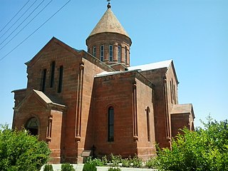
Bambakashat ; formerly known as Molla Bayazet or Mullah-Bayazid, is a village in the Armavir Province of Armenia.
Jrashen, is a village in the Armavir Province of Armenia. It was founded in 1928. According to the 2001 census, the population was 727.
Nor Yedesia is a village in the Aragatsotn Province of Armenia. Nor Yedesia was a former sovkhoz founded in 1975.
Pokr Shagriar is a town in the Armavir Province of Armenia.
Tandzut is a village in the Armavir Province of Armenia.
Tsaghkalanj is a village in the Armavir Province of Armenia. The village's church, dedicated to Saint George, dates to the 1870s. It rests on an earlier circular foundation. Nearby, is the whitewashed Amenaprkich Church of an unknown date. There is also a Neolithic-Chalcolithic tell in the village and Bronze Age burial mounds, while the ruins of Amenaprkich, a medieval settlement are nearby.
Tsiatsan is a village in the Armavir Province of Armenia.
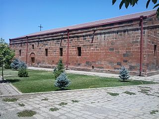
Sardarapat, is a major village in the Armavir province of Armenia. The settlement was originally known as Sardarapat until 1935 when it was renamed Hoktember (October) in memory of the 1917 October Revolution.
Nor Artagers, is a village in the Armavir Province of Armenia. The village is inhabited by Armenians, Yazidis and Assyrians.
Tyoax Pass is a mountain pass in the Chilcotin Ranges of the Pacific Ranges, the southernmost main subdivision of the Coast Mountains of British Columbia, Canada. Located at the head of Tyaughton Creek, a north tributary of the Bridge River, it connects the basin of the Bridge River with that of Big Creek in the southern Chilcotin District, and is therefore at the boundary between the Spruce Lake Protected Area and Big Creek Provincial Park.