Related Research Articles

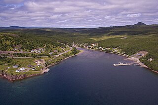
Dildo is a local service district and designated place in the Canadian province of Newfoundland and Labrador on the island of Newfoundland. It is located on the southeastern Dildo Arm of Trinity Bay about 100 kilometres (62 mi) west of St. John's. South Dildo is a neighbouring community of 200 residents. The town's unusual name has brought it a certain amount of notoriety.
Whitbourne is a town on the Avalon Peninsula in Newfoundland and Labrador, Canada in Division 1.
Division No. 1, Subdivision A is an unorganized subdivision on the Avalon Peninsula in Newfoundland and Labrador, Canada. It is in Division No. 1, and lies between Trinity Bay and Placentia Bay.

Sunnyside is a town on the Avalon Peninsula in Newfoundland and Labrador, Canada. It is in Division 1 on Bull Arm.

The Avalon Peninsula is a large peninsula that makes up the southeast portion of the island of Newfoundland. It is 9,220.61 square kilometres (3,560.10 sq mi) in size.

Ferryland is a town in Newfoundland and Labrador on the Avalon Peninsula. According to the 2021 Statistics Canada census, its population is 371.

Avalon is a federal electoral district on Newfoundland Island in Newfoundland and Labrador, Canada. It has been represented in the House of Commons of Canada since 2004.
Upper Island Cove, Newfoundland and Labrador is a town in Newfoundland and Labrador. It is located in Division 1, Newfoundland and Labrador census division. It is north east of Bay Roberts. The Way office was established in 1864. The population was 942 in 1940; 1,346 in 1951, 1,563 in 1956, and 1762 in 1966. As of 2021, the population is 1,401.

Dildo Island is an island in the Canadian province of Newfoundland and Labrador. It is the largest of three islands located at the entrance to Dildo Tip in the bottom of Trinity Bay, off the coast of the neighbouring town of Dildo. As of 2016, Dildo was home to approximately 1,200 people.
Red Bay is a fishing village in Labrador, notable as one of the most precious underwater archaeological sites in the Americas. Between 1530 and the early 17th century, it was a major Basque whaling area. Several whaling ships, both large galleons and small chalupas, sank there, and their discovery led to the designation of Red Bay in 2013 as a UNESCO World Heritage Site.
The Bay de Verde Peninsula is the largest peninsula that makes up part of the Avalon Peninsula, of the province of Newfoundland and Labrador, Canada. The peninsula separates both Trinity and Conception Bay.
Victoria is an incorporated town in Conception Bay located approximately midway on the Bay de Verde Peninsula of Newfoundland and Labrador, Canada.

Ugao-Miraballes is a town and municipality in the province of Biscay and autonomous community of the Basque Country in northern Spain.

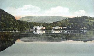
Waterford Flat is a historic village in the town of Waterford in Oxford County, Maine, United States. The village has been called by other names in its history, including Sweats Island, Sweet Island, Swetts Island, and Waterford. It is located north of Keoka Lake.

Byer is an unincorporated community in northwestern Washington Township, Jackson County, Ohio, United States. It lies along State Route 327 between Wellston and Londonderry, at 39°10′53″N82°37′53″W.
Admirals Beach is a rural community located in Newfoundland and Labrador, Canada.
Little Bay East is a town in the Canadian province of Newfoundland and Labrador. The town had a population of 84 in the Canada 2021 Census.

Southern Harbour is a town in the province of Newfoundland and Labrador, Canada. The town had a population of 369 in the Canada 2016 Census.

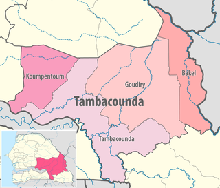
Goudiry Department is one of the 45 departments of Senegal, one of four making up the Tambacounda Region. It was created by decree in 2008.

Division No. 1, Subdivision G is an unorganized subdivision on the Avalon Peninsula in Newfoundland and Labrador, Canada. It is in Division 1 and contains the unincorporated communities of Baccalieu Island, Besom Cove, Bradley's Cove, Burnt Point, Caplin Cove, Daniel's Cove, Grates Cove, Gull Island, Job's Cove, Kingston, Long Beach, Lower Island Cove, Low Point, Northern Bay, Ochre Pit Cove, Red Head Cove, Riverhead, Smooth Cove and Western Bay.
References
- ↑ Year Book and Almanac of Newfoundland, 18 19 Containing a Calendar and Nautical Intelligence for the Year: Authentic and Valuable Information Relating to Public Offices, Institutions, Banks, Etc. ... with a ... Directory of All Towns, Villages and Settlements in the Island, and the Customs' Tariff (official) Corrected to Date. J.W. Withers, king's printer. 1910. p. 94.