Baczyńscy

Last updated
Baczyńscy
Village
Country Flag of Poland.svg  Poland
Voivodeship Podlaskie
County Hajnówka
Gmina Narewka

Baczyńscy [baˈt͡ʂɨɲst͡sɨ] is a village in the administrative district of Gmina Narewka, within Hajnówka County, Podlaskie Voivodeship, in north-eastern Poland, close to the border with Belarus. [1]

Village Small clustered human settlement smaller than a town

A village is a clustered human settlement or community, larger than a hamlet but smaller than a town, with a population ranging from a few hundred to a few thousand. Though villages are often located in rural areas, the term urban village is also applied to certain urban neighborhoods. Villages are normally permanent, with fixed dwellings; however, transient villages can occur. Further, the dwellings of a village are fairly close to one another, not scattered broadly over the landscape, as a dispersed settlement.

Gmina Narewka is a rural gmina in Hajnówka County, Podlaskie Voivodeship, in north-eastern Poland, on the border with Belarus. Its seat is the village of Narewka, which lies approximately 18 kilometres (11 mi) north-east of Hajnówka and 51 km (32 mi) south-east of the regional capital Białystok.

Hajnówka County County in Podlaskie, Poland

Hajnówka County is a unit of territorial administration and local government (powiat) in Podlaskie Voivodeship, north-eastern Poland, on the border with Belarus. It came into being on January 1, 1999, as a result of the Polish local government reforms passed in 1998. Its administrative seat and largest town is Hajnówka, which lies 51 kilometres (32 mi) south-east of the regional capital Białystok. The only other town in the county is Kleszczele, lying 25 km (16 mi) south-west of Hajnówka.

It is in one of five Polish/Belarusian bilingual Gmina in Podlaskie Voivodeship regulated by the Act of 6 January 2005 on National and Ethnic Minorities and on the Regional Languages, which permits certain gminas with significant linguistic minorities to introduce a second, auxiliary language to be used in official contexts alongside Polish. [2]

Belarusian language east Slavic language

Belarusian is an official language of Belarus, along with Russian, and is also spoken in Russia, Poland and Ukraine. Before Belarus gained independence from the Soviet Union in 1991, the language was only known in English as Byelorussian or Belorussian, transliterating the Russian name, белорусский язык Belorusskiy yazyk, or alternatively as White Ruthenian or White Russian. Following independence, it has acquired the additional name Belarusian.

The bilingual status of gminas (municipalities) in Poland is regulated by the Act of 6 January 2005 on National and Ethnic Minorities and on the Regional Languages, which permits certain gminas with significant linguistic minorities to introduce a second, auxiliary language to be used in official contexts alongside Polish. So far 44 gminas have done this:
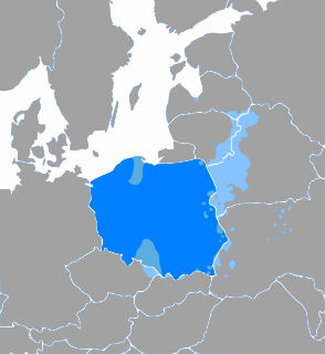
Polish language West Slavic language spoken in Poland

Polish is a West Slavic language of the Lechitic group. It is spoken primarily in Poland and serves as the native language of the Poles. In addition to being an official language of Poland, it is also used by Polish minorities in other countries. There are over 50 million Polish language speakers around the world and it is one of the official languages of the European Union.

Related Research Articles

Orla, Podlaskie Voivodeship Village in Podlaskie, Poland

Orla is a village in Bielsk County, Podlaskie Voivodeship, in north-eastern Poland. It is the seat of the gmina called Gmina Orla. It lies approximately 11 kilometres (7 mi) south-east of Bielsk Podlaski and 47 km (29 mi) south of the regional capital Białystok.

Czechy Zabłotne Village in Podlaskie, Poland

Czechy Zabłotne is a village in the administrative district of Gmina Orla, within Bielsk County, Podlaskie Voivodeship, in north-eastern Poland. It lies approximately 13 kilometres (8 mi) south-west of Orla, 15 km (9 mi) south of Bielsk Podlaski, and 54 km (34 mi) south of the regional capital Białystok.

Dydule Village in Podlaskie, Poland

Dydule is a village in the administrative district of Gmina Orla, within Bielsk County, Podlaskie Voivodeship, in north-eastern Poland. It lies approximately 11 kilometres (7 mi) south-west of Orla, 13 km (8 mi) south of Bielsk Podlaski, and 52 km (32 mi) south of the regional capital Białystok.

Krugłe Village in Podlaskie, Poland

Krugłe is a village in the administrative district of Gmina Orla, within Bielsk County, Podlaskie Voivodeship, in north-eastern Poland. It lies approximately 11 kilometres (7 mi) south-west of Orla, 15 km (9 mi) south of Bielsk Podlaski, and 54 km (34 mi) south of the regional capital Białystok.

Krywiatycze Village in Podlaskie, Poland

Krywiatycze is a village in the administrative district of Gmina Orla, within Bielsk County, Podlaskie Voivodeship, in north-eastern Poland. It lies approximately 4 kilometres (2 mi) east of Orla, 14 km (9 mi) south-east of Bielsk Podlaski, and 47 km (29 mi) south of the regional capital Białystok.

Malinniki Village in Podlaskie, Poland

Malinniki is a village in the administrative district of Gmina Orla, within Bielsk County, Podlaskie Voivodeship, in north-eastern Poland. It lies approximately 6 kilometres (4 mi) south-west of Orla, 13 km (8 mi) south-east of Bielsk Podlaski, and 52 km (32 mi) south of the regional capital Białystok.

Paszkowszczyzna, Bielsk County Village in Podlaskie, Poland

Paszkowszczyzna is a village in the administrative district of Gmina Orla, within Bielsk County, Podlaskie Voivodeship, in north-eastern Poland. It lies approximately 6 kilometres (4 mi) south-west of Orla, 11 km (7 mi) south-east of Bielsk Podlaski, and 49 km (30 mi) south of the regional capital Białystok.

Reduty Village in Podlaskie, Poland

Reduty is a village in the administrative district of Gmina Orla, within Bielsk County, Podlaskie Voivodeship, in north-eastern Poland. It lies approximately 5 kilometres (3 mi) south of Orla, 16 km (10 mi) south-east of Bielsk Podlaski, and 52 km (32 mi) south of the regional capital Białystok.

Szczyty-Dzięciołowo Village in Podlaskie, Poland

Szczyty-Dzięciołowo is a village in the administrative district of Gmina Orla, within Bielsk County, Podlaskie Voivodeship, in north-eastern Poland. It lies approximately 5 kilometres (3 mi) north-east of Orla, 11 km (7 mi) east of Bielsk Podlaski, and 44 km (27 mi) south of the regional capital Białystok.

Szczyty-Nowodwory Village in Podlaskie, Poland

Szczyty-Nowodwory is a village in the administrative district of Gmina Orla, within Bielsk County, Podlaskie Voivodeship, in north-eastern Poland. It lies approximately 4 kilometres (2 mi) north-east of Orla, 11 km (7 mi) east of Bielsk Podlaski, and 44 km (27 mi) south of the regional capital Białystok.

Topczykały Village in Podlaskie, Poland

Topczykały is a village in the administrative district of Gmina Orla, within Bielsk County, Podlaskie Voivodeship, in north-eastern Poland. It lies approximately 5 kilometres (3 mi) west of Orla, 9 km (6 mi) south-east of Bielsk Podlaski, and 47 km (29 mi) south of the regional capital Białystok.

Wólka Wygonowska Village in Podlaskie, Poland

Wólka Wygonowska is a village in the administrative district of Gmina Orla, within Bielsk County, Podlaskie Voivodeship, in north-eastern Poland. It lies approximately 11 kilometres (7 mi) south-west of Orla, 17 km (11 mi) south of Bielsk Podlaski, and 55 km (34 mi) south of the regional capital Białystok.

Babia Góra, Podlaskie Voivodeship Village in Podlaskie, Poland

Babia Góra is a village in the administrative district of Gmina Narewka, within Hajnówka County, Podlaskie Voivodeship, in north-eastern Poland, close to the border with Belarus. It lies approximately 11 kilometres (7 mi) north-east of Narewka, 28 km (17 mi) north-east of Hajnówka, and 55 km (34 mi) south-east of the regional capital Białystok.

Bazylowe is a village in the administrative district of Gmina Narewka, within Hajnówka County, Podlaskie Voivodeship, in north-eastern Poland, close to the border with Belarus.

Bernacki Most Village in Podlaskie, Poland

Bernacki Most is a village in the administrative district of Gmina Narewka, within Hajnówka County, Podlaskie Voivodeship, in north-eastern Poland, close to the border with Belarus. It lies approximately 6 kilometres (4 mi) west of Narewka, 16 km (10 mi) north-east of Hajnówka, and 46 km (29 mi) south-east of the regional capital Białystok.

Bielscy is a village in the administrative district of Gmina Narewka, within Hajnówka County, Podlaskie Voivodeship, in north-eastern Poland, close to the border with Belarus.

Bokowe, Podlaskie Voivodeship Village in Podlaskie, Poland

Bokowe is a village in the administrative district of Gmina Narewka, within Hajnówka County, Podlaskie Voivodeship, in north-eastern Poland, close to the border with Belarus. It lies approximately 9 kilometres (6 mi) north-west of Narewka, 22 km (14 mi) north-east of Hajnówka, and 43 km (27 mi) south-east of the regional capital Białystok.

Borowe, Podlaskie Voivodeship Village in Podlaskie, Poland

Borowe is a village in the administrative district of Gmina Narewka, within Hajnówka County, Podlaskie Voivodeship, in north-eastern Poland, close to the border with Belarus. It lies approximately 10 kilometres (6 mi) north-east of Narewka, 27 km (17 mi) north-east of Hajnówka, and 54 km (34 mi) south-east of the regional capital Białystok.

Chomińszczyzna is a village in the administrative district of Gmina Narewka, within Hajnówka County, Podlaskie Voivodeship, in north-eastern Poland, close to the border with Belarus.

Cieremki is a village in the administrative district of Gmina Narewka, within Hajnówka County, Podlaskie Voivodeship, in north-eastern Poland, close to the border with Belarus.

References


Coordinates: 52°52′24″N23°41′49″E / 52.87333°N 23.69694°E / 52.87333; 23.69694

Geographic coordinate system Coordinate system

A geographic coordinate system is a coordinate system that enables every location on Earth to be specified by a set of numbers, letters or symbols. The coordinates are often chosen such that one of the numbers represents a vertical position and two or three of the numbers represent a horizontal position; alternatively, a geographic position may be expressed in a combined three-dimensional Cartesian vector. A common choice of coordinates is latitude, longitude and elevation. To specify a location on a plane requires a map projection.