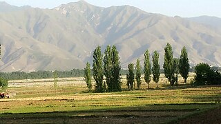
Swat District, also known as the Swat Valley, is a district in the Malakand Division of Khyber Pakhtunkhwa, Pakistan. Known for its stunning natural beauty, the district is a popular tourist destination. With a population of 2,309,570 per the 2017 national census, Swat is the 15th-largest district of Khyber Pakhtunkhwa.

The Swat River is a perennial river in the northern region of the Khyber-Pakhtunkhwa Province of Pakistan. The river's source is in the high glacial valleys of the Hindu Kush mountains, where it then flows into the Kalam Valley before forming the spine of the wider Swat Valley.

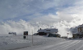
Pordoi is a pass in the Dolomites in the Alps, located between the Sella group in the north and the Marmolada group in the south. The pass is at an altitude of 2,239 m (7,346 ft), and the road crossing the pass connects Arabba with Canazei. It is the second highest surfaced road traversing a pass in the Dolomites, after the Sella Pass.

Utror, also spelt Atror, is a valley located in the Swat District of Khyber Pakhtunkhwa, Pakistan. It is surrounded by snow-clad mountains, green pastures and waterfalls. The area of the valley is about 47,400 hectares. Utror is 16 km (9.9 mi) away from Kalam Valley and 116 km (72 mi) from Saidu Sharif.
Gawri (ګاوری), also known as Kalami (کالامي), or Bashkarik, is an Indo-Aryan language spoken in Swat Kohistan region in the upper Swat District and in the upper Panjkora river valley of Upper Dir District, Khyber Pakhtunkhwa, Pakistan.

Pass of the Republic, is a mountain pass in the Balkan Mountains in Bulgaria. It connects Veliko Tarnovo and Gurkovo.

Kundol Lake, also known as Kundol Dand and Kundal, is a lake in the Swat Valley of Khyber Pakhtunkhwa, Pakistan. It is located in the north of the Utror Valley. It is 19 kilometres (12 mi) away from the Kalam Valley.
The Tera Pass is the primary route connecting Logar and Paktia provinces in Afghanistan. The pass was unimproved until 2006, when construction of a paved surface was completed as part of the ongoing international reconstruction effort.

The Guoliang Tunnel (Chinese: 郭亮洞) is carved along the side of and through a mountain in China. The tunnel links the village of Guoliang to the outside through the Taihang Mountains which are situated in Huixian, Xinxiang, Henan Province of China.

Kuza Bandai is a well developed village in Swat Valley of Khyber Pakhtunkhwa, Pakistan. It is known for its natural environment and also known as an area crossed by Alexander the Great. Later, after the Lal Masjid battle, Kuza Bandai and Bara Bandai became sympathetic to the Taliban movement. The village consists of Yusufzai Pakhtun tribes. It is one of Pakistan's Provincially Administered Tribal Areas (PATA).
The Anjuman Pass is a mountain pass in the Hindu Kush in Afghanistan. It connects the Panjshir Valley and beyond in the south-west with Badakhshan province and beyond to the north-east, which is the most north-easterly province of Afghanistan. The Anjuman Pass is located on Panjshir Province's border with Badakhshan and Takhar province. The climate in this area is usually cold with snow. The roads are narrow and slippery.

Usho is a village in Usho Valley, Khyber Pakhtunkhwa province of Pakistan. It is situated 8 kilometers (5.0 mi) from Kalam and 123 kilometers (76 mi) km from Mingora, at the height of 2,300 meters. It is accessible through a non metalled road from Kalam by jeeps only.
Gabral is a village and union council in Swat District of Khyber Pakhtunkhwa province, Pakistan. It is located on the slopes of the western end of the Himalayas, at the lower end of the Gujjar Gabral Valley, where the Gabral River joins the Utror River, a tributary of the Swat River. Gabral is located at an elevation of 2,286 metres (7,500 ft). It is about 7 kilometres (4.3 mi) northwest from Utror, 20 kilometres (12 mi) west of Kalam, and 120 kilometres (75 mi) of Saidu Sharif.
Darmai is an administrative unit, known as Union council, of Swat District in the Khyber Pakhtunkhwa province of Pakistan. District Swat has 9 Tehsils, including Khwazakhela, Kabal, Madyan, Barikot, Mingora, Charbagh, and Kalam. Each Tehsil comprises a number of union councils. There are 65 union councils in district Swat, which include 56 rural and 9 urban ones.
Sakhra is an administrative unit, known as union council, of Swat District in the Khyber Pakhtunkhwa province of Pakistan. District Swat has 9 Tehsils, including Khwazakhela, Kabal, Madyan, Barikot, Mingora, Charbagh, and Kalam. Each Tehsil comprises a number of union councils. The 65 union councils of district Swat include 56 rural and 9 urban ones.
Shalpin is an administrative unit, known as Union council, of Swat District in the Khyber Pakhtunkhwa province of Pakistan. Union council Shalpin has 3 village councils i.e. Shalpin, Faqira and Bawrai. Village council Faqira includes the following villages: Faqira, Banda, Sholgara and Karal etc. Shalpin is a village of Swat District situated 32 kilometres away from Mingaora. Elevation of the area is 4,300 ft. The most cultivated crops of the area are Wheat and Maize. Shalpin is also famous for its fruits like Peaches locally named is Shaltaloo, Apricots and Persimons. The Shalpin valley is diverse in vegetation. Pashtu is the most common language although few families in the mountain areas maybe speaking kohistani and gujri. Shalpin has a public high School for boys and girls and two private middle Schools. Shalpin also has a basic health Unit. People of Shalpin are highly educated and several alumni of high school are serving at different key positions in the country and abroad.

Saidgai Lake also known as Saidgai Dand is a lake in the upper reaches of the Ushirai Dara within the Upper Dir District of the Khyber Pakhtunkhwa province of Pakistan. It is located at an elevation of 11,500 feet (3,500 m) above the sea level. It is located to the northwest of Gabin Jabba. The temperature is normally about 5 °C to 10 °C during hot months. Primarily, this lake attracts tourists from Dir as well as other regions of the country, especially during the months of June, July, and August. However, for the rest of the months, the lake remains covered by snow. Saidgai lake is at the boundary of Dir Upper and Swat.

Bashkaro Pass, also known as Bashkaro Top, is a mountain pass located in Pakistan. It is classified as a T - Hypsographic pass and is situated in the Asia/Pacific region. The pass has an elevation of 4,924 meters above sea level and is geographically positioned at approximately 35°52'55" N latitude and 72°32'27" E longitude in Degrees Minutes Seconds (DMS) format, or 35.8819° N and 72.5408° E in decimal degrees. Its UTM position is BV77, and its Joint Operation Graphics reference is NI43-01.
Mushroom Lake is a small alpine lake is located in the Gabral Valley of Kalam Swat. Mushroom Lake is called Mushroom because of its mushroom-shaped structure. It is Ten hours hike from Shahi Bagh Kalam.


